English (UK)
  Italiano
  Français



Great
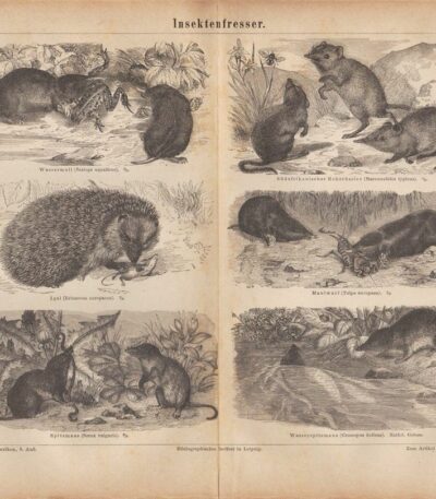
Insettivori, 1890
15,00 €Insettivori It is a lithograph from 1890, taken from the encyclopedic publication Meyers Conversations Lexicon, published in Germany.
Questa opera, realizzata dal Bibliographischen Instituts, è un esempio significativo della produzione editoriale del XIX secolo.
- Sheet size: cm. 29×23
- Engraving size: cm. 29×23
- Support: Paper
- Condition: Fair condition, with light yellowing and central crease
The sheet has a central fold because it was originally inserted folded into the volume from which it was taken.
L’immagine rappresenta vari insettivori, tra cui il Maulwurf, Igel, Wasser-Spitzmaus e il Südafrikanischer Rohrrüssler.

Goldoni's house in Venice, 1884
30,00 €Goldoni's house in Venice It is a page extracted from The Italian Illustration of 1884, published in Milan by Fratelli Treves Editori.
This work offers a fascinating look at Venetian history and architecture, with inscriptions on the verso that enhance its value.
- Sheet size: cm. 35×25 approx.
- Condition: Excellent
- Support: Paper
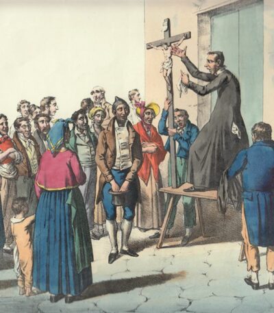
La predica, Ledoux, 1840-50
90,00 €La Predica è una litografia acquerellata a mano e rifinita all’albume, realizzata tra il 1840 e il 1850.
Questa opera proviene probabilmente da Scenes populaires en Italie lithographiees par A. Ledoux d’après les dessins de F. Cerrone, pubblicata a Napoli da Augusto Ledoux, noto negoziante di litografie.
L’immagine rappresenta una scena popolare animata e variopinta, rendendola un pezzo raro e affascinante per collezionisti.
- Sheet size: mm. 440×270
- Condition: Excellent state of preservation
- Support: Paper

Map of North America, 1869
60,00 €Mappa del Nordamerica It is a watercolour lithograph from 1869, made on strong paper.
This map, part of the work Hand – Und Schulatlas uber alle Theile Der Erde, presenta un retro bianco e una piega editoriale.
- Sheet size: mm. 437×347
- Condition: Excellent
- Support: Strong paper

Map of South America, 1869
60,00 €Mappa del Sudamerica è una litografia acquarellata realizzata nel 1869.
This map, part of the volume Hand – Und Schulatlas uber alle Theile Der Erde, presents a sheet size of mm. 437×347 and a white back.
- Sheet size: Great
- Technique: Lithography
- Condition: Excellent
- Support: Strong paper
- Characteristics: Editorial fold

Map of Africa, 1869
60,00 €Map of Africa It is a watercolour lithograph made in 1869.
This map, part of the volume Hand – Und Schulatlas uber alle Theile Der Erde, has a sheet size of 437x347 mm.
- Sheet size: mm. 437×347
- Technique: Watercolor lithograph
- Support: Strong paper
- Condition: Excellent condition
- Back: White
- Special features: Editorial fold
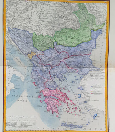
Map of Eastern Europe, 1869
60,00 €Map of Eastern Europe It is a watercolour lithograph made in 1869, which represents Turkey, Bulgaria, Bosnia and Greece.
This map is taken from the volume Hand – Und Schulatlas über alle Teile Der Erde and is characterized by an editorial fold.
- Sheet size: mm. 437×347
- Support: Strong paper
- Condition: Excellent condition
- Back: White

Map of France, 1869
60,00 €Map of France It is a watercolour lithograph made in 1869, which offers a detailed representation of the French territory.
This map is taken from the volume Hand – Und Schulatlas über alle Teile Der Erde, and is characterized by an editorial fold.
- Sheet size: mm. 437×347
- Support: Strong paper
- Condition: Excellent condition
- Back: White

Map of Germany, 1869
60,00 €Map of Germany è una litografia acquarellata risalente al 1869.
This map, part of the volume Hand – Und Schulatlas uber alle Theile Der Erde, features accurate details and vivid coloring.
- Sheet size: mm. 437×347
- Support: Strong paper
- Condition: Excellent condition
- Characteristics: White back, editorial fold

Map of Germany, 1869
60,00 €Map of Germany è una litografia acquarellata del 1869, che rappresenta in modo dettagliato il territorio tedesco.
This map is taken from the volume Hand – Und Schulatlas uber alle Theile Der Erde, and is characterized by an editorial fold.
- Sheet size: mm. 437×347
- Support: Strong paper
- Condition: Excellent condition
- Back: White

Map of Germany, 1869
60,00 €Map of Germany It is a watercolour lithograph made in 1869, which offers a detailed representation of the German territory.
This map is taken from the volume Hand – Und Schulatlas über alle Teile Der Erde, a reference work of the time.
- Sheet size: mm. 437×347
- Support: Strong paper
- Condition: Excellent condition
- Characteristics: White back, editorial fold

Map of Great Britain, 1869
60,00 €Map of Great Britain It is a watercolour lithograph made in 1869, which represents England, Scotland and Ireland in detail.
This map is taken from the volume Hand – Und Schulatlas uber alle Theile Der Erde and is presented with an editorial twist.
- Sheet size: mm. 437×347
- Support: Strong paper
- Condition: Excellent condition
- Back: White
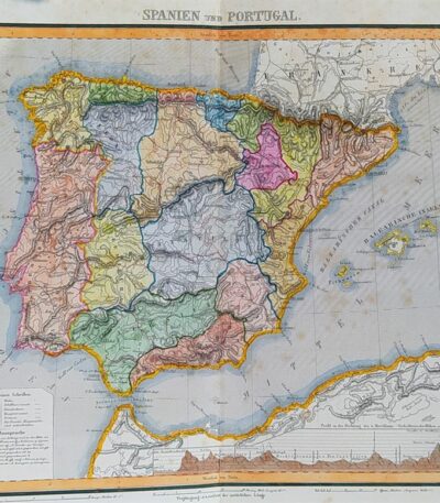
Map of Spain and Portugal, 1869
60,00 €Map of Spain and Portugal It is a watercolour lithograph from 1869, which represents the Iberian territories in detail.
This map is taken from the volume Hand – Und Schulatlas uber alle Theile Der Erde and is presented with an editorial twist.
- Sheet size: mm. 437×347
- Support: Strong paper
- Condition: Excellent condition

Mappa della Svezia, 1869
60,00 €Mappa della Svezia è una litografia acquarellata realizzata nel 1869, che rappresenta la Svezia, la Norvegia e la Danimarca.
This map is taken from the volume Hand – Und Schulatlas uber alle Theile Der Erde e presenta un retro bianco con una piega editoriale.
- Sheet size: mm. 437×347
- Technique: Lithography
- Condition: Excellent
- Support: Strong paper
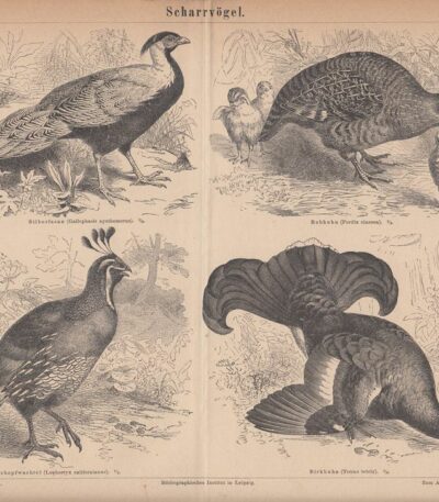
Pernice, Quaglia, 1890
15,00 €Pernice, Quaglia It is a lithograph made in 1890, taken from the encyclopedic publication Meyers Conversations Lexicon, published in Germany.
This work was published by the Bibliographischen Instituts, with branches in Leipzig and Vienna, starting in the second half of the 19th century.
- Sheet size: cm. 29×23
- Condition: Fair condition, with slight yellowing of the sheet
- Support: Carta, con retro bianco
- Note: Il foglio presenta una piega centrale poiché in origine era inserito ripiegato nel volume
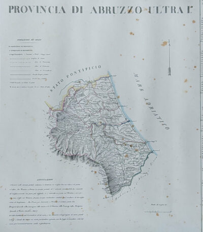
Provincia di Abruzzo Ultra I, B. Marzolla, 1832
90,00 €Provincia di Abruzzo Ultra I it is a geographical map created by B. Marzolla in 1832.
Questa opera è parte dell’Historical and statistical chorographic atlas of the Kingdom of the Two Sicilies, eseguito litograficamente e dedicato a S.M. il Re Ferdinando II.
- Sheet size: cm. 45×60
- Paper size: Great
- Technique: Lithography
- Condition: Good state of preservation
- Support: Paper
La carta presenta confini acquarellati e include notizie storiche e statistiche della provincia. Si notano alcune macchie del tempo e leggere gore di umidità, ma il foglio è privo di pieghe editoriali.
La spedizione avverrà in tubo rigido con posta raccomandata.
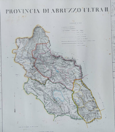
Provincia di Abruzzo Ultra II, B. Marzolla, 1832
90,00 €Provincia di Abruzzo Ultra II it is a geographical map created by B. Marzolla in 1832.
This lithograph has watercolored borders and is part of the work Historical and statistical chorographic atlas of the Kingdom of the Two Sicilies, dedicated to HM King Ferdinand II.
- Sheet size: cm. 45×60
- Paper size: Great
- Technique: Lithography
- Condition: Good state of preservation
- Support: Paper
The paper has some age stains and light humidity stains, but is free of editorial creases.
It will be shipped in a rigid tube with registered mail.
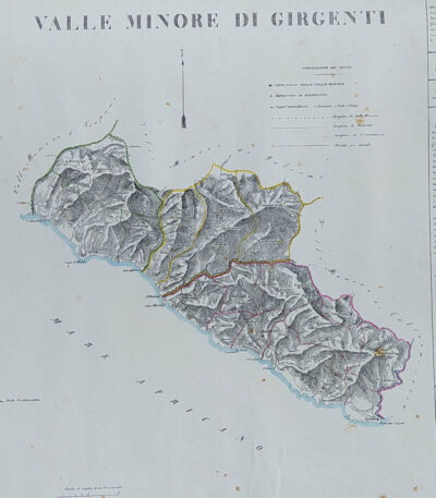
Provincia di Agrigento, B. Marzolla, 1832
90,00 €Provincia di Agrigento It is a geographical map created by B. Marzolla in 1832, executed in lithography with watercolor borders.
This map is part of the work Historical and statistical chorographic atlas of the Kingdom of the Two Sicilies, compilato e dedicato a S.M. il Re Ferdinando II, pubblicato a Napoli dalla Reale Tipografia Milit. nel 1832.
- Sheet size: cm. 45×60
- Condition: Good state of preservation
- Support: Paper
La carta presenta macchie del tempo e leggere gore di umidità, ma è priva di pieghe editoriali. Ai lati, sono riportate notizie storiche e statistiche della provincia. La spedizione avverrà in tubo rigido con posta raccomandata.

Province of Bari, B. Marzolla, 1832
80,00 €Province of Bari It is a geographical map made by Benedict Marzolla in 1832, performed in lithography with watercolor borders.
This map is part of the work Historical and statistical chorographic atlas of the Kingdom of the Two Sicilies, dedicated to HM King Ferdinand II.
- Sheet size: cm. 45×60
- Condition: Good state of preservation
- Support: Paper
The paper has age stains and light humidity stains, but is free of editorial creases.
On the sides, there are historical and statistical information about the provinces of Bari, Trani, Monopoli, Andria and Molfetta. The map will be sent in a rigid tube with registered mail.

Province of Bari, B. Marzolla, 1832
90,00 €Province of Bari it is a geographical map created by B. Marzolla in 1832.
This map was made in lithography with watercolor borders and is part of the work Historical and statistical chorographic atlas of the Kingdom of the Two Sicilies, dedicated to HM King Ferdinand II.
- Sheet size: cm. 45×60
- Condition: Good state of preservation
- Support: Paper
- Notes: Stains of time and light humidity stains, sheet without editorial fold

Provincia di Calabria Citra, B. Marzolla, 1832
90,00 €Provincia di Calabria Citra it is a geographical map created by B. Marzolla in 1832.
This lithograph has watercolored borders and is part of the work Historical and statistical chorographic atlas of the Kingdom of the Two Sicilies, dedicated to HM King Ferdinand II.
- Sheet size: cm. 45×60
- Paper size: Great
- Technique: Lithography
- Condition: Good state of preservation
- Support: Paper
The paper has age stains and light humidity stains, but is free of editorial creases.
Ai lati sono riportate notizie storiche e statistiche della provincia. La carta verrà spedita in tubo rigido con posta raccomandata.

Provincia di Calabria Ultra I, B. Marzolla, 1832
90,00 €Provincia di Calabria Ultra I it is a geographical map created by B. Marzolla in 1832.
This map was made in lithography with watercolor borders and is part of the work Historical and statistical chorographic atlas of the Kingdom of the Two Sicilies, dedicated to HM King Ferdinand II.
- Sheet size: cm. 45×60
- Condition: Good state of preservation
- Support: Paper
- Details: Stains of time and light humidity stains, sheet without editorial fold
The card will be shipped in a rigid tube via registered mail.

Provincia di Calabria Ultra II, B. Marzolla, 1832
90,00 €Provincia di Calabria Ultra II è una carta geografica litografica realizzata da B. Marzolla nel 1832.
This map is part of the work Historical and statistical chorographic atlas of the Kingdom of the Two Sicilies, dedicated to HM King Ferdinand II.
- Sheet size: cm. 45×60
- Map dimensions: cm. 45×60
- Technique: Lithography
- Condition: Good state of preservation
- Support: Paper
La carta presenta confini acquarellati e include notizie storiche e statistiche della provincia.
È importante notare che ci sono macchie del tempo e leggere gore di umidità, ma il foglio è senza piega editoriale. La mappa verrà spedita in tubo rigido con posta raccomandata.

Province of Caltanissetta, B. Marzolla, 1832
Provincia di Caltanisetta It is a geographical map created by B. Marzolla in 1832, executed in lithography with watercolor borders.
This map is taken from the work Historical and statistical chorographic atlas of the Kingdom of the Two Sicilies, dedicated to HM King Ferdinand II and published by the Royal Military Typography of Naples.
- Sheet size: cm. 45×60
- Condition: Good state of preservation
- Support: Paper
- Notes: It has age stains and light humidity stains, but is free of editorial creases.
La carta include anche notizie storiche e statistiche sulla provincia e verrà spedita in tubo rigido con posta raccomandata.