
XVI
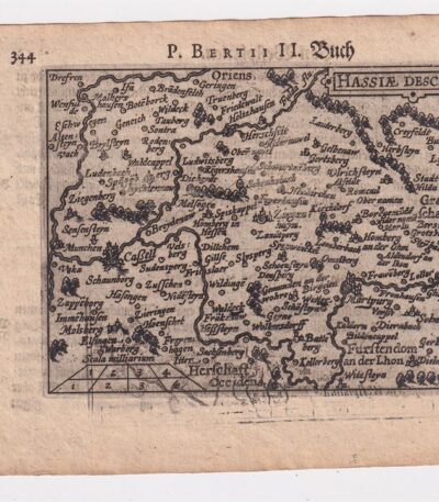
Petrus Bertius, Hesse,1612
40,00 €Petrus Bertius, Hesse It is an original map made in 1612 by Petrus Bertius (1565-1629), a well-known Dutch geographer.
This map is taken from the volume Petri Bertii Geographischer eyn oder zusammengezogener Tabeln Funff unterschiedliche Bucher.
- Paper size: mm. 125×83
- Sheet size: cm. 12×17
- Support: Laid paper
- Condition: Excellent condition

Petrus Bertius, Caletenfium,1612
40,00 €Petrus Bertius, Caletenfium It is an original watercolor map made by Petrus Bertius in 1612.
This map is taken from Petri Bertii Geographischer eyn oder zusammengezogener Tabeln Funff unterschiedliche Bucher, a work that collects various geographical representations of the time.
- Sheet size: cm. 12×17 approx.
- Map dimensions: mm. 125×83
- Support: Laid paper
- Condition: Excellent state of preservation

Petrus Bertius, Hannonia,1612
40,00 €Petrus Bertius, Hannonia It is an original watercolor map made in 1612 by Petrus Bertius, a well-known French geographer.
This map is taken from the volume Petri Bertii Geographischer eyn oder zusammengezogener Tabeln Funff unterschiedliche Bucher.
- Sheet size: cm. 12×17 approx.
- Map dimensions: mm. 125×83
- Support: Laid paper
- Condition: Excellent condition

Petrus Bertius, Lotharingia 1612
40,00 €Petrus Bertius, Lotharingia 1612 It is an original watercolor map, made by Petrus Bertius in 1612.
This map is taken from Petri Bertii Geographischer eyn oder zusammengezogener Tabeln Funff unterschiedliche Bucher.
- Paper size: mm. 125×83
- Stand dimensions: cm. 12×17
- Support: Laid paper
- Condition: Excellent condition

Petrus Bertius, Vaucluse, 1612
40,00 €Petrus Bertius, Vaucluse It is an original watercolor map made in 1612 by Petrus Bertius (1565-1629).
This map is taken from Petri Bertii Geographischer eyn oder zusammengezogener Tabeln Funff unterschiedliche Bucher.
- Sheet size: cm. 12×17 approx.
- Map dimensions: mm. 125×83
- Support: Laid paper
- Condition: Excellent condition

Petrus Bertius, Veromadui,1612
40,00 €Petrus Bertius, Veromadui It is an original watercolor map made in 1612 by Petrus Bertius, a well-known French geographer.
This map is taken from Petri Bertii Geographischer eyn oder zusammengezogener Tabeln Funff unterschiedliche Bucher, pubblicato nello stesso anno.
- Sheet size: cm. 12×17 approx.
- Map dimensions: mm. 125×83
- Support: Laid paper
- Condition: Excellent condition

Petrus Bertius, Westfalia,1612
40,00 €Petrus Bertius, Westfalia è una mappa originale acquarellata realizzata nel 1612 da Petrus Bertius, un geografo di origine olandese.
This map is taken from the volume Petri Bertii Geographischer eyn oder zusammengezogener Tabeln Funff unterschiedliche Bucher.
- Sheet size: cm. 12×17 approx.
- Map dimensions: mm. 125×83
- Support: Laid paper
- Condition: Excellent condition

Salzburg, St. Munster, 1614
Salzburg, St. Munster, 1614 è una splendida veduta della città di Salisburgo, estratta dalla celebre opera Cosmography Universalis by Sebastian Munster.
Questa xilografia, realizzata su carta vergellata acquarellata, offre un affascinante sguardo sulla città nel 1614. Sul retro, sono presenti altre immagini che arricchiscono ulteriormente l’opera.
- Sheet size: cm. 36×22 approx.
- Image size: cm. 12.5×15 approx.
- Support: Watercolored laid paper
- Condition: Excellent
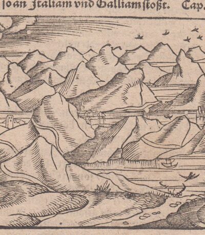
Svizzera, Cosmographia, 1588
30,00 €Svizzera, Cosmographia, 1588 è una mappa in legno della Svizzera, pubblicata da Sebastian Munster nel suo celebre volume Cosmography.
Questa opera, che presenta scritte in ancient gothic, è un esempio significativo della cartografia del XVI secolo.
- Sheet size: cm. 33×20 approx.
- Engraving size: cm. 8×13 approx.
- Support: Handmade laid paper
- Condition: Excellent
There Cosmography è considerata uno dei libri più popolari e di successo del XVI secolo, contribuendo in modo significativo alla diffusione della conoscenza geografica dell’epoca.
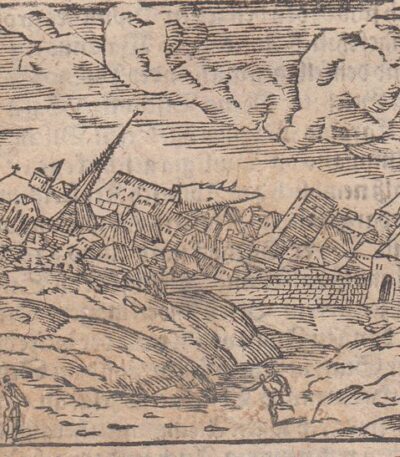
Terremoto di Basilea, Cosmographia, 1588
30,00 €Terremoto di Basilea It is an engraving made in woodcut, pubblicata nel 1588 da Sebastian Munster all’interno della sua celebre opera Cosmography.
Questa illustrazione, caratterizzata da una scritta in ancient gothic, rappresenta un evento significativo e fa parte di uno dei libri più popolari del XVI secolo.
- Sheet size: cm. 33×20 approx.
- Engraving size: cm. 7×12 approx.
- Support: Handmade laid paper
- Condition: Excellent
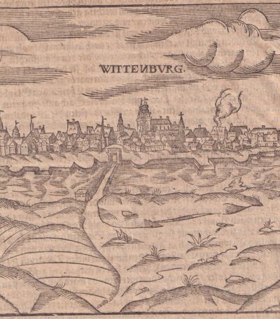
Wittenburg, St.Munster, 1614
Wittenburg, S.Munster è una veduta di Wittenberg, rappresentante un’importante località legata a Martin Lutero in Germania.
This engraving is taken from the famous work Cosmography Universalis di Sebastian Munster, pubblicata a Basilea nel 1614. Sul retro si trova un’immagine di Martin Lutero, figura centrale della Riforma protestante.
- Sheet size: cm. 36×22 approx.
- Image size: cm. 12×15 approx.
- Support: Watercolored laid paper
- Condition: Excellent state of preservation
