English (UK)
  Italiano
  Français


Italian Maps and Cards

Carta Geografica delle Marche, 1890
30,00 €Carta Geografica delle Marche it is a woodcut print made in 1890, coming from an Italian text from the late nineteenth century.
Questa carta offre una rappresentazione dettagliata della regione Marche, con testo al verso del foglio.
- Sheet size: cm. 30×20 approx.
- Image size: cm. 22×16 approx.
- Support: Paper
- Condition: Excellent

Carta Italia, Grecia, Macedonia, C.Frommel, 1829
25,00 €Carta Italia, Grecia, Macedonia It is an engraving made by Carl Frommel in 1829.
This work is taken from 50 Bilder zu Virgils Heneide… e presenta un’incisione di alta qualità su carta media.
- Sheet size: cm. 13×22 approx.
- Engraving size: cm. 7×10 approx.
- Support: Paper
- Condition: Excellent state of preservation
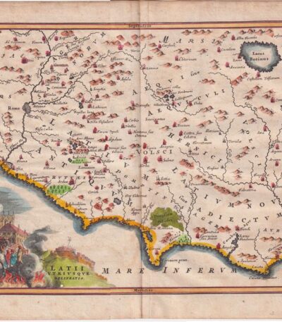
Cellarius, Central Italy, 1701
150,00 €Cellarius, Central Italy, 1701 è una mappa incisa su rame, tratta dal volume Notitia Orbis Antiqui sive Geographia Plenior by Christophorus Cellarius, published in 1701.
Questa incisione, colorata a mano, rappresenta una rara e dettagliata visione dell’Italia Centrale dell’epoca.
- Sheet size: cm. 24×33 approx.
- Engraving size: cm. 20×30 approx.
- Technique: Burin
- Condition: Excellent
- Support: Paper
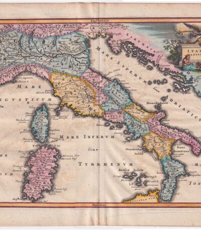
Cellarius, Italy, 1701
180,00 €Cellarius, Italy, 1701 è una pregiata incisione su rame che rappresenta una dettagliata carta dell’Italia.
This work is taken from Notitia Orbis Antiqui sive Geographia Plenior by Christophorus Cellarius, published in 1701.
- Sheet size: cm. 24×33 approx.
- Engraving size: cm. 20×30 approx.
- Support: Paper
- Condition: Excellent state of preservation
- Coloration: Colorata a mano
Questa rara rappresentazione è caratterizzata da una ottima coloritura e offre una visione affascinante dell’Italia del XVII secolo.

Cellarius, Map of Italy, 1701
180,00 €Cellarius, Mappa dell’Italia è un’incisione su rame realizzata nel 1701, che rappresenta una mappa dettagliata dell’Italia secondo la divisione di Augusto Cesare.
This work is taken from the volume Notitia Orbis Antiqui sive Geographia Plenior by Christophorus Cellarius.
- Sheet size: cm. 24×33 approx.
- Engraving size: cm. 20×30 approx.
- Support: Paper
- Condition: Excellent state of preservation
Rara rappresentazione, con ottima coloritura, che rende questa mappa un pezzo pregiato per collezionisti e appassionati di geografia storica.
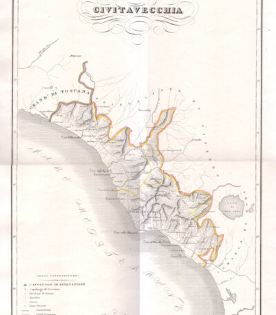
Civitavecchia, 1833-1845
70,00 €Civitavecchia, 1833-1845 è un’incisione realizzata da Attilio Zuccagni-Orlandini, un noto cartografo e geografo italiano.
This acquaforte rifinita al bulino rappresenta la città di Civitavecchia e i suoi dintorni, ed è tratta dall’importante opera Corografia fisica, storica e statistica dell’Italia e delle sue isole, pubblicata tra il 1833 e il 1845.
- Sheet size: mm. 450×620
- Engraving size: mm. 330×510
- Support: Thick engraving paper
- Condition: Perfect state of preservation

Clouet, Jean Baptiste Louis (1730 – 1790) map of Northern Italy 1767
80,00 €Mappa dell’Italia Settentrionale, realizzata nel 1767 da Jean Baptiste Louis Clouet (1730-1790), è un’opera di grande valore storico e artistico.
La mappa offre una dettagliata rappresentazione geografica del Nord Italia, evidenziando confini, città principali e rilievi. La colorazione coeva a mano conferisce all’opera un fascino particolare, tipico delle mappe settecentesche. Stampata su carta vergellata, rinomata per la sua qualità e resistenza, la mappa si presenta in condizioni eccellenti.
- Era: XVIII secolo (1767)
- Technique: Incisione su rame con colorazione coeva
- Dimensions: Grandi (60×43 cm, intero foglio)
- Support: Laid paper
- Condition: Excellent
Questa mappa è un pregevole esempio della cartografia settecentesca, perfetta per collezionisti o appassionati di storia geografica italiana.
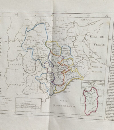
Clouet, Jean Baptiste Louis map of Sardinia Northern Italy 1767
80,00 €Mappa dell’Italia Settentrionale e Sardegna, realizzata nel 1767 da Jean Baptiste Louis Clouet (1730-1790), è un’opera cartografica di grande rilevanza, creata da uno dei più noti geografi del XVIII secolo.
La mappa raffigura dettagliatamente il Nord Italia e la Sardegna, evidenziando confini, città principali e caratteristiche geografiche. La colorazione coeva a mano arricchisce il valore estetico dell’opera, mentre il supporto in carta vergellata conferisce una qualità superiore e duratura.
- Era: XVIII secolo (1767)
- Technique: Incisione su rame con colorazione coeva
- Dimensions: Grandi (60×43 cm, intero foglio)
- Support: Laid paper
- Condition: Excellent
Quest’opera rappresenta una preziosa testimonianza della cartografia settecentesca, ideale per collezionisti o studiosi interessati alla storia geografica dell’Italia.

By Fer Nicolas, Naples, 1706
220,00 €By Fer Nicolas, Naples, 1706 It is a copper engraving that offers a perspective view of the city of Naples, enriched by 31 references located in the lower part.
This copy is made on slightly yellowed paper, giving a touch of historical authenticity to the work.
- Sheet size: cm. 22.7×33.8 approx.
- Engraving size: cm. 22.7×33.8 approx.
- Support: Paper
- Condition: Excellent state of preservation
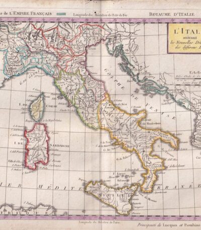
Delamarche, Atlas Elémentaire, 1806
650,00 €Elementary Atlas by Charles-François Delamarche is a work published in 1806, composed by XXXIII cards colored around the outline.
This third edition is an important cartographic resource, complete with all the maps, which offers a detailed vision of the geography of the period.
- Book dimensions: cm. 23×16
- Condition: Good condition, with some small woodworm holes in the margins of some pages
- Cover Details: Cover rubbed with small loss on the spine
- Details on the map: The map of France, folded several times, has a tear of a few centimetres repaired on the back with paper
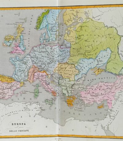
Europa all’epoca delle Crociate, 1865
60,00 €Europa all’epoca delle Crociate It is a watercolour map made in 1865.
Drawn by Naymiller and engraved by Allodi, this map is from the work Atlas of Universal Geography Chronological, Historical, Statistical and Literary by Francesco Pagnoni, published in Milan.
- Sheet size: cm. 49×38 approx.
- Paper size: cm. 40×32 approx.
- Support: Paper
- Condition: Excellent

Fano, Salmon Thomas, 1738-1768
50,00 €The City of Fano in the Duchy of Urbino It is an engraving made by Thomas Salmon between 1738 and 1768.
This work, an etching on copper, is part of the volume The present state of all the Countries, and Peoples of the World, Natural, Political, and Moral…, published in Naples.
- Sheet size: cm. 15×10 approx.
- Support: Laid paper
- Condition: Excellent state of preservation
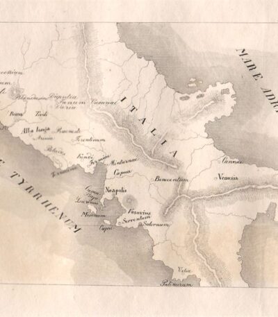
Italia Centrale, 1829
20,00 €Italia Centrale, 1829 è un’incisione realizzata a bulino su rame, che cattura l’essenza della regione centrale italiana.
This work is taken from Horazen's Works by Dr. Sickler, with engravings by Carl Frommel.
- Sheet size: cm. 26×21 approx.
- Engraving size: cm. 11×7 approx.
- Support: Medium paper with white back
- Condition: Excellent state of preservation
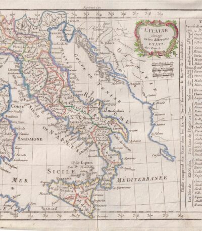
Italy, CF Delamarche, 1816
80,00 €Italy è un’incisione su rame colorata al contorno realizzata da C.F. Delamarche nel 1816.
Questa mappa dell’Italia è tratta dal Petit Atlas Moderne ou Collection de Cartes Elementaires, dedicated to youth and published in Paris by Delamarche.
- Sheet size: cm. 21×27
- Condition: Good condition, with some peeling and a central editorial crease
- Support: Paper

Kitchin Large map of Italy from 1755 contemporary colouring cm.50×60
60,00 €Mappa dell’Italia è un’incisione cartografica realizzata da Thomas Kitchin, noto cartografo britannico del XVIII secolo.
La mappa, di ampie dimensioni e decorata con una raffinata colorazione coeva, offre una rappresentazione dettagliata della penisola italiana, evidenziando confini, città principali e caratteristiche geografiche dell’epoca. Realizzata su carta spessa di alta qualità, testimonia la maestria tecnica e l’accuratezza delle opere di Kitchin, apprezzato in tutta Europa per il suo contributo alla cartografia.
- Era: 18th century
- Technique: Incisione su rame con colorazione coeva
- Dimensions: Grandi (circa 60×50 cm)
- Support: Thick paper
- Condition: Excellent
Questa mappa rappresenta un prezioso oggetto da collezione, perfetto per arricchire una raccolta di cartografia storica o per studiosi interessati all’evoluzione geografica dell’Italia.

Macerata, Salmon Thomas, 1738-1768
40,00 €Macerata It is an engraving made by Thomas Salmon between 1738 and 1768.
This work represents the city of Macerata, located in the March of Ancona of the Ecclesiastical State.
- Sheet size: cm. 15×10 approximately, with irregular margins
- Technique: Etching on copper
- Support: Laid paper without watermark
- Condition: Excellent condition
The engraving is taken from the volume The present state of all the Countries, and Peoples of the World, Natural, Political, and Moral…, published in Naples by Thomas Salmon.

Mantua, Topographical map, 1871
25,00 €Mantova, Pianta topografica It is a woodcut made in 1871, taken from the work The Hundred Cities of Italy for Ariodante Manfredi, Milazzo.
Questa pianta offre una rappresentazione dettagliata della città di Mantova, evidenziando le sue caratteristiche topografiche.
- Sheet size: cm. 30×23
- Support: Light paper
- Condition: Excellent condition
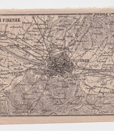
Mappa dei dintorni di Firenze, 1873
25,00 €Mappa dei dintorni di Firenze It is a copper engraving made in 1873.
This map is taken from the Guide in Italy, edited by Cav. PE Sacchi and published by the Artaria company of Milan.
Sul retro è presente un’area bianca, mentre a lato si trova la legenda dei siti più importanti della città.
- Sheet size: cm. 15.5x9.5 approx.
- Condition: Excellent condition
- Support: Paper
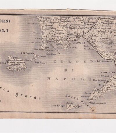
Mappa dei dintorni di Napoli, 1873
25,00 €Mappa dei dintorni di Napoli è un’incisione su rame realizzata nel 1873, che rappresenta la città di Napoli e l’Italia meridionale.
This map is taken from the publication Guide in Italy, curata dal cav. P.E. Sacchi e stampata dalla ditta Artaria di Milano.
- Sheet size: cm. 15.5x9.5 approx.
- Support: Paper
- Condition: Excellent condition
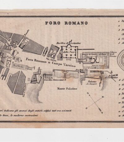
Map of the Roman Forum, 1873
25,00 €Map of the Roman Forum It is a copper engraving made in 1873.
This map, taken from the Guide in Italy edited by Cav. PE Sacchi and published by the Artaria company of Milan, offers a detailed representation of the Roman Forum.
- Sheet size: cm. 15.5x9.5 approx.
- Support: Paper
- Condition: Excellent state of preservation
- Characteristics: White back with legend of the most important sites of the city

Mappa dell’ Europa, 1869
60,00 €Mappa dell’Europa, 1869 è una litografia colorata all’acquarello che rappresenta una visione dettagliata del continente europeo.
This map, part of the Hand und Schulatlas di Dr. V.F. Klun, è stata pubblicata nel 1869 e si distingue per la sua precisione e bellezza.
- Map dimensions: cm. 34×28 circa
- Sheet size: cm. 44×35 circa
- Support: Strong paper
- Condition: Excellent condition
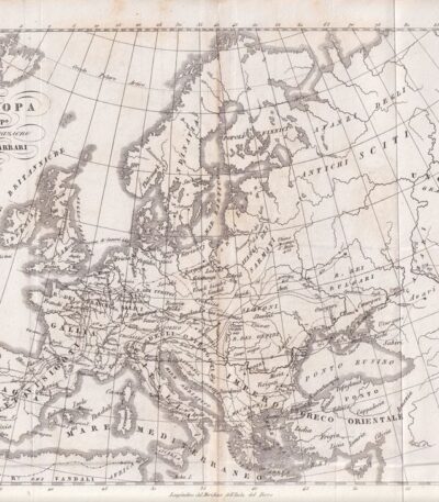
Mappa dell’Europa, 1846
30,00 €Mappa dell’Europa, 1846 è un’incisione in rame che rappresenta l’Europa dopo la migrazione dei Barbari.
This map is taken from the Storia Universale di Cesare Cantù, pubblicata a Torino presso gli Editori Giuseppe Pomba & C nel 1846.
- Sheet size: cm. 20×24 approx.
- Condition: Buone condizioni, con varie pieghe editoriali
- Support: Paper

Mappa dell’Europa, 1846
40,00 €Mappa dell’Europa, 1846 è un’incisione in rame che rappresenta l’Europa al tempo delle Crociate.
This map is taken from the Storia Universale di Cesare Cantù, pubblicata a Torino presso gli Editori Giuseppe Pomba & C nel 1846.
- Sheet size: cm. 20×24 approx.
- Technique: Burin
- Condition: Buone condizioni, con varie pieghe editoriali
- Support: Paper
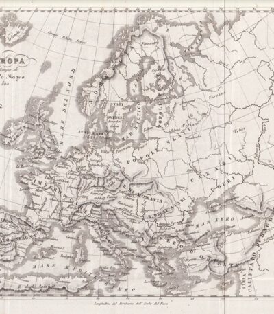
Mappa dell’Europa, 1846
30,00 €Mappa dell’Europa è un’incisione in rame realizzata nel 1846, che rappresenta l’Europa al tempo di Carlo Magno.
This map is taken from the Storia Universale di Cesare Cantù, pubblicata a Torino presso gli Editori Giuseppe Pomba & C.
- Sheet size: cm. 20×24 approx.
- Technique: Burin
- Condition: Good
- Support: Paper