France

Showing 1–24 of 28 results

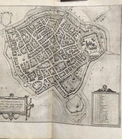
1578, Georg Braun, Frans Hogenberg, map of S. Omer Saudmer France by Ortelius

140,00 

1578, Georg Braun, Frans Hogenberg, mappa di S. Omer Saudmer Francia di Ortelius è un’incisione realizzata da George Brown And Frans Hogenberg In the 1578, tratta dal celebre atlante urbano Cities of the Earth's Orb. Quest’opera, considerata una pietra miliare nella cartografia rinascimentale, offre una rappresentazione dettagliata di quattro città dei Paesi Bassi, mostrando un’elevata precisione geografica e uno stile artistico raffinato.
Il volume, curato da Georg Braun e illustrato da Frans Hogenberg, rappresentava un capolavoro del XVI secolo, concepito per celebrare l’architettura e l’urbanistica delle città più importanti del mondo.


  • Era: 16th century
  • Technique: Etching
  • Dimensions: Large (42×54 cm)
  • Support: Laid paper
  • Condition: Excellent

Quest’opera si distingue per il suo eccellente stato di conservazione e la qualità del dettaglio, rendendola ideale per collezionisti e appassionati di cartografia storica.

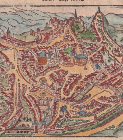
Aachen, St.Munster, 1614

80,00 

Aachen, St.Munster, 1614 it's a view of the city of Hachen Aachen, also known as Aken or Aix-la-Chapelle, taken from the famous work Cosmography Universalis by Sebastian Munster.
This woodcut, made on watercolour laid paper, offers a fascinating representation of the city in 1614. On the back there is a writing that adds further historical value to the work.

  • Sheet size: cm. 36×22 approx.
  • Image size: cm. 12.5x15.5 approx.
  • Support: Watercolored laid paper
  • Condition: Excellent state of preservation

Cellarius, France, 1701

60,00 

Cellarius It is a copper engraving map made in France in 1701, taken from the work Notitia Orbis Antiqui sive Geographia Plenior by Christophorus Cellarius.
This engraving offers a detailed representation of Gaul, highlighting the geographical features of the time.

  • Sheet size: cm. 24×33 approx.
  • Engraving size: cm. 20×30 approx.
  • Support: Paper
  • Condition: Excellent state of preservation

France, CF Delamarche, 1816

70,00 

France, CF Delamarche, 1816 it's a carta della Francia divisa nei suoi dipartimenti, realizzata con incisione su rame colorata al contorno.
This map is taken from the volume Petit Atlas Moderne ou Collection de Cartes Elementaires, dedicato alla gioventù, pubblicato a Parigi da Delamarche nel 1816.

  • Sheet size: cm. 21×27
  • Engraving size: cm. 21×27
  • Support: Paper
  • Condition: Good

Presenta qualche spellatura e una piega centrale editoriale, ma nel complesso si trova in buone condizioni.

France, CF Delamarche, 1816

70,00 

Map of France It is an engraving made by CF Delamarche in 1816, which represents France divided into its 86 departments.
This work is taken from the Petit Atlas Moderne ou Collection de Cartes Elementaires, dedicated to youth and published in Paris by Delamarche.

  • Sheet size: cm. 21×27 approx.
  • Engraving size: cm. 20×26 approx.
  • Support: Paper
  • Condition: Good condition, with some peeling and central editorial crease

Kitchin Large map of France from 1754 contemporary colouring cm.50×60

60,00 

Map of France, incisione realizzata nel 1754 da Thomas Kitchin, celebre cartografo del XVIII secolo.
Questa mappa, in colorazione coeva, offre un dettaglio accurato della Francia dell’epoca ed è un esempio di maestria cartografica del periodo illuminista. Incisa su carta spessa, rappresenta una preziosa testimonianza storica e geografica.

  • Era: 18th century
  • Technique: Engraving
  • Dimensions: Grandi (60×50 cm circa)
  • Support: Thick paper
  • Condition: Buone condizioni, con colorazione originale dell’epoca

Map of France, 1614

60,00 

Map of France It is a page extracted from the Cosmography Universalis by Sebastian Munster, published in Basel in 1614.
This map represents Gaul and includes the coat of arms of France, dating back to the 16th century. On the back there is a writing that adds further historical value to the work.

  • Sheet size: cm. 36×22 approx.
  • Image size: cm. 8×13 approx.
  • Support: Watercolored laid paper
  • Condition: Excellent state of preservation

Map of France, 1869

60,00 

Map of France It is a watercolour lithograph made in 1869, which offers a detailed representation of the French territory.
This map is taken from the volume Hand – Und Schulatlas über alle Teile Der Erde, and is characterized by an editorial fold.

  • Sheet size: mm. 437×347
  • Support: Strong paper
  • Condition: Excellent condition
  • Back: White

Map of Cales, 1614

70,00 

Map of Cales It is a page extracted from the Cosmography Universalis, created by Sebastian Munster in 1614.
This view of Cales, located in France, was colored in watercolor, while the reverse features a view of the city of Artois.

  • Sheet size: cm. 36×22 approx.
  • Image size: cm. 12×15,5 approx.
  • Support: Laid paper
  • Condition: Excellent state of preservation

Map of Estampes, 1614

50,00 

Map of Estampes it is a valuable woodcut made by Sebastian Munster in 1614, taken from his famous work Cosmography Universalis.
This map provides a detailed view of the city of Estampes (Etampes) in France, highlighting the geographical and historical importance of the region.

  • Sheet size: cm. 36×22 approx.
  • Image size: cm. 10×18 approx.
  • Support: Watercolored laid paper
  • Condition: Excellent state of preservation

Map of Gravelines, France, 1614

60,00 

Map of Gravelines, France it is a valuable engraving made by Sebastian Munster in 1614, taken from his famous work Cosmography Universalis.
This map offers a detailed view of Gravelines (Gravelingen), coloured in watercolour, with a view of Sancerra on the reverse.

  • Sheet size: cm. 36×22 approx.
  • Image size: cm. 12×15,5 approx.
  • Support: Watercolored laid paper
  • Condition: Excellent state of preservation

Mappa di Perpignan, Francia, da Cosmografia di S.Munster, 1614

60,00 

Map of Perpignan, France It is a woodcut made by Sebastian Munster in 1614, taken from his work Cosmography Universalis.
This map features the historic city of Perpignan, capital of the Pyrénées-Orientales department and once capital of the County of Roussillon.

  • Sheet size: cm. 36×22 approx.
  • Image size: cm. 12.5x15.5 approx.
  • Support: Laid paper
  • Condition: Excellent state of preservation

Petrus Bertius, Anjou,1612

40,00 

Petrus Bertius, Anjou It is an original watercolor map made in 1612 by Petrus Bertius, a well-known 17th century geographer.
This map is from his work Petri Bertii Geographischer eyn oder zusammengezogener Tabeln Funff unterschiedliche Bucher, and is a significant example of the cartography of the time.

  • Sheet size: cm. 12×17 approx.
  • Map dimensions: mm. 125×83
  • Support: Laid paper
  • Condition: Excellent condition

Petrus Bertius, Artesia,1612

40,00 

Petrus Bertius, Artesia It is an original watercolor map made in 1612 by Petrus Bertius, a well-known French geographer.
This map is taken from Petri Bertii Geographischer eyn oder zusammengezogener Tabeln Funff unterschiedliche Bucher, a significant work of the 17th century.

  • Sheet size: cm. 12×17 approx.
  • Map dimensions: mm. 125×83
  • Support: Laid paper
  • Condition: Excellent condition

Petrus Bertius, Caletenfium,1612

40,00 

Petrus Bertius, Caletenfium It is an original watercolor map made by Petrus Bertius in 1612.
This map is taken from Petri Bertii Geographischer eyn oder zusammengezogener Tabeln Funff unterschiedliche Bucher, a work that collects various geographical representations of the time.

  • Sheet size: cm. 12×17 approx.
  • Map dimensions: mm. 125×83
  • Support: Laid paper
  • Condition: Excellent state of preservation

Petrus Bertius, Gascony, 1612

40,00 

Petrus Bertius, Gascony It is an original watercolor map made in 1612 by Petrus Bertius, a well-known 16th century geographer.
This map is from his work Geographischer eyn oder zusammengezogener Tabeln Funff unterschiedliche Bucher.

  • Sheet size: cm. 12×17 approx.
  • Map dimensions: mm. 125×83
  • Support: Laid paper
  • Condition: Excellent condition

Petrus Bertius, Hannonia,1612

40,00 

Petrus Bertius, Hannonia It is an original watercolor map made in 1612 by Petrus Bertius, a well-known French geographer.
This map is taken from the volume Petri Bertii Geographischer eyn oder zusammengezogener Tabeln Funff unterschiedliche Bucher.

  • Sheet size: cm. 12×17 approx.
  • Map dimensions: mm. 125×83
  • Support: Laid paper
  • Condition: Excellent condition

Petrus Bertius, Lotharingia 1612

40,00 

Petrus Bertius, Lotharingia 1612 It is an original watercolor map, made by Petrus Bertius in 1612.
This map is taken from Petri Bertii Geographischer eyn oder zusammengezogener Tabeln Funff unterschiedliche Bucher.

  • Paper size: mm. 125×83
  • Stand dimensions: cm. 12×17
  • Support: Laid paper
  • Condition: Excellent condition

Petrus Bertius, Namur,1612

40,00 

Petrus Bertius, Namur, 1612 It is an original watercolor map, taken from Petri Bertii Geographischer eyn oder zusammengezogener Tabeln Funff unterschiedliche Bucher, published in 1612.
This small map is a significant example of 17th century cartography.

  • Sheet size: cm. 12×17 approx.
  • Map dimensions: mm. 125×83
  • Support: Laid paper
  • Condition: Excellent condition

Petrus Bertius, Normandy, 1612

40,00 

Petrus Bertius, Normandy It is an original watercolor map made in 1612 by Petrus Bertius (1565-1629).
This map is taken from the volume Petri Bertii Geographischer eyn oder zusammengezogener Tabeln Funff unterschiedliche Bucher.

  • Sheet size: cm. 12×17 approx.
  • Map dimensions: mm. 125×83
  • Support: Laid paper
  • Condition: Excellent condition

Petrus Bertius, Picardy,1612

40,00 

Petrus Bertius, Picardia è una mappa originale acquarellata realizzata nel 1612 da Petrus Bertius, un noto geografo olandese.
This map is taken from Petri Bertii Geographischer eyn oder zusammengezogener Tabeln Funff unterschiedliche Bucher.

  • Paper size: mm. 125×83
  • Stand dimensions: cm. 12×17
  • Support: Laid paper
  • Condition: Excellent condition

Petrus Bertius, Vaucluse, 1612

40,00 

Petrus Bertius, Vaucluse It is an original watercolor map made in 1612 by Petrus Bertius (1565-1629).
This map is taken from Petri Bertii Geographischer eyn oder zusammengezogener Tabeln Funff unterschiedliche Bucher.

  • Sheet size: cm. 12×17 approx.
  • Map dimensions: mm. 125×83
  • Support: Laid paper
  • Condition: Excellent condition

Petrus Bertius, Veromadui,1612

40,00 

Petrus Bertius, Veromadui It is an original watercolor map made in 1612 by Petrus Bertius, a well-known French geographer.
This map is taken from Petri Bertii Geographischer eyn oder zusammengezogener Tabeln Funff unterschiedliche Bucher, pubblicato nello stesso anno.

  • Sheet size: cm. 12×17 approx.
  • Map dimensions: mm. 125×83
  • Support: Laid paper
  • Condition: Excellent condition

Philippus Cluverius (1580-1622), Mappa della Francia, 1686

80,00 

La Mappa della Francia It is an engraving made by Philippus Cluverius nel 1686.
This map, part of the work Introductionis in universam geographiam, tam veterem quam novam, è un esempio significativo della cartografia del XVII secolo.

  • Sheet size: cm. 13.4×14 approx.
  • Engraving size: cm. 13.4×14 approx.
  • Support: Laid paper
  • Condition: Excellent state of preservation

Explore the fascinating world of antique prints

Antique prints are silent witnesses of history, capable of transporting us to distant eras through the art of engraving. Our e-commerce offers a vast selection of these precious finds, carefully selected for their authenticity and artistic value. Whether you are an expert collector or a novice enthusiast, you will find unique pieces here that will enrich your spaces with a touch of timeless elegance.

A safe and rewarding shopping experience

We understand the importance of each individual print and are committed to ensuring a flawless purchasing experience. Our secure payment system and insured shipping with professional packaging ensure that each piece arrives in the best condition. Our expertise in the sector allows us to offer detailed descriptions and personalized advice, helping you to make informed choices. If you have any questions or specific requests, do not hesitate to contact us: we will be happy to guide you into the wonderful world of antique prints.