English (UK)
  Italiano
  Français


Ancient Maps

Philippus Cluverius (1580-1622), Germania, 1686
80,00 €Philippus Cluverius è un’incisione in rame acquarellata realizzata nel 1686, proveniente dall’opera Introductionis in universam geographiam, tam veterem quam novam, libri VI, published in Amsterdam.
Questa incisione rappresenta un’importante testimonianza della geografia del XVII secolo e misura mm. 134×140.
- Sheet size: Small
- Engraving size: mm. 134×140
- Support: Laid paper
- Condition: Excellent

Philippus Cluverius (1580-1622), England, 1686
80,00 €Philippus Cluverius (1580-1622) presents a map of England, part of the British Isles, dated 1686.
This copper engraving is watercolour and comes from the work Introductionis in universam geographiam, tam veterem quam novam, libri VI, published in Amsterdam in 1686.
- Sheet size: mm. 134×140
- Technique: Burin
- Support: Laid paper
- Condition: Excellent

Philippus Cluverius (1580-1622), Liguria, 1686
80,00 €Philippus Cluverius è un’incisione in rame acquarellata realizzata nel 1686, rappresentante la Liguria, Italia Settentrionale.
This work is taken from the volume Introductionis in universam geographiam, tam veterem quam novam, libri VI, published in Amsterdam.
- Sheet size: mm. 134×140
- Support: Laid paper with partial watermark
- Condition: Excellent condition

Philippus Cluverius (1580-1622), Map of Europe, 1686
80,00 €Philippus Cluverius – Map of Europe It is a watercolour copper engraving made in 1686.
This map is taken from the work Introductionis in universam geographiam, tam veterem quam novam, libri VI, published in Amsterdam.
- Sheet size: mm. 134×140
- Technique: Burin
- Support: Laid paper
- Condition: Excellent condition

Philippus Cluverius (1580-1622), Map of China, 1686
70,00 €Philippus Cluverius (1580-1622) presents a map of China and Japan, built in 1686.
This copper engraving is watercolour and comes from the work Introductionis in universam geographiam, tam veterem quam novam, libri VI, published in Amsterdam.
- Sheet size: mm. 134×140
- Technique: Burin
- Support: Laid paper
- Condition: Excellent
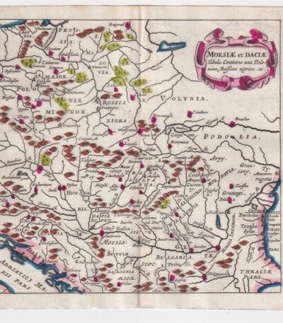
Philippus Cluverius (1580-1622), Map of Dacia, 1686
60,00 €Philippus Cluverius – Map of Dacia It is a watercolour copper engraving made in 1686.
This map represents Dacia, Hungary, Poland and Moesia, and is taken from the work Introductionis in universam geographiam, tam veterem quam novam, libri VI, published in Amsterdam.
- Sheet size: mm. 134×140
- Technique: Burin
- Support: Laid paper
- Condition: Excellent

Philippus Cluverius (1580-1622), Mappa della Francia, 1686
80,00 €La Mappa della Francia It is an engraving made by Philippus Cluverius nel 1686.
This map, part of the work Introductionis in universam geographiam, tam veterem quam novam, è un esempio significativo della cartografia del XVII secolo.
- Sheet size: cm. 13.4×14 approx.
- Engraving size: cm. 13.4×14 approx.
- Support: Laid paper
- Condition: Excellent state of preservation

Philippus Cluverius (1580-1622), Mappa della Germania 1686
60,00 €Philippus Cluverius (1580-1622) presents a Mappa della Germania Inferiore, built in 1686.
This copper engraving is watercolour and comes from the work Introductionis in universam geographiam, tam veterem quam novam, libri VI, published in Amsterdam in 1686.
- Sheet size: mm. 134×140
- Technique: Burin
- Support: Laid paper
- Condition: Excellent

Philippus Cluverius (1580-1622), Mappa della Germania, 1686
60,00 €Philippus Cluverius – Mappa della Germania It is a watercolour copper engraving made in 1686.
This map is taken from the work Introductionis in universam geographiam, tam veterem quam novam, libri VI, published in Amsterdam.
- Sheet size: mm. 134×140
- Support: Laid paper
- Condition: Excellent condition

Philippus Cluverius (1580-1622), Mappa della Germania, 1686
60,00 €Philippus Cluverius (1580-1622) presents a Map of Germany realizzata nel 1686.
Questa incisione in rame è stata acquarellata e proviene dall’opera Introductionis in universam geographiam, tam veterem quam novam, libri VI, published in Amsterdam.
- Sheet size: mm. 134×140
- Technique: Burin
- Support: Laid paper
- Condition: Excellent
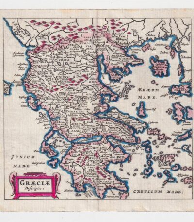
Philippus Cluverius (1580-1622), Map of Greece, 1686
60,00 €Philippus Cluverius – Map of Greece It is a watercolour copper engraving made in 1686.
This map is taken from the work Introductionis in universam geographiam, tam veterem quam novam, libri VI, published in Amsterdam.
- Sheet size: cm. 13.4×14 approx.
- Support: Laid paper
- Condition: Excellent state of preservation

Philippus Cluverius (1580-1622), Map of Spain, 1686
80,00 €Philippus Cluverius – Mappa della Spagna It is a watercolour copper engraving made in 1686.
This map is taken from the work Introductionis in universam geographiam, tam veterem quam novam, libri VI, published in Amsterdam.
- Sheet size: mm. 134×140
- Technique: Burin
- Support: Laid paper
- Condition: Excellent condition
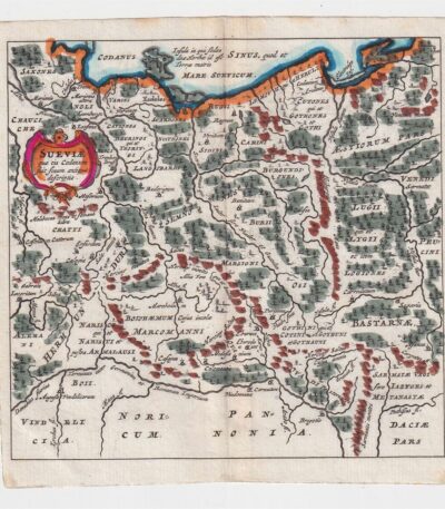
Philippus Cluverius (1580-1622), Mappa della Suevia, 1686
60,00 €Philippus Cluverius (1580-1622) presenta la sua Mappa della Suevia, un’incisione in rame acquarellata realizzata nel 1686.
Questa mappa, che rappresenta la regione della Suevia in Germania, è tratta dall’opera Introductionis in universam geographiam, tam veterem quam novam, libri VI, published in Amsterdam.
- Sheet size: mm. 134×140
- Technique: Burin
- Support: Laid paper
- Condition: Excellent
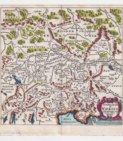
Philippus Cluverius (1580-1622), Mappa della Vindelicia, 1686
60,00 €La Mappa della Vindelicia It is an engraving made by Philippus Cluverius (1580-1622) in 1686.
Questa mappa rappresenta la regione della Vindelicia, situata in Germania, ed è parte dell’opera Introductionis in universam geographiam, tam veterem quam novam, libri VI, published in Amsterdam.
- Sheet size: mm. 134×140
- Technique: Burin
- Support: Laid paper
- Condition: Excellent condition

Dutch possessions, Otto Petri, 1853
50,00 €Possedimenti Olandesi è un’incisione colorata a mano realizzata da Otto Petri nel 1853.
Questa mappa rappresenta i possedimenti olandesi d’oltremare, inclusi Java e Borneo, ed è tratta dal School Atlas Alle Deelen Der Aarde, published by J. Van Den Bosch in Rotterdam.
- Sheet size: cm. 26×34 approx.
- Engraving size: cm. 22×27 approx.
- Support: Medium thickness paper
- Condition: Excellent state of preservation

Prussia, Otto Petri, 1853
50,00 €Mappa della Prussia è un’incisione colorata a mano realizzata da Otto Petri nel 1853.
This map, part of the School Atlas Alle Deelen Der Aarde, pubblicato da J. Van Den Bosch a Rotterdam, offre una rappresentazione dettagliata della Prussia dell’epoca.
- Sheet size: cm. 26×34 approx.
- Engraving size: cm. 22×27 approx.
- Support: Medium thickness paper
- Condition: Excellent condition
- Characteristics: White back, editorial fold
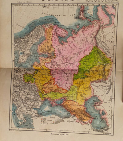
Russia, Otto Petri, 1853
50,00 €Russia It is a detailed map made by Eight Petri In the 1853.
This hand-colored engraving measures cm. 22×27 on a sheet of paper cm. 26×34.
- Sheet size: cm. 26×34
- Map dimensions: cm. 22×27
- Support: Medium thickness paper
- Condition: Excellent condition
The map is taken from the School Atlas Alle Deelen Der Aarde, published by J. Van Den Bosch, Rotterdam.

Salzburg, St. Munster, 1614
Salzburg, St. Munster, 1614 è una splendida veduta della città di Salisburgo, estratta dalla celebre opera Cosmography Universalis by Sebastian Munster.
Questa xilografia, realizzata su carta vergellata acquarellata, offre un affascinante sguardo sulla città nel 1614. Sul retro, sono presenti altre immagini che arricchiscono ulteriormente l’opera.
- Sheet size: cm. 36×22 approx.
- Image size: cm. 12.5×15 approx.
- Support: Watercolored laid paper
- Condition: Excellent
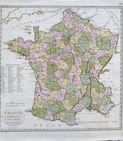
Samuel John Neele (1763 – 1824) vintage colored map of France 1798
80,00 €Map of France, realizzata nel 1798 da Samuel John Neele (1763–1824), incisore e cartografo britannico.
Quest’opera offre una rappresentazione dettagliata della Francia rivoluzionaria, arricchita da una colorazione coeva che evidenzia le divisioni amministrative e i principali centri urbani. Stampata su carta vergellata con filigrana, si distingue per la qualità della lavorazione e si presenta in ottime condizioni.
- Era: XVIII secolo (1798)
- Technique: Incisione su rame con colorazione coeva
- Dimensions: Alla battuta del rame: 36×36 cm; intero foglio: 44×42 cm
- Support: Laid paper with watermark
- Condition: Excellent
Questa mappa è un’importante testimonianza della cartografia di fine Settecento, ideale per collezionisti e studiosi di storia e geografia della Francia.

Spain and Portugal, Otto Petri, 1853
50,00 €Spain and Portugal It is a hand-engraved and hand-colored map, made by Otto Petri in 1853.
This map, part of the School Atlas Alle Deelen Der Aarde, published by J. Van Den Bosch in Rotterdam, offers a detailed representation of Iberian geography.
- Sheet size: cm. 26×34 approx.
- Map dimensions: cm. 22×27 approx.
- Support: Medium thickness paper
- Condition: Excellent condition
- Fold: Editorial fold
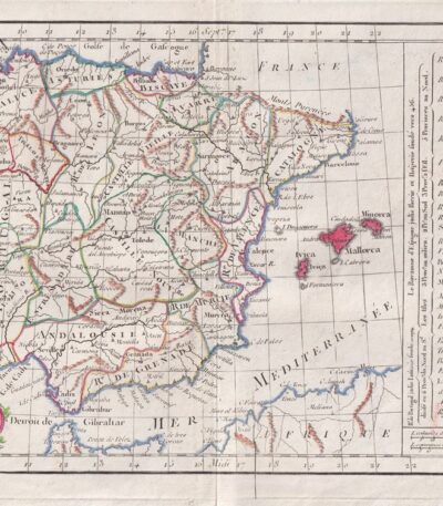
Spain, CF Delamarche, 1816
70,00 €Map of Spain and Portugal realizzata da C.F. Delamarche nel 1816.
This copper engraving is colored around the outline and comes from the volume Petit Atlas Moderne ou Collection de Cartes Elementaires, dedicato alla gioventù e pubblicato a Parigi da Delamarche.
- Sheet size: cm. 21×27
- Condition: Good condition, with some peeling and a central editorial crease
- Support: Paper
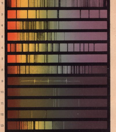
Spettro delle diverse fonti di luce, solare stellare comete terrestre, xilografia 1882
30,00 €Rappresentazione delle costellazioni, taken from Les Étoiles et les Curiosités du Ciel Of Camille Flammarion, pubblicato a Parigi nel 1882.
Questa affascinante stampa xilografica illustra una rappresentazione antica delle costellazioni, accompagnata da testo descrittivo. L’incisione è parte di una pagina originale del celebre trattato astronomico di Flammarion, autore noto per la sua opera di divulgazione scientifica. La pagina ha testo intorno all’immagine e sul verso.
- Era: 19th century
- Technique: Woodcut
- Page size: Medie (cm 25×16 circa)
- Support: Paper
- Condition: Good
- Characteristics: La stampa verrà spedita nella pagina intera originale
Un’interessante testimonianza della tradizione astronomica ottocentesca, ideale per collezionisti e appassionati di storia dell’astronomia.
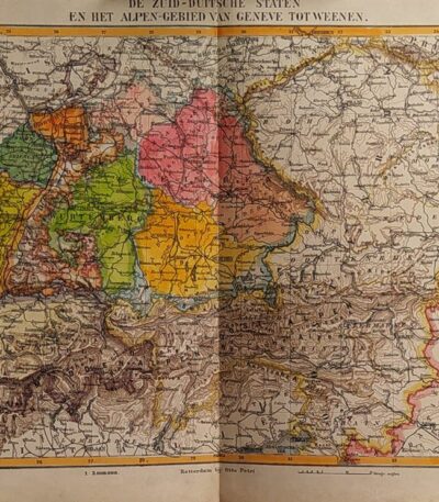
States of Germany, Otto Petri, 1853
50,00 €Stati della Germania è una mappa incisa a mano da Otto Petri nel 1853, che rappresenta gli stati della Germania meridionale e l’area delle Alpi, da Ginevra a Vienna.
Questa incisione colorata è parte del School Atlas Alle Deelen Der Aarde, published by J. Van Den Bosch in Rotterdam.
- Sheet size: cm. 26×34 approx.
- Engraving size: cm. 22×27 approx.
- Support: Medium thickness paper
- Condition: Excellent state of preservation
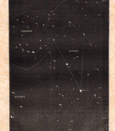
Stelle della costellazione del Bouvier, xilografia 1882
30,00 €Rappresentazione delle costellazioni, taken from Les Étoiles et les Curiosités du Ciel Of Camille Flammarion, pubblicato a Parigi nel 1882.
Questa affascinante stampa xilografica illustra una rappresentazione antica delle costellazioni, accompagnata da testo descrittivo. L’incisione è parte di una pagina originale del celebre trattato astronomico di Flammarion, autore noto per la sua opera di divulgazione scientifica. La pagina ha testo intorno all’immagine e sul verso.
- Era: 19th century
- Technique: Woodcut
- Page size: Medie (cm 25×16 circa)
- Support: Paper
- Condition: Good
- Characteristics: La stampa verrà spedita nella pagina intera originale
Un’interessante testimonianza della tradizione astronomica ottocentesca, ideale per collezionisti e appassionati di storia dell’astronomia.