Large Format Prints

Showing 1–24 of 181 results

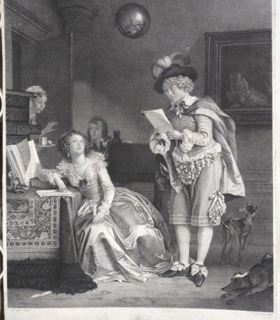
1785-1794 Gerard The Art of Love Courtship Etching Dotted

180,00 

The Art of Loving: Courtship It is an engraving made between the 1785 and 1794 from Mr. Gerard, an artist known for his refined and elegant style. The print, created with the etching and dotting technique, captures a delicate moment of courtship, reflecting the aesthetic and decorative taste typical of the 18th century. At the bottom, the signatures "M. Gerard pinxit" and "Ferard Sculpsit" are visible, testifying to the authenticity of the work.
This print stands out for its artistic beauty and strong decorative impact, ideal for enthusiasts of vintage engravings.

  • Era: 18th century
  • Technique: Etching and dotting
  • Dimensions: Large (about 56×45 cm)
  • Support: Medium thickness paper, white back
  • Condition: Excellent condition

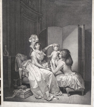
1793 Boilly l'amour couronne dotted engraved by Cazenave

250,00 

The Love of the Crown It is a dotted etching made by the engraver Jean-François Cazenave In the 1793, inspired by a painting by the famous French artist Louis-Léopold Boilly.
This work is an exceptional example of the stippling technique, particularly in vogue in France and England at the end of the 18th century, made famous by masters such as Francesco Bartolozzi. Cazenave, born in Paris around 1770, distinguished himself as a specialist in this technique, collaborating with renowned artists such as Boilly and Prud'hon.

  • Era: 18th century
  • Technique: Etching and dotting
  • Dimensions: Large (approx. 56 x 45 cm)
  • Support: Thick paper with white backing
  • Condition: Excellent state of preservation

This print is characterized by a high artistic and decorative quality, making it an ideal choice for collectors and lovers of historical art.

1793 Boilly the dotted Zograscope L'Optique engraved by Cazenave

250,00 

The Optique it is a dotted etching made by Jean-François Cazenave In the 1793, inspired by a painting by Louis-Léopold Boilly.
The work portrays Louise-Sebastienne Gély, second wife of Georges Danton, and Antoine, son of Danton's first marriage, observing prints through a Zograscope, an optical instrument popular in the 18th century.
This print is an excellent example of the fashion for stipple engraving, introduced in France in the late eighteenth century, partly inspired by the work of Francesco Bartolozzi in England.

  • Era: 18th century
  • Technique: Dotted etching
  • Dimensions: Large (about 56×45 cm)
  • Support: Thick paper with white backing
  • Condition: Excellent state of preservation

The Optique It is a work of great decorative and artistic impact, appreciated not only for its technical refinement but also for its historical value, linked to the French Revolutionary period. Jean-François Cazenave, born in Paris around 1770, was a master of stipple engraving, and this print is considered one of the masterpieces of his production.

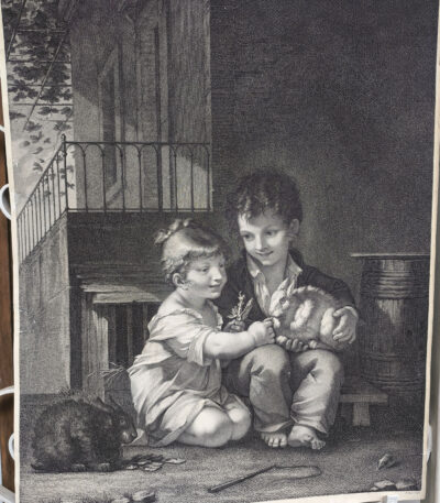
1793 Pierre-Paul Prud'hon Children with a Rabbit, etching and dotting

250,00 

Children with rabbit it is a dotted etching made by the engraver B. Roger in 1793, inspired by a painting by Pierre-Paul Prud'hon, a famous French Romantic painter. Prud'hon, active between the 18th and 19th centuries, was famous for his allegorical paintings and portraits that combined grace and romantic sensitivity. This work represents a delicate moment of childhood intimacy, captured with exceptional technical finesse and a decorative touch.

  • Era: 18th century
  • Technique: Dotted etching
  • Dimensions: Large (approximately 56×45 cm)
  • Support: Thick paper with white backing
  • Condition: Excellent

This print stands out for its visual and decorative impact, ideal for enriching artistic collections or refined environments.

1800, Map of Northern Italy

120,00 

Map of Northern Italy It is a lithograph made in 1800, representing the theatre of war in Italy during the campaigns of 1796 and 1799.
This hand-colored map is a rare historical representation with exceptional coloring.

  • Sheet size: cm. 41×65
  • Condition: Excellent, with some editorial creases
  • Technique: Lithography
  • Support: Paper

1800, Map of Northern Italy

80,00 

1800, Map of Northern Italy It is a lithograph representing a detailed map of the theatre of war in Italy during the campaigns of 1796 and 1799.
This rare representation offers a fascinating glimpse into the historical events of that period.

  • Sheet size: cm. 41×65
  • Condition: Excellent, with some editorial creases
  • Support: Paper

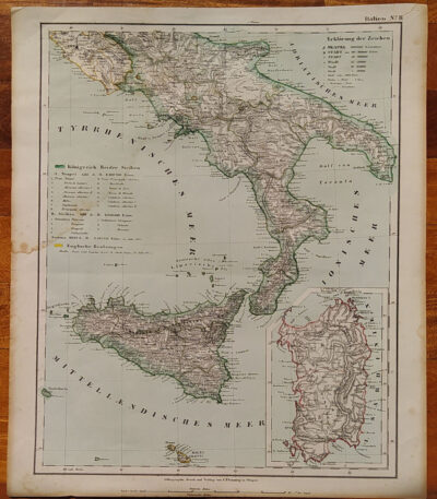
1855, Map of Southern Italy

80,00 

1855, Map of Southern Italy It is a lithograph made by C. Flemming, published in 1855.
This map represents Southern Italy and Sardinia, and was produced by Berghaus, Heinrich and Sohr, Karl.

  • Sheet size: cm. 44×37
  • Coloration: Contemporary with the outline
  • Condition: Excellent condition
  • Rarity: Rare representation with excellent coloring

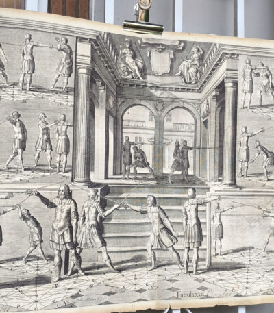
Adriaen Jacobsen Matham (1599-1660) Fencing Lessons, large etching

180,00 

Fencing Lessons #5 It is a refined engraving made by Adriaen Jacobsen Matham (1599-1660), a well-known Dutch artist of the 17th century. This print is part of a series dedicated to the art of fencing, a theme that was particularly popular in the cultural and artistic context of the Dutch Golden Age. Crispian Queborn's signature is in the center of the work, underlining the quality and importance of the work.

This work represents a precious reference for historical fencing enthusiasts and a rare collector's item thanks to its technical quality and monumental size.

  • Era: 17th century
  • Technique: Etching
  • Dimensions: Large (about 50×70 cm)
  • Support: Medium thickness paper, white back
  • Condition: Good storage conditions

This print is not only a testimony of the seventeenth-century engraving art, but also a document of historical interest for scholars of Western martial arts.

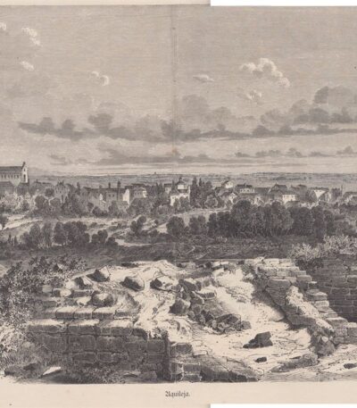
Aquilea, 1865

40,00 

Aquilea It is a woodcut made in 1865, which offers a general view of the historic city of Aquileia.
This work is printed on a sheet of paper of the following dimensions: cm. 40×27 and has another engraving on the back.

  • Sheet size: cm. 40×27
  • Engraving size: cm. 36×23
  • Technique: Woodcut
  • Condition: Excellent
  • Support: Paper

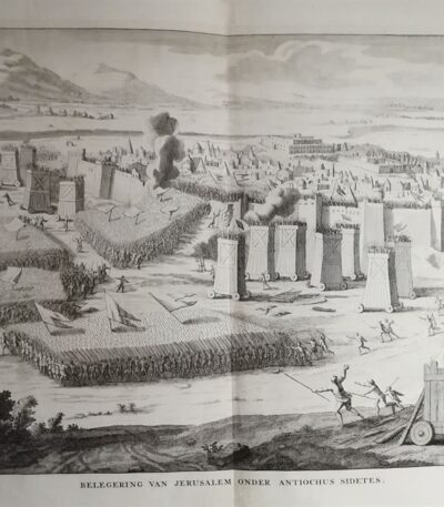
Siege of Jerusalem, etching ca. 1650

40,00 

Assedio di Gerusalemme è un’acquaforte realizzata intorno al 1650, che rappresenta l’assedio della città sotto Antioco Sidete.
Questa opera è stampata su carta spessa vergellata senza filigrana, con una dimensione alla battuta del rame di cm. 43×30 e un foglio di cm. 46×38.

  • Sheet size: cm. 46×38
  • Engraving size: cm. 43×30
  • Support: Carta spessa vergellata
  • Condition: Excellent condition

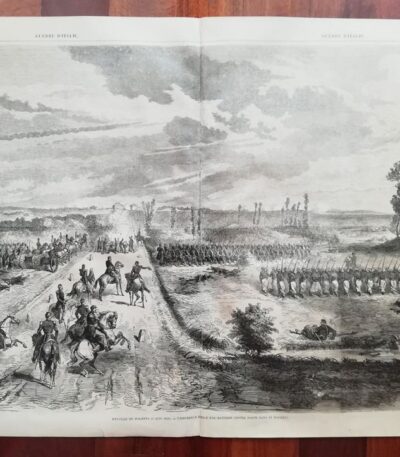
Battle of Magenta, 1859

50,00 

Battle of Magenta, 1859 it is a woodcut that represents one of the crucial moments of the Italian wars.
This print, with a printed part measurement of cm. 50×34, is extracted from the volume Wars of Italy of 1859.

  • Sheet size: Small
  • Support: Paper
  • Condition: Good

Battle of Solferino, 1859

50,00 

Battle of Solferino It is a woodcut made in 1859, which represents one of the crucial moments of the war.
This print is taken from the volume Wars of Italy, and is characterised by small margins and writing on the back.

  • Sheet size: cm. 50×34 approx.
  • Technique: Woodcut
  • Condition: Excellent
  • Support: Paper

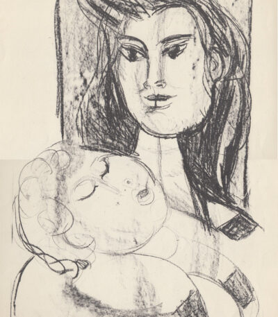
Bruno Cassinari (1912-1992), Motherhood

120,00 

Maternità è una litografia di Bruno Cassinari (1912-1992), un’opera che cattura l’essenza della maternità attraverso uno stile distintivo.
Questo esemplare è firmato a mano dall’autore ed è parte di una tiratura limitata di soli 220 esemplari, realizzata dalla Saga (Società Applicazioni Gomma Antivibranti). La stampa è stata curata dall’Istituto Geografico De Agostini di Novara.

  • Sheet size: cm. 48×33
  • Condition: Excellent condition
  • Price: €120,00

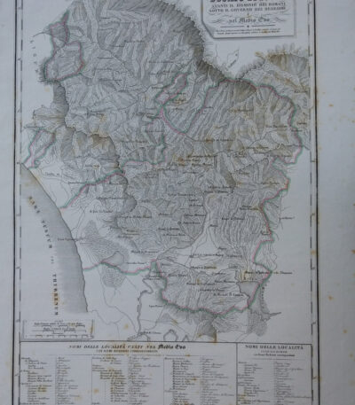
Map of the Duchy of Lucca, 1842

90,00 

Map of the Duchy of Lucca It is an engraving made in 1842, which represents the territory of Lucca during Roman rule and in the Middle Ages.
This work is a physical, historical and statistical chorography of Italy and its islands, created by Attilio Zuccagni-Orlandini.

  • Sheet size: cm. 45×62
  • Engraving size: cm. 45×62
  • Support: Thick engraving paper
  • Condition: Perfect state of preservation
  • Technique: Etching finished with a burin

This detailed map offers a historical overview of the city of Lucca and its surroundings.

Map of Northern Italy, 1836

40,00 

Map of Northern Italy è un’incisione in rame realizzata da Th. Duvotenay nel 1836.
Questa carta, parte delle carte routiere de l’Italie, è una rappresentazione dettagliata e decorativa dell’Italia Settentrionale.

  • Sheet size: cm. 55×37 circa
  • Engraving size: cm. 47×29 circa
  • Support: Lightweight paper, white back
  • Condition: Excellent

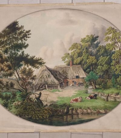
Circle of Jakob Philipp Hackert, Gouache, 1794

1.600,00 

Cerchia di Jakob Philipp Hackert è una splendida gouache realizzata nel 1794.
Questa opera, di soggetto bucolico, presenta una fattura dettagliata delle mucche e un sapiente uso dei verdi, che rendono plausibile l’attribuzione a Jakob Philipp Hackert o a un suo seguace.

  • Dimensioni dell’ovale: cm. 37×48
  • Dimensioni del cartoncino: cm. 41×51
  • Support: Carta spessa incollata su cartoncino
  • Condition: Ottime, con qualche strappo ai margini del cartoncino di supporto, che non interessa il dipinto

L’opera si vende senza certificato di attribuzione con la clausola di visto e piaciuto.

Clouet, Jean Baptiste Louis (1730 – 1790) map of Austria Carinthia 1767

80,00 

Mappa dell’Austria e Carinzia, realizzata nel 1767 da Jean Baptiste Louis Clouet (1730-1790), è un’importante testimonianza cartografica del XVIII secolo.
L’opera raffigura con notevole precisione il territorio dell’Austria e della Carinzia, evidenziando confini, città e rilievi montuosi. La colorazione coeva, applicata a mano, aggiunge un valore estetico e storico, mentre il supporto in carta vergellata sottolinea la qualità del lavoro.

  • Era: XVIII secolo (1767)
  • Technique: Incisione su rame con colorazione coeva
  • Dimensions: Grandi (60×43 cm, intero foglio)
  • Support: Laid paper
  • Condition: Excellent

Questa mappa rappresenta un magnifico esempio della cartografia settecentesca, perfetta per collezionisti o studiosi di storia geografica dell’Europa centrale.

Clouet, Jean Baptiste Louis (1730 – 1790) map of Northern Italy 1767

80,00 

Mappa dell’Italia Settentrionale, realizzata nel 1767 da Jean Baptiste Louis Clouet (1730-1790), è un’opera di grande valore storico e artistico.
La mappa offre una dettagliata rappresentazione geografica del Nord Italia, evidenziando confini, città principali e rilievi. La colorazione coeva a mano conferisce all’opera un fascino particolare, tipico delle mappe settecentesche. Stampata su carta vergellata, rinomata per la sua qualità e resistenza, la mappa si presenta in condizioni eccellenti.

  • Era: XVIII secolo (1767)
  • Technique: Incisione su rame con colorazione coeva
  • Dimensions: Grandi (60×43 cm, intero foglio)
  • Support: Laid paper
  • Condition: Excellent

Questa mappa è un pregevole esempio della cartografia settecentesca, perfetta per collezionisti o appassionati di storia geografica italiana.

Clouet, Jean Baptiste Louis (1730 – 1790) map of Sweden Danim Norway 1767

80,00 

Mappa della Svezia, Danimarca e Norvegia, realizzata nel 1767 da Jean Baptiste Louis Clouet (1730–1790), noto cartografo francese del XVIII secolo.
Questa mappa raffigura dettagliatamente i territori della Scandinavia, evidenziando confini, città e caratteristiche geografiche dell’epoca. Arricchita da una colorazione coeva a mano, è stampata su carta vergellata di alta qualità e si presenta in ottime condizioni, rendendola un esempio pregevole della cartografia del periodo.

  • Era: XVIII secolo (1767)
  • Technique: Incisione su rame con colorazione coeva
  • Dimensions: Intero foglio: 60×43 cm
  • Support: Laid paper
  • Condition: Excellent

Questa mappa è un’opera ideale per collezionisti e appassionati di cartografia antica, offrendo una visione unica della Scandinavia del XVIII secolo

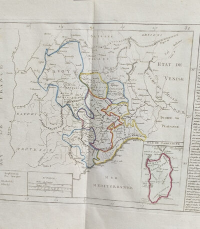
Clouet, Jean Baptiste Louis map of Sardinia Northern Italy 1767

80,00 

Mappa dell’Italia Settentrionale e Sardegna, realizzata nel 1767 da Jean Baptiste Louis Clouet (1730-1790), è un’opera cartografica di grande rilevanza, creata da uno dei più noti geografi del XVIII secolo.
La mappa raffigura dettagliatamente il Nord Italia e la Sardegna, evidenziando confini, città principali e caratteristiche geografiche. La colorazione coeva a mano arricchisce il valore estetico dell’opera, mentre il supporto in carta vergellata conferisce una qualità superiore e duratura.

  • Era: XVIII secolo (1767)
  • Technique: Incisione su rame con colorazione coeva
  • Dimensions: Grandi (60×43 cm, intero foglio)
  • Support: Laid paper
  • Condition: Excellent

Quest’opera rappresenta una preziosa testimonianza della cartografia settecentesca, ideale per collezionisti o studiosi interessati alla storia geografica dell’Italia.

Italian Peasant, 1825

60,00 

Italian Peasant It is a lithograph made by Charles Motte in the period 1825-29, inspired by a subject by M. Monvoisin and Jean Vatout & JP Quénot.
This work is part of the series Galerie lithographiée de son altesse royale Monsigneur le Duc d Orleans… and is a significant example of French lithography of the time.

  • Sheet size: cm. 55×34 approx.
  • Engraving size: cm. 25×20 approx.
  • Support: Thick paper
  • Condition: Excellent

Knightly costumes, 1876

20,00 

Costumi cavallereschi è una cromolitografia realizzata nel 1876, tratta dall’opera Histoire du costume di RACINET, pubblicata da Firmin Didot et C. a Parigi.
Questa stampa illustra con grande dettaglio i costumi tipici dei cavalieri dell’epoca, offrendo uno spaccato affascinante della moda storica.

  • Sheet size: cm. 42×29
  • Support: Thick paper with white backing
  • Condition: Excellent condition

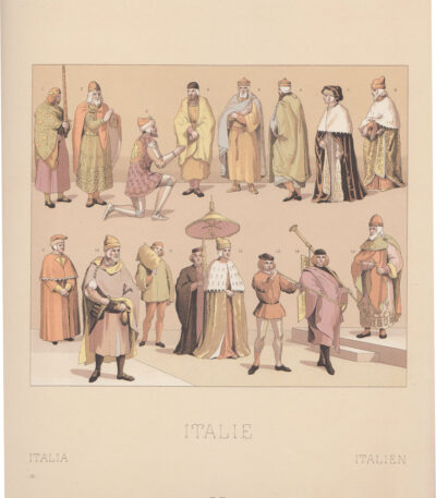
Costumes of Italy of the 16th century, 1876

20,00 

Costumi Italia del XVI secolo it's a chromolithography realizzata nel 1876, tratta dall’opera Histoire du costume di RACINET, pubblicata da Firmin Didot et C. a Parigi.
Questa stampa offre una rappresentazione vivida e dettagliata dei costumi dell’epoca, rendendola un pezzo prezioso per collezionisti e appassionati di storia del costume.

  • Sheet size: cm. 42×29
  • Support: Thick paper with white backing
  • Condition: Excellent condition

Religious Costumes, 1876

20,00 

Costumi Religiosi è una splendida cromolitografia realizzata nel 1876, tratta dall’opera Histoire du Costume di RACINET, pubblicata da Firmin Didot et C. a Parigi.
Questa illustrazione offre una visione affascinante dei costumi religiosi dell’epoca, evidenziando la ricchezza dei dettagli e dei colori.

  • Sheet size: cm. 42×29
  • Support: Thick paper with white backing
  • Condition: Excellent condition

Explore the fascinating world of antique prints

Antique prints are silent witnesses of history, capable of transporting us to distant eras through the art of engraving. Our e-commerce offers a vast selection of these precious finds, carefully selected for their authenticity and artistic value. Whether you are an expert collector or a novice enthusiast, you will find unique pieces here that will enrich your spaces with a touch of timeless elegance.

A safe and rewarding shopping experience

We understand the importance of each individual print and are committed to ensuring a flawless purchasing experience. Our secure payment system and insured shipping with professional packaging ensure that each piece arrives in the best condition. Our expertise in the sector allows us to offer detailed descriptions and personalized advice, helping you to make informed choices. If you have any questions or specific requests, do not hesitate to contact us: we will be happy to guide you into the wonderful world of antique prints.