
Burin
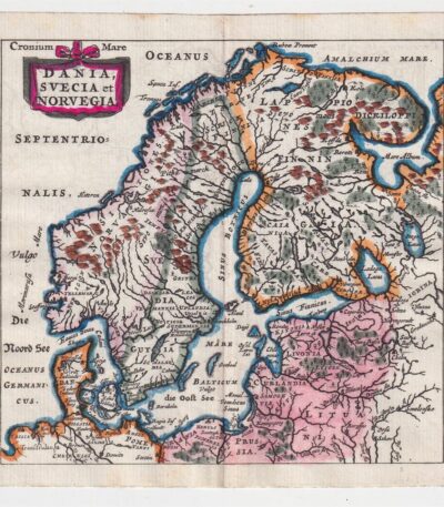
Philippus Cluverius (1580-1622), Mappa della Norvegia, 1686
80,00 €La Mappa della Norvegia di Philippus Cluverius è un’incisione in rame acquarellata realizzata nel 1686.
Questa mappa, che include anche la Svezia e la Danimarca, è tratta dall’opera Introductionis in universam geographiam, tam veterem quam novam, libri VI, published in Amsterdam.
- Sheet size: mm. 134×140
- Support: Laid paper
- Condition: Excellent condition
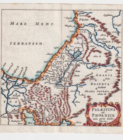
Philippus Cluverius (1580-1622), Map of Palestine, 1686
60,00 €The Map of Palestine It is an engraving made by Philippus Cluverius (1580-1622) in 1686.
This map, representing Palestine and Syria, is taken from the work Introductionis in universam geographiam, tam veterem quam novam, libri VI, published in Amsterdam.
- Sheet size: mm. 134×140
- Technique: Burin
- Support: Laid paper
- Condition: Excellent condition
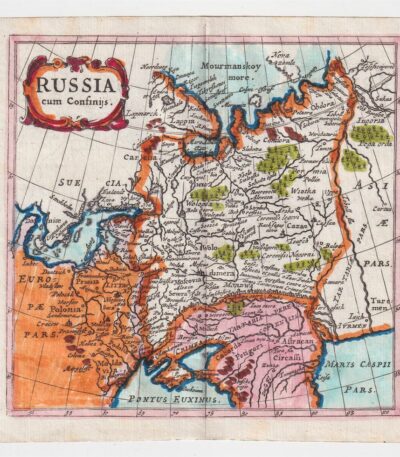
Philippus Cluverius (1580-1622), Mappa della Russia, 1686
60,00 €La Mappa della Russia It is an engraving made by Philippus Cluverius (1580-1622) in 1686.
This map is taken from the work Introductionis in universam geographiam, tam veterem quam novam, libri VI, published in Amsterdam.
- Sheet size: mm. 134×140
- Technique: Incisione in rame acquarellata
- Support: Laid paper
- Condition: Excellent condition

Philippus Cluverius (1580-1622), Map of Spain, 1686
80,00 €Philippus Cluverius – Mappa della Spagna It is a watercolour copper engraving made in 1686.
This map is taken from the work Introductionis in universam geographiam, tam veterem quam novam, libri VI, published in Amsterdam.
- Sheet size: mm. 134×140
- Technique: Burin
- Support: Laid paper
- Condition: Excellent condition
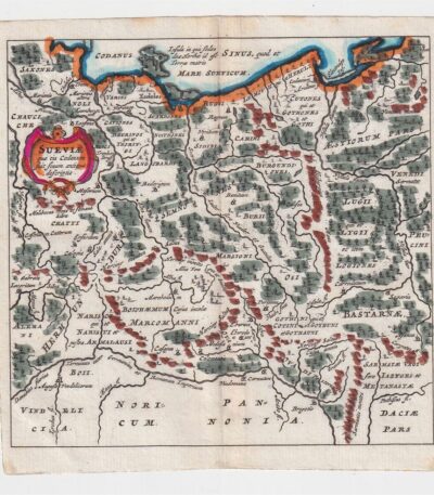
Philippus Cluverius (1580-1622), Mappa della Suevia, 1686
60,00 €Philippus Cluverius (1580-1622) presenta la sua Mappa della Suevia, un’incisione in rame acquarellata realizzata nel 1686.
Questa mappa, che rappresenta la regione della Suevia in Germania, è tratta dall’opera Introductionis in universam geographiam, tam veterem quam novam, libri VI, published in Amsterdam.
- Sheet size: mm. 134×140
- Technique: Burin
- Support: Laid paper
- Condition: Excellent
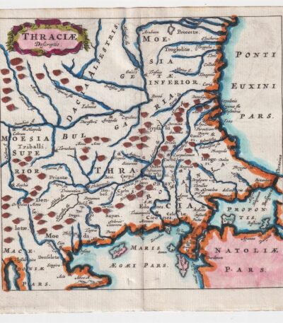
Philippus Cluverius (1580-1622), Mappa della Tracia, 1686
60,00 €La Mappa della Tracia è un’incisione realizzata da Philippus Cluverius nel 1686, che rappresenta la Tracia, la Dacia e la Bulgaria.
This map is taken from the work Introductionis in universam geographiam, tam veterem quam novam, libri VI, published in Amsterdam.
- Sheet size: mm. 134×140
- Technique: Burin
- Support: Laid paper
- Condition: Excellent
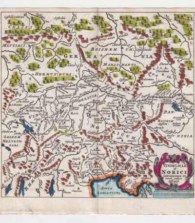
Philippus Cluverius (1580-1622), Mappa della Vindelicia, 1686
60,00 €La Mappa della Vindelicia It is an engraving made by Philippus Cluverius (1580-1622) in 1686.
Questa mappa rappresenta la regione della Vindelicia, situata in Germania, ed è parte dell’opera Introductionis in universam geographiam, tam veterem quam novam, libri VI, published in Amsterdam.
- Sheet size: mm. 134×140
- Technique: Burin
- Support: Laid paper
- Condition: Excellent condition
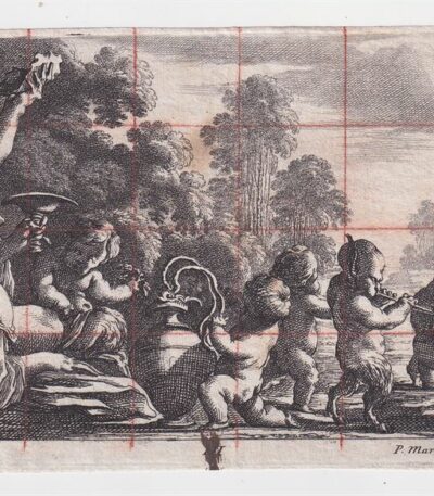
Pierre Mariette Baccanale, XVII secolo
50,00 €Baccanale è uno studio per un affresco realizzato da Pierre Mariette in the 17th century.
Questo lavoro, firmato in basso a destra con la sigla P.Mariette e monogrammato FL, è un esempio significativo dell’arte del periodo.
- Sheet size: mm. 102×222 alla battuta del rame
- Technique: Bulino e matita rossa su carta vergellata
- Condition: Foglio un po’ maltrattato

Pierre Mortier (1661-1711), Plagues of Egypt, 1700
40,00 €Plagues of Egypt It is an engraving made by Pierre Mortier in 1700, which illustrates two episodes from the Old Testament: the third plague of Egypt, represented by insects, and the fourth plague, which shows mosquitoes or locusts.
This work is part of the publication History of the old and new Testaments, enriched with over four hundred burin engravings, published in Antwerp by Pierre Mortier.
- Sheet size: cm. 36×23 plus irregular margins
- Technique: Burin
- Condition: Good
- Support: Laid paper

Saint Macrina, 1711
20,00 €Saint Macrina It is an engraving made in 1711 by Mariette, a well-known engraver of the time.
This work is performed with the technique ofetching and burin, presenting a measure of the engraving of cm. 6×11 on a sheet of paper cm. 10×16.
- Support: Laid paper with partial watermark
- Condition: Good condition
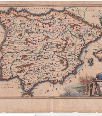
Spain. Cellarius – 1701
80,00 €Spain – Hispania Antiqua It is a copperplate map made by Christophorus Cellarius in 1701.
This work is taken from the volume Notitia Orbis Antiqui sive Geographia Plenior and presents historical and geographical details of Spain.
- Sheet size: cm. 24×33 approx.
- Engraving size: cm. 20×30 approx.
- Support: Laid paper
- Condition: Good condition
