English (UK)
  Italiano
  Français



Burin

Shrimp Fishermen, 1850
20,00 €Pescatori di gamberetti It is an engraving made in 1850, che rappresenta un affascinante momento della vita dei giovani pescatori di gamberetti.
This work is taken from the Art Journal Engraving e presenta una combinazione di etching and burin.
- Sheet size: cm. 32×24 approx.
- Condition: Excellent state of preservation
- Support: Strong engraving paper
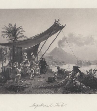
Neapolitan Fishermen, 1850
30,00 €Pescatori Napoletani è un’incisione realizzata da W. French nel 1877, che rappresenta una vivace scena di pescatori a Napoli.
Questa acquaforte al bulino mostra numerosi personaggi in un contesto dinamico, con il Vesuvius fumante sullo sfondo, creando un contrasto affascinante.
- Sheet size: cm. 27×20 circa
- Engraving size: cm. 20×15 approx.
- Support: Medium thickness paper
- Condition: Excellent state of preservation
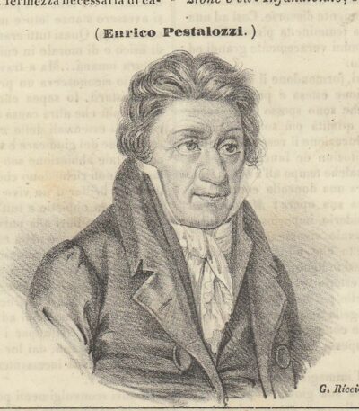
Pestalozzi Enrico, 1844
15,00 €Pestalozzi Enrico è un’incisione su rame realizzata nel 1844, tratta dall’Picturesque Omnibus.
Questa opera presenta un’incisione di dimensioni cm. 10×12 circa, con testo sia intorno che al verso.
- Sheet size: Small
- Condition: Excellent
- Support: Paper
Johann Heinrich Pestalozzi, nato a Zurigo il 12 gennaio 1746 e deceduto a Brugg il 17 febbraio 1827, è stato un importante pedagogista e riformista svizzero. È noto per il suo contributo all’educazione e al sistema scolastico, oltre ad essere un filosofo impegnato in politica.
La stampa verrà spedita insieme alla pagina intera tratta dal libro.
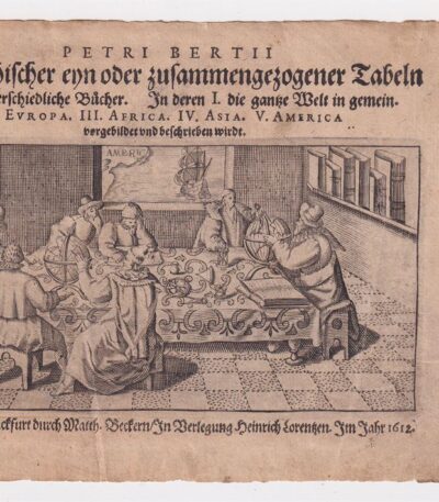
Petrus Bertius (1565-1629), Frontespizio, 1612
40,00 €Petrus Bertius (1565-1629), Frontespizio è un’incisione realizzata nel 1612, tratta dall’opera Petri Bertii Geographischer eyn oder zusammengezogener Tabeln Funff unterschiedliche Bucher.
Questa incisione presenta una dimensione di cm. 7×13 e si trova su carta vergellata con dimensioni di cm. 12×17, dotata di retro bianco.
- Condition: Excellent condition
- Support: Laid paper
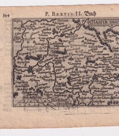
Petrus Bertius, Hesse,1612
40,00 €Petrus Bertius, Hesse It is an original map made in 1612 by Petrus Bertius (1565-1629), a well-known Dutch geographer.
This map is taken from the volume Petri Bertii Geographischer eyn oder zusammengezogener Tabeln Funff unterschiedliche Bucher.
- Paper size: mm. 125×83
- Sheet size: cm. 12×17
- Support: Laid paper
- Condition: Excellent condition

Philippus Cluverius (1580-1622), Germania, 1686
80,00 €Philippus Cluverius è un’incisione in rame acquarellata realizzata nel 1686, proveniente dall’opera Introductionis in universam geographiam, tam veterem quam novam, libri VI, published in Amsterdam.
Questa incisione rappresenta un’importante testimonianza della geografia del XVII secolo e misura mm. 134×140.
- Sheet size: Small
- Engraving size: mm. 134×140
- Support: Laid paper
- Condition: Excellent

Philippus Cluverius (1580-1622), England, 1686
80,00 €Philippus Cluverius (1580-1622) presents a map of England, part of the British Isles, dated 1686.
This copper engraving is watercolour and comes from the work Introductionis in universam geographiam, tam veterem quam novam, libri VI, published in Amsterdam in 1686.
- Sheet size: mm. 134×140
- Technique: Burin
- Support: Laid paper
- Condition: Excellent

Philippus Cluverius (1580-1622), Liguria, 1686
80,00 €Philippus Cluverius è un’incisione in rame acquarellata realizzata nel 1686, rappresentante la Liguria, Italia Settentrionale.
This work is taken from the volume Introductionis in universam geographiam, tam veterem quam novam, libri VI, published in Amsterdam.
- Sheet size: mm. 134×140
- Support: Laid paper with partial watermark
- Condition: Excellent condition

Philippus Cluverius (1580-1622), Map of Europe, 1686
80,00 €Philippus Cluverius – Map of Europe It is a watercolour copper engraving made in 1686.
This map is taken from the work Introductionis in universam geographiam, tam veterem quam novam, libri VI, published in Amsterdam.
- Sheet size: mm. 134×140
- Technique: Burin
- Support: Laid paper
- Condition: Excellent condition
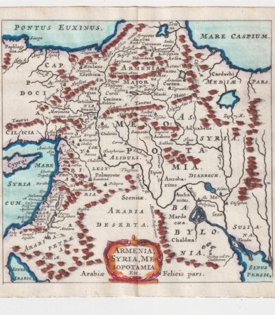
Philippus Cluverius (1580-1622), Mappa della Armenia 1686
60,00 €La Mappa della Armenia It is an engraving made by Philippus Cluverius nel 1686, che rappresenta non solo l’Armenia, ma anche la Siria e la Mesopotamia.
This map is taken from the work Introductionis in universam geographiam, tam veterem quam novam, libri VI, published in Amsterdam.
- Sheet size: mm. 134×140
- Technique: Incisione in rame acquarellata
- Support: Laid paper
- Condition: Excellent condition

Philippus Cluverius (1580-1622), Map of China, 1686
70,00 €Philippus Cluverius (1580-1622) presents a map of China and Japan, built in 1686.
This copper engraving is watercolour and comes from the work Introductionis in universam geographiam, tam veterem quam novam, libri VI, published in Amsterdam.
- Sheet size: mm. 134×140
- Technique: Burin
- Support: Laid paper
- Condition: Excellent
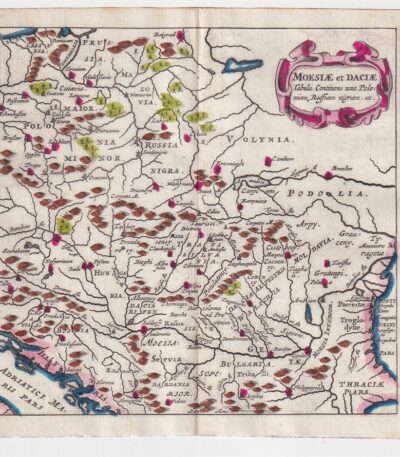
Philippus Cluverius (1580-1622), Map of Dacia, 1686
60,00 €Philippus Cluverius – Map of Dacia It is a watercolour copper engraving made in 1686.
This map represents Dacia, Hungary, Poland and Moesia, and is taken from the work Introductionis in universam geographiam, tam veterem quam novam, libri VI, published in Amsterdam.
- Sheet size: mm. 134×140
- Technique: Burin
- Support: Laid paper
- Condition: Excellent

Philippus Cluverius (1580-1622), Mappa della Francia, 1686
80,00 €La Mappa della Francia It is an engraving made by Philippus Cluverius nel 1686.
This map, part of the work Introductionis in universam geographiam, tam veterem quam novam, è un esempio significativo della cartografia del XVII secolo.
- Sheet size: cm. 13.4×14 approx.
- Engraving size: cm. 13.4×14 approx.
- Support: Laid paper
- Condition: Excellent state of preservation

Philippus Cluverius (1580-1622), Mappa della Germania 1686
60,00 €Philippus Cluverius (1580-1622) presents a Mappa della Germania Inferiore, built in 1686.
This copper engraving is watercolour and comes from the work Introductionis in universam geographiam, tam veterem quam novam, libri VI, published in Amsterdam in 1686.
- Sheet size: mm. 134×140
- Technique: Burin
- Support: Laid paper
- Condition: Excellent

Philippus Cluverius (1580-1622), Mappa della Germania, 1686
60,00 €Philippus Cluverius – Mappa della Germania It is a watercolour copper engraving made in 1686.
This map is taken from the work Introductionis in universam geographiam, tam veterem quam novam, libri VI, published in Amsterdam.
- Sheet size: mm. 134×140
- Support: Laid paper
- Condition: Excellent condition

Philippus Cluverius (1580-1622), Mappa della Germania, 1686
60,00 €Philippus Cluverius (1580-1622) presents a Map of Germany realizzata nel 1686.
Questa incisione in rame è stata acquarellata e proviene dall’opera Introductionis in universam geographiam, tam veterem quam novam, libri VI, published in Amsterdam.
- Sheet size: mm. 134×140
- Technique: Burin
- Support: Laid paper
- Condition: Excellent
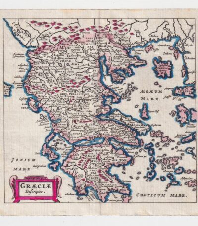
Philippus Cluverius (1580-1622), Map of Greece, 1686
60,00 €Philippus Cluverius – Map of Greece It is a watercolour copper engraving made in 1686.
This map is taken from the work Introductionis in universam geographiam, tam veterem quam novam, libri VI, published in Amsterdam.
- Sheet size: cm. 13.4×14 approx.
- Support: Laid paper
- Condition: Excellent state of preservation
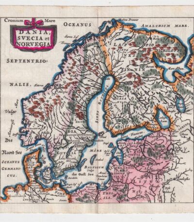
Philippus Cluverius (1580-1622), Mappa della Norvegia, 1686
80,00 €La Mappa della Norvegia di Philippus Cluverius è un’incisione in rame acquarellata realizzata nel 1686.
Questa mappa, che include anche la Svezia e la Danimarca, è tratta dall’opera Introductionis in universam geographiam, tam veterem quam novam, libri VI, published in Amsterdam.
- Sheet size: mm. 134×140
- Support: Laid paper
- Condition: Excellent condition
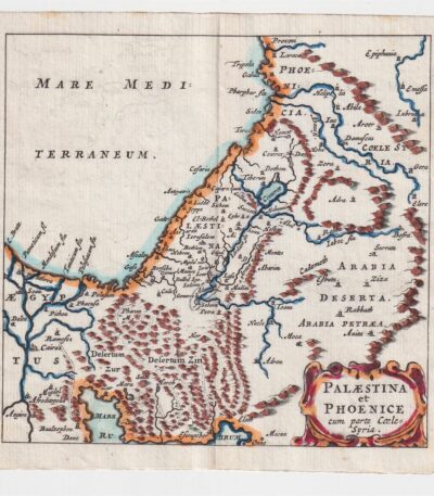
Philippus Cluverius (1580-1622), Map of Palestine, 1686
60,00 €The Map of Palestine It is an engraving made by Philippus Cluverius (1580-1622) in 1686.
This map, representing Palestine and Syria, is taken from the work Introductionis in universam geographiam, tam veterem quam novam, libri VI, published in Amsterdam.
- Sheet size: mm. 134×140
- Technique: Burin
- Support: Laid paper
- Condition: Excellent condition
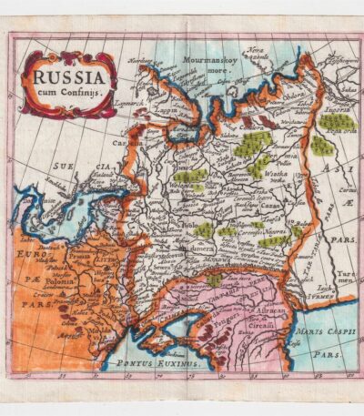
Philippus Cluverius (1580-1622), Mappa della Russia, 1686
60,00 €La Mappa della Russia It is an engraving made by Philippus Cluverius (1580-1622) in 1686.
This map is taken from the work Introductionis in universam geographiam, tam veterem quam novam, libri VI, published in Amsterdam.
- Sheet size: mm. 134×140
- Technique: Incisione in rame acquarellata
- Support: Laid paper
- Condition: Excellent condition

Philippus Cluverius (1580-1622), Map of Spain, 1686
80,00 €Philippus Cluverius – Mappa della Spagna It is a watercolour copper engraving made in 1686.
This map is taken from the work Introductionis in universam geographiam, tam veterem quam novam, libri VI, published in Amsterdam.
- Sheet size: mm. 134×140
- Technique: Burin
- Support: Laid paper
- Condition: Excellent condition
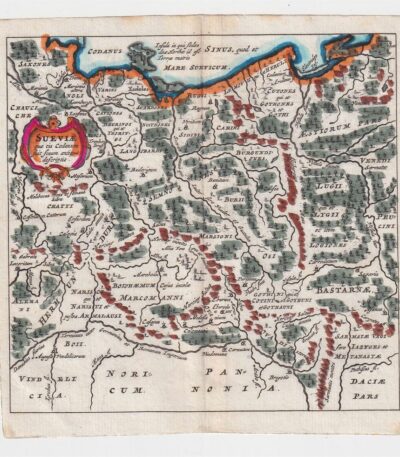
Philippus Cluverius (1580-1622), Mappa della Suevia, 1686
60,00 €Philippus Cluverius (1580-1622) presenta la sua Mappa della Suevia, un’incisione in rame acquarellata realizzata nel 1686.
Questa mappa, che rappresenta la regione della Suevia in Germania, è tratta dall’opera Introductionis in universam geographiam, tam veterem quam novam, libri VI, published in Amsterdam.
- Sheet size: mm. 134×140
- Technique: Burin
- Support: Laid paper
- Condition: Excellent
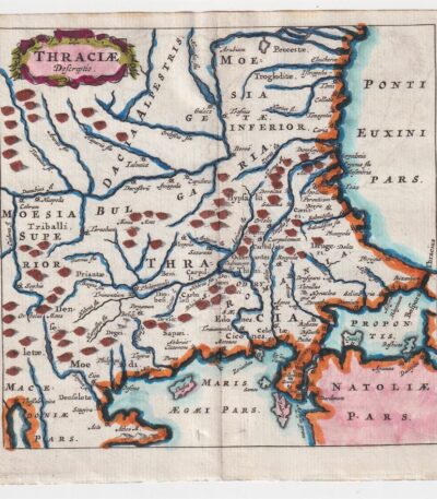
Philippus Cluverius (1580-1622), Mappa della Tracia, 1686
60,00 €La Mappa della Tracia è un’incisione realizzata da Philippus Cluverius nel 1686, che rappresenta la Tracia, la Dacia e la Bulgaria.
This map is taken from the work Introductionis in universam geographiam, tam veterem quam novam, libri VI, published in Amsterdam.
- Sheet size: mm. 134×140
- Technique: Burin
- Support: Laid paper
- Condition: Excellent
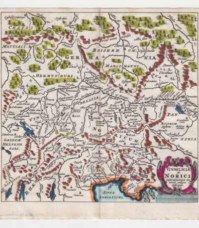
Philippus Cluverius (1580-1622), Mappa della Vindelicia, 1686
60,00 €La Mappa della Vindelicia It is an engraving made by Philippus Cluverius (1580-1622) in 1686.
Questa mappa rappresenta la regione della Vindelicia, situata in Germania, ed è parte dell’opera Introductionis in universam geographiam, tam veterem quam novam, libri VI, published in Amsterdam.
- Sheet size: mm. 134×140
- Technique: Burin
- Support: Laid paper
- Condition: Excellent condition