English (UK)
  Italiano
  Français



Excellent
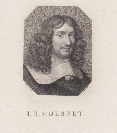
Jean-Baptiste Colbert, 1770
30,00 €Jean-Baptiste Colbert è un’incisione realizzata nel 1770, che ritrae il celebre politico ed economista francese.
Questa opera è un’acquaforte su carta vergellata, caratterizzata da un retro bianco.
- Sheet size: cm. 26×21 approx.
- Engraving size: cm. 9×7 approx.
- Support: Laid paper
- Condition: Excellent state of preservation

Lavoratore di Avorio, Caspar e Jan Luyken, 1694
15,00 €Lavoratore di Avorio It is a woodcut made by Caspar e Jan Luyken In the 1694.
This work is taken from the volume Spiegel van het Menselyk Bedryf (Mirror of Human Activities), e presenta un’illustrazione dettagliata del mestiere di lavorazione dell’avorio.
- Sheet size: mm. 75×120
- Engraving size: mm. 60×64
- Support: Laid paper without watermark
- Condition: Excellent
Oltre alla xilografia, il foglio include note esplicative in olandese e presenta una stampa anche sul retro.
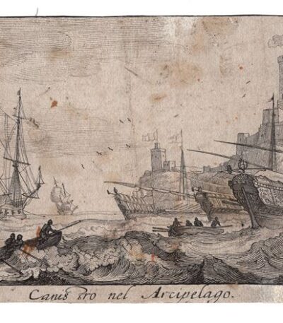
Lucas Vorsterman, Canis in the Archipelago, 1670
80,00 €Canis in the Archipelago It is an engraving made by Lucas Vorsterman in 1670, in collaboration with Jan Peeters the Elder.
This work, published in Antwerp by Jacob Peeters, is an etching on laid paper, signed lower left by Peeters and on the right by Vorsterman.
- Sheet size: cm. 24×11 approx.
- Technique: Etching
- Condition: Excellent
- Support: Laid paper
Lucas Vorsterman, a Flemish engraver of the Baroque period, worked for illustrious artists such as Peter Paul Rubens and Anthony van Dyck, contributing significant works of his time.
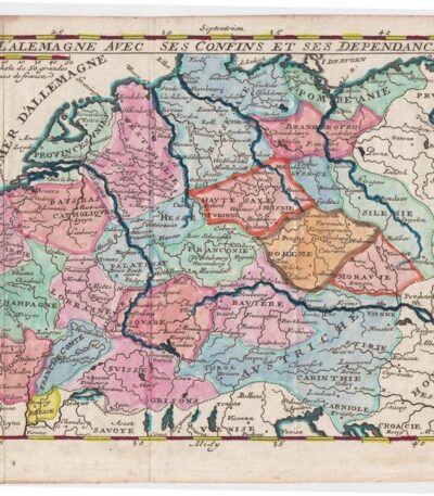
M. Demasso, Mappa della Germania, 1700
80,00 €Map of Germany è un’incisione realizzata da M. Demasso nel 1700, intitolata L’Alemagne avec ses confins et ses dependances.
Questa mappa è colorata all’acquarello e presenta dettagli accurati sui confini e le dipendenze della Germania dell’epoca.
- Sheet size: cm. 16×23 approx.
- Map dimensions: cm. 14×18 approx.
- Support: Paper
- Condition: Excellent
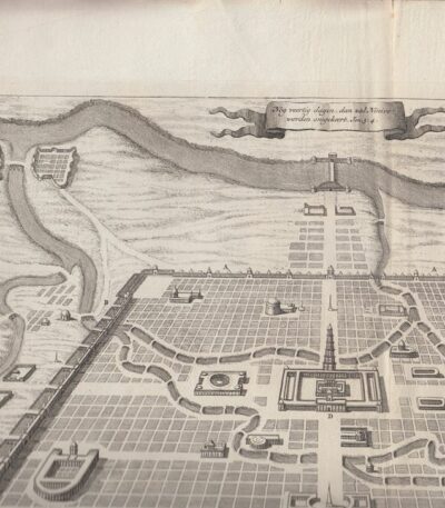
Mappa della città di Ninive, 1650 ca
40,00 €Mappa della città di Ninive è un’incisione realizzata da Diodoro Siculo, datata circa 1650.
Questa mappa rappresenta la città di Ninive secondo le descrizioni di Diodoro Siculo e del famoso erudito E.P. Kircherus.
- Sheet size: cm. 46×38 circa
- Engraving size: cm. 43×30 approx.
- Technique: Etching
- Support: Carta spessa vergellata senza filigrana
- Condition: Excellent condition
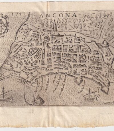
Map of Ancona, Scotus, 1659
90,00 €Map of Ancona it is a copper engraving made in 1659 by Francesco Scoto.
This map is part of the work Itinerary of Italy, published in Padua by Matteo Cadorino.
- Sheet size: cm. 16×20 approx.
- Engraving size: cm. 12×17 approx.
- Support: Light laid paper
- Condition: Excellent state of preservation
- Fold: Editorial fold
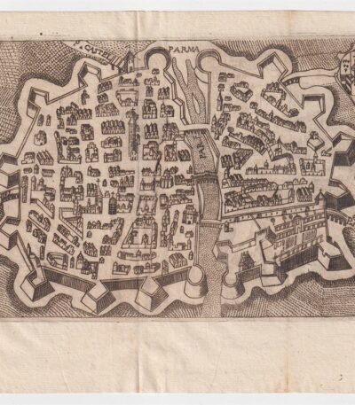
Map of Parma, Scotus, 1659
90,00 €Map of Parma it is a copper engraving made by Francesco Scoto in 1659.
This map is part of the work Itinerary of Italy, published in Padua by Matteo Cadorino.
- Sheet size: cm. 16×20 approx.
- Engraving size: cm. 12×17 approx.
- Support: Light laid paper
- Condition: Excellent condition

Mappa di Perpignan, Francia, da Cosmografia di S.Munster, 1614
Map of Perpignan, France It is a woodcut made by Sebastian Munster in 1614, taken from his work Cosmography Universalis.
This map features the historic city of Perpignan, capital of the Pyrénées-Orientales department and once capital of the County of Roussillon.
- Sheet size: cm. 36×22 approx.
- Image size: cm. 12.5x15.5 approx.
- Support: Laid paper
- Condition: Excellent state of preservation
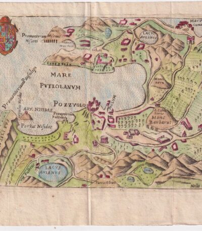
Map of Pozzuoli, Scotus, 1659
Map of Pozzuoli it is a watercolour copper engraving made by Francesco Scoto in 1659.
This map is part of the work Itinerary of Italy, published in Padua by Matteo Cadorino.
- Sheet size: cm. 16×20 approx.
- Engraving size: cm. 12×17 approx.
- Support: Light laid paper
- Condition: Excellent condition
- Characteristic: Editorial fold
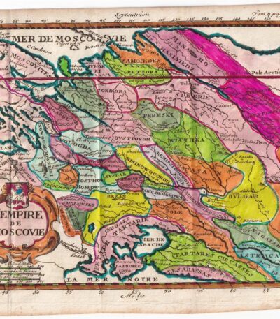
Matthieu Ogier, Map of the Russian States, Moscow, 1700
40,00 €Map of Russian states It is an engraving made by Matthieu Ogier in 1700.
This map, titled The Empire of Moscow, is colored in watercolour and represents a precious cartographic testimony of the time.
- Sheet size: cm. 16×23 approx.
- Map dimensions: cm. 14×18 approx.
- Technique: Burin
- Condition: Excellent
- Support: Paper
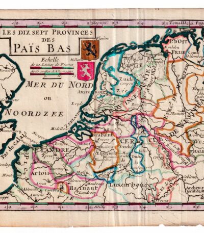
Matthieu Ogier, Map of the Netherlands, Holland, 1700
50,00 €Matthieu Ogier, Map of the Netherlands It is an engraving made in 1700, representing the seventeen provinces of the Netherlands.
This map was engraved by Matthieu Ogier and hand-colored in watercolor, making it a unique and fascinating piece.
- Sheet size: cm. 16×23 approx.
- Map dimensions: cm. 14×18 approx.
- Support: Paper
- Condition: Excellent
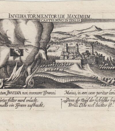
Meisner, Castelnovo di Porto, 1678
60,00 €Meisner, Castelnovo di Porto, 1678 è una veduta tratta dall’edizione del 1678 della celebre Sciagraphia Cosmica.
Questa incisione in rame presenta margini e si trova in perfetto stato di conservazione.
- Sheet size: cm. 13×19 approx.
- Engraving size: cm. 10×15 approx.
- Support: Laid paper without watermark
- Condition: Excellent state of preservation
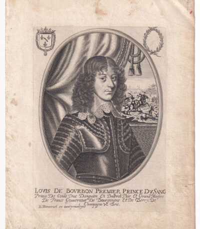
Moncornet B., Louis de Bourbon, ca. 1640.
40,00 €Louis de Bourbon, Premier Prince du Sang è un’incisione realizzata da Balthasar Moncornet intorno al 1640.
Questa opera è un esempio pregiato della maestria di Moncornet, noto per le sue raffigurazioni di figure di spicco del XVII secolo.
- Sheet size: cm. 21×16 approx.
- Engraving size: cm. 16×12 approx.
- Technique: Etching
- Support: Laid paper
- Condition: Excellent state of preservation

Napoli, Chiesa di S.Luigi Gonzaga, 1712
25,00 €Napoli, Chiesa di S.Luigi Gonzaga it is an engraving made by P. Mortier in 1712.
This work is an etching on copper, taken from The delights of Italy, edizione tedesca di De Rogissart, pubblicata a Berlino.
- Sheet size: cm. 10×15 approx.
- Engraving size: cm. 7×13 approx.
- Support: Light laid paper
- Condition: Excellent state of preservation
La chiesa di San Luigi Gonzaga è una chiesa monumentale situata nel quartiere Posillipo di Napoli, facilmente raggiungibile tramite una scalinata rupestre adornata da pregevoli pezzi marmorei.
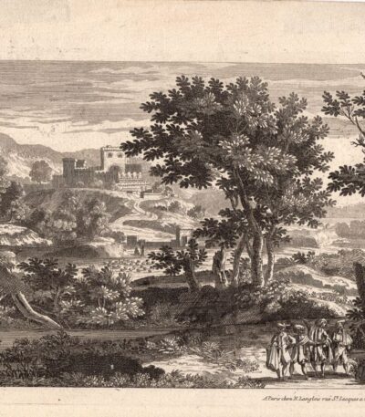
Nicolas Langlois, Paesaggio, XVII secolo
40,00 €Paesaggio con castello It is an engraving made by Nicolas Langlois in the 17th century.
Questa opera, firmata in basso a destra, è un esempio pregevole della sua arte e rappresenta un paesaggio suggestivo con un castello.
- Sheet size: cm. 18×26 circa
- Technique: Etching
- Support: Laid paper
- Condition: Excellent
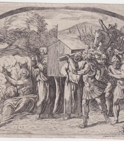
Orazio Borgianni, Arca dell’Alleanza, 1615
120,00 €Arca dell’Alleanza è un’incisione realizzata da Orazio Borgianni nel 1615, che rappresenta il Trasporto dell’arca dell’Alleanza a Gerusalemme.
Questa opera è la tavola n.39 della serie Storie bibliche dipinte nelle Logge Vaticane da Raffaello, con incisioni di Borgianni.
- Author: Sanzio Raffaello (e aiuti) (1483/1520), inventore; Borgianni Orazio (1578/1616), incisore
- Engraving size: cm. 15×19 alla battuta del rame
- Support: Laid paper
- Condition: Excellent state of preservation
- Monogramma e data: HB 1615 in lastra
- Riferimenti: Bartsch XVII.319, Charles Le Blanc, T. II, n°1-52
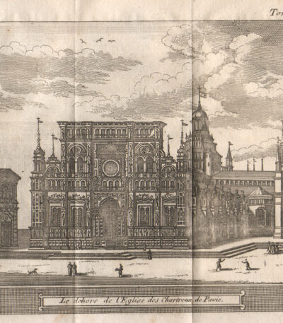
Pavia, 1707, Charterhouse
40,00 €Pavia, 1707, Charterhouse è un’incisione realizzata da Magdeleine Horthemels nel 1707, che rappresenta una veduta della Certosa di Pavia.
This work is taken from the volume The delights of Italy, pubblicato da De Rogissart a Parigi.
- Sheet size: mm. 150×120
- Technique: Burin
- Condition: Excellent
- Support: Paper

Petrus Bertius, Namur,1612
40,00 €Petrus Bertius, Namur, 1612 It is an original watercolor map, taken from Petri Bertii Geographischer eyn oder zusammengezogener Tabeln Funff unterschiedliche Bucher, published in 1612.
This small map is a significant example of 17th century cartography.
- Sheet size: cm. 12×17 approx.
- Map dimensions: mm. 125×83
- Support: Laid paper
- Condition: Excellent condition

Petrus Bertius, Normandy, 1612
40,00 €Petrus Bertius, Normandy It is an original watercolor map made in 1612 by Petrus Bertius (1565-1629).
This map is taken from the volume Petri Bertii Geographischer eyn oder zusammengezogener Tabeln Funff unterschiedliche Bucher.
- Sheet size: cm. 12×17 approx.
- Map dimensions: mm. 125×83
- Support: Laid paper
- Condition: Excellent condition

Philippus Cluverius (1580-1622), Germania, 1686
80,00 €Philippus Cluverius è un’incisione in rame acquarellata realizzata nel 1686, proveniente dall’opera Introductionis in universam geographiam, tam veterem quam novam, libri VI, published in Amsterdam.
Questa incisione rappresenta un’importante testimonianza della geografia del XVII secolo e misura mm. 134×140.
- Sheet size: Small
- Engraving size: mm. 134×140
- Support: Laid paper
- Condition: Excellent

Philippus Cluverius (1580-1622), England, 1686
80,00 €Philippus Cluverius (1580-1622) presents a map of England, part of the British Isles, dated 1686.
This copper engraving is watercolour and comes from the work Introductionis in universam geographiam, tam veterem quam novam, libri VI, published in Amsterdam in 1686.
- Sheet size: mm. 134×140
- Technique: Burin
- Support: Laid paper
- Condition: Excellent

Philippus Cluverius (1580-1622), Liguria, 1686
80,00 €Philippus Cluverius è un’incisione in rame acquarellata realizzata nel 1686, rappresentante la Liguria, Italia Settentrionale.
This work is taken from the volume Introductionis in universam geographiam, tam veterem quam novam, libri VI, published in Amsterdam.
- Sheet size: mm. 134×140
- Support: Laid paper with partial watermark
- Condition: Excellent condition

Philippus Cluverius (1580-1622), Map of Europe, 1686
80,00 €Philippus Cluverius – Map of Europe It is a watercolour copper engraving made in 1686.
This map is taken from the work Introductionis in universam geographiam, tam veterem quam novam, libri VI, published in Amsterdam.
- Sheet size: mm. 134×140
- Technique: Burin
- Support: Laid paper
- Condition: Excellent condition
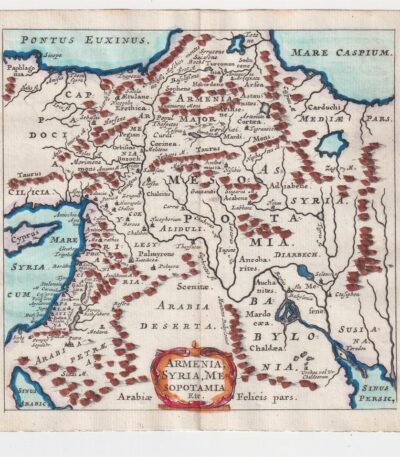
Philippus Cluverius (1580-1622), Mappa della Armenia 1686
60,00 €La Mappa della Armenia It is an engraving made by Philippus Cluverius nel 1686, che rappresenta non solo l’Armenia, ma anche la Siria e la Mesopotamia.
This map is taken from the work Introductionis in universam geographiam, tam veterem quam novam, libri VI, published in Amsterdam.
- Sheet size: mm. 134×140
- Technique: Incisione in rame acquarellata
- Support: Laid paper
- Condition: Excellent condition