Excellent

Showing 169–192 of 256 results

Map of Lucca, Scotus, 1659

90,00 

Map of Lucca it is a copper engraving made by Francesco Scoto in 1659.
This map is part of the work Itinerary of Italy, published in Padua by Matteo Cadorino.

  • Sheet size: cm. 16×20 approx.
  • Engraving size: cm. 12×17 approx.
  • Support: Light laid paper
  • Condition: Excellent condition

Map of Mantua, Scoto, 1659

120,00 

Map of Mantua It is a watercolour copper engraving made in 1659 by Francis Scotus.
This map is part of the work Itinerary of Italy, published in Padua by Matteo Cadorino.

  • Sheet size: cm. 16×20 approx.
  • Engraving size: cm. 12×17 approx.
  • Support: Light laid paper
  • Condition: Excellent condition

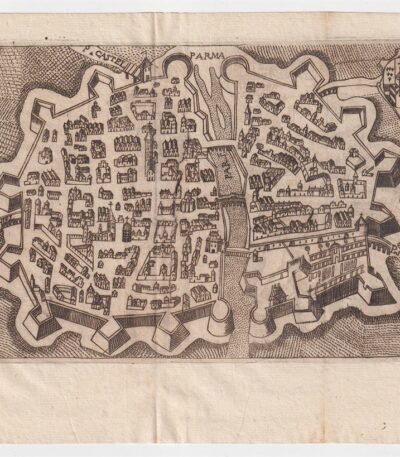
Map of Parma, Scotus, 1659

90,00 

Map of Parma it is a copper engraving made by Francesco Scoto in 1659.
This map is part of the work Itinerary of Italy, published in Padua by Matteo Cadorino.

  • Sheet size: cm. 16×20 approx.
  • Engraving size: cm. 12×17 approx.
  • Support: Light laid paper
  • Condition: Excellent condition

Mappa di Perpignan, Francia, da Cosmografia di S.Munster, 1614

60,00 

Map of Perpignan, France It is a woodcut made by Sebastian Munster in 1614, taken from his work Cosmography Universalis.
This map features the historic city of Perpignan, capital of the Pyrénées-Orientales department and once capital of the County of Roussillon.

  • Sheet size: cm. 36×22 approx.
  • Image size: cm. 12.5x15.5 approx.
  • Support: Laid paper
  • Condition: Excellent state of preservation

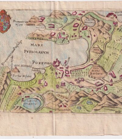
Map of Pozzuoli, Scotus, 1659

90,00 

Map of Pozzuoli it is a watercolour copper engraving made by Francesco Scoto in 1659.
This map is part of the work Itinerary of Italy, published in Padua by Matteo Cadorino.

  • Sheet size: cm. 16×20 approx.
  • Engraving size: cm. 12×17 approx.
  • Support: Light laid paper
  • Condition: Excellent condition
  • Characteristic: Editorial fold

Marco Sadeler, Petrus Stephani, Paesaggio montano, XVII

60,00 

Mountain landscape è un’incisione realizzata da Marco Sadeler, con la collaborazione di Petrus Stephani, nel XVII secolo.
This work, performed in etching, presenta un paesaggio suggestivo e dettagliato, tipico dell’epoca.

  • Sheet size: cm. 21×28 approx.
  • Support: Thick laid paper
  • Condition: Excellent state of preservation

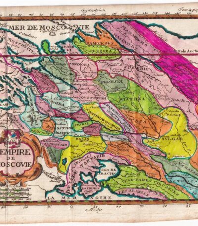
Matthieu Ogier, Map of the Russian States, Moscow, 1700

40,00 

Map of Russian states It is an engraving made by Matthieu Ogier in 1700.
This map, titled The Empire of Moscow, is colored in watercolour and represents a precious cartographic testimony of the time.

  • Sheet size: cm. 16×23 approx.
  • Map dimensions: cm. 14×18 approx.
  • Technique: Burin
  • Condition: Excellent
  • Support: Paper

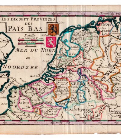
Matthieu Ogier, Map of the Netherlands, Holland, 1700

50,00 

Matthieu Ogier, Map of the Netherlands It is an engraving made in 1700, representing the seventeen provinces of the Netherlands.
This map was engraved by Matthieu Ogier and hand-colored in watercolor, making it a unique and fascinating piece.

  • Sheet size: cm. 16×23 approx.
  • Map dimensions: cm. 14×18 approx.
  • Support: Paper
  • Condition: Excellent

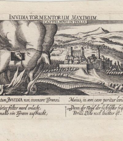
Meisner, Castelnovo di Porto, 1678

60,00 

Meisner, Castelnovo di Porto, 1678 è una veduta tratta dall’edizione del 1678 della celebre Sciagraphia Cosmica.
Questa incisione in rame presenta margini e si trova in perfetto stato di conservazione.

  • Sheet size: cm. 13×19 approx.
  • Engraving size: cm. 10×15 approx.
  • Support: Laid paper without watermark
  • Condition: Excellent state of preservation

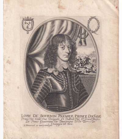
Moncornet B., Louis de Bourbon, ca. 1640.

40,00 

Louis de Bourbon, Premier Prince du Sang è un’incisione realizzata da Balthasar Moncornet intorno al 1640.
Questa opera è un esempio pregiato della maestria di Moncornet, noto per le sue raffigurazioni di figure di spicco del XVII secolo.

  • Sheet size: cm. 21×16 approx.
  • Engraving size: cm. 16×12 approx.
  • Technique: Etching
  • Support: Laid paper
  • Condition: Excellent state of preservation

Napoli, Chiesa di S.Luigi Gonzaga, 1712

25,00 

Napoli, Chiesa di S.Luigi Gonzaga it is an engraving made by P. Mortier in 1712.
This work is an etching on copper, taken from The delights of Italy, edizione tedesca di De Rogissart, pubblicata a Berlino.

  • Sheet size: cm. 10×15 approx.
  • Engraving size: cm. 7×13 approx.
  • Support: Light laid paper
  • Condition: Excellent state of preservation

La chiesa di San Luigi Gonzaga è una chiesa monumentale situata nel quartiere Posillipo di Napoli, facilmente raggiungibile tramite una scalinata rupestre adornata da pregevoli pezzi marmorei.

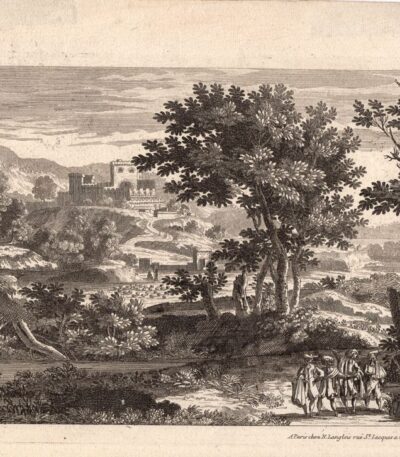
Nicolas Langlois, Paesaggio, XVII secolo

40,00 

Paesaggio con castello It is an engraving made by Nicolas Langlois in the 17th century.
Questa opera, firmata in basso a destra, è un esempio pregevole della sua arte e rappresenta un paesaggio suggestivo con un castello.

  • Sheet size: cm. 18×26 circa
  • Technique: Etching
  • Support: Laid paper
  • Condition: Excellent

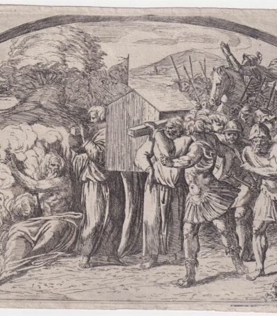
Orazio Borgianni, Arca dell’Alleanza, 1615

120,00 

Arca dell’Alleanza è un’incisione realizzata da Orazio Borgianni nel 1615, che rappresenta il Trasporto dell’arca dell’Alleanza a Gerusalemme.
Questa opera è la tavola n.39 della serie Storie bibliche dipinte nelle Logge Vaticane da Raffaello, con incisioni di Borgianni.

  • Author: Sanzio Raffaello (e aiuti) (1483/1520), inventore; Borgianni Orazio (1578/1616), incisore
  • Engraving size: cm. 15×19 alla battuta del rame
  • Support: Laid paper
  • Condition: Excellent state of preservation
  • Monogramma e data: HB 1615 in lastra
  • Riferimenti: Bartsch XVII.319, Charles Le Blanc, T. II, n°1-52

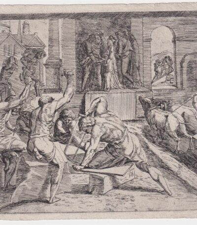
Orazio Borgianni, Costruzione del tempio 1615

120,00 

Costruzione del Tempio It is an engraving made by Orazio Borgianni nel 1615, che rappresenta la costruzione del Tempio di Salomone.
Questa opera è la tavola n.39 della serie Storie bibliche dipinte nelle Logge Vaticane da Raffaello e incise da Borgianni.

  • Author: Sanzio Raffaello (inventore) e Orazio Borgianni (incisore)
  • Engraving size: cm. 15×17 alla battuta del rame
  • Support: Laid paper
  • Monogrammato e datato in lastra: HB 1615
  • Riferimenti: Bartsch XVII.319, Charles Le Blanc, T. II, n°1-52

Orazio Borgianni, Giacobbe e Labano, 1615

120,00 

Giacobbe e Labano è un’incisione realizzata da Orazio Borgianni nel 1615, parte della serie Storie bibliche dipinte nelle Logge Vaticane da Raffaello.
This work represents the Patto tra Giacobbe e Labano ed è monogrammata e datata in lastra con le iniziali HB 1615.

  • Sheet size: cm. 15×19 approx.
  • Support: Laid paper
  • Condition: Excellent state of preservation

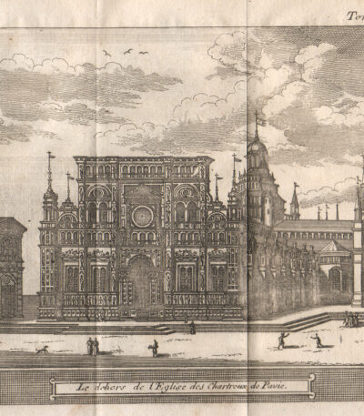
Pavia, 1707, Charterhouse

40,00 

Pavia, 1707, Charterhouse è un’incisione realizzata da Magdeleine Horthemels nel 1707, che rappresenta una veduta della Certosa di Pavia.
This work is taken from the volume The delights of Italy, pubblicato da De Rogissart a Parigi.

  • Sheet size: mm. 150×120
  • Technique: Burin
  • Condition: Excellent
  • Support: Paper

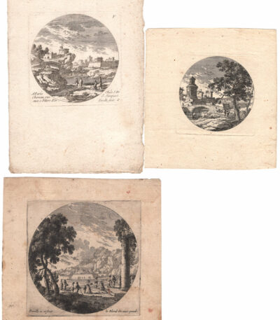
Perelle, 3 Round Landscapes, 17th century

80,00 

Perelle, 3 Paesaggi formato tondo è una serie di tre stampe realizzate nel XVII secolo, attribuite alla celebre famiglia di incisori francesi, i Perelle.
Queste opere, caratterizzate da un formato tondo, presentano paesaggi incantevoli e sono state realizzate con la tecnica dell’etching on laid paper.

  • Dimensions: diametro cm. 8/9/11 circa
  • Condition: Excellent
  • Support: Laid paper
  • Engravers: Gabriel Perelle (1604-1677), Adam Perelle (1638-1695), Nicolas Perelle (1631-1695)
  • Firmati: Due delle stampe sono firmate ‘Perelle fecit’ e ‘le Blond exc.’

I Perelle sono noti per la loro abilità nel rappresentare paesaggi e la loro opera è caratterizzata da una grande attenzione ai dettagli. La collaborazione tra Gabriel e i suoi figli ha reso difficile attribuire con certezza le stampe a un singolo incisore, rendendo queste opere ancora più affascinanti per i collezionisti e gli appassionati d’arte.

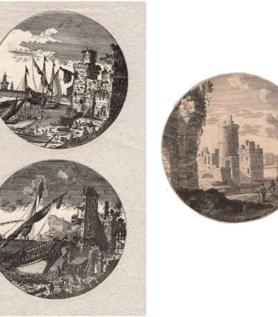
Perelle, Paesaggi in tondo, XVII sec

80,00 

Perelle, Paesaggi in tondo è una serie di tre stampe risalenti al 17th century, realizzate dalla celebre famiglia di incisori francesi, i Perelle.
Gabriel Perelle (1604-1677), Adam Perelle (1638-1695) e Nicolas Perelle (1631-1695) sono noti per i loro paesaggi incisi, spesso collaborando tra loro.
Queste stampe, eseguite in etching, presentano un diametro di circa cm. 11 e sono rifilate alla linea marginale.

  • Sheet size: Small
  • Condition: Excellent
  • Support: Laid paper

Petrus Bertius, Namur,1612

40,00 

Petrus Bertius, Namur, 1612 It is an original watercolor map, taken from Petri Bertii Geographischer eyn oder zusammengezogener Tabeln Funff unterschiedliche Bucher, published in 1612.
This small map is a significant example of 17th century cartography.

  • Sheet size: cm. 12×17 approx.
  • Map dimensions: mm. 125×83
  • Support: Laid paper
  • Condition: Excellent condition

Petrus Bertius, Normandy, 1612

40,00 

Petrus Bertius, Normandy It is an original watercolor map made in 1612 by Petrus Bertius (1565-1629).
This map is taken from the volume Petri Bertii Geographischer eyn oder zusammengezogener Tabeln Funff unterschiedliche Bucher.

  • Sheet size: cm. 12×17 approx.
  • Map dimensions: mm. 125×83
  • Support: Laid paper
  • Condition: Excellent condition

Philippus Cluverius (1580-1622), Germania, 1686

80,00 

Philippus Cluverius è un’incisione in rame acquarellata realizzata nel 1686, proveniente dall’opera Introductionis in universam geographiam, tam veterem quam novam, libri VI, published in Amsterdam.
Questa incisione rappresenta un’importante testimonianza della geografia del XVII secolo e misura mm. 134×140.

  • Sheet size: Small
  • Engraving size: mm. 134×140
  • Support: Laid paper
  • Condition: Excellent

Philippus Cluverius (1580-1622), England, 1686

80,00 

Philippus Cluverius (1580-1622) presents a map of England, part of the British Isles, dated 1686.
This copper engraving is watercolour and comes from the work Introductionis in universam geographiam, tam veterem quam novam, libri VI, published in Amsterdam in 1686.

  • Sheet size: mm. 134×140
  • Technique: Burin
  • Support: Laid paper
  • Condition: Excellent

Philippus Cluverius (1580-1622), Liguria, 1686

80,00 

Philippus Cluverius è un’incisione in rame acquarellata realizzata nel 1686, rappresentante la Liguria, Italia Settentrionale.
This work is taken from the volume Introductionis in universam geographiam, tam veterem quam novam, libri VI, published in Amsterdam.

  • Sheet size: mm. 134×140
  • Support: Laid paper with partial watermark
  • Condition: Excellent condition

Philippus Cluverius (1580-1622), Map of Europe, 1686

80,00 

Philippus Cluverius – Map of Europe It is a watercolour copper engraving made in 1686.
This map is taken from the work Introductionis in universam geographiam, tam veterem quam novam, libri VI, published in Amsterdam.

  • Sheet size: mm. 134×140
  • Technique: Burin
  • Support: Laid paper
  • Condition: Excellent condition

Explore the fascinating world of antique prints

Antique prints are silent witnesses of history, capable of transporting us to distant eras through the art of engraving. Our e-commerce offers a vast selection of these precious finds, carefully selected for their authenticity and artistic value. Whether you are an expert collector or a novice enthusiast, you will find unique pieces here that will enrich your spaces with a touch of timeless elegance.

A safe and rewarding shopping experience

We understand the importance of each individual print and are committed to ensuring a flawless purchasing experience. Our secure payment system and insured shipping with professional packaging ensure that each piece arrives in the best condition. Our expertise in the sector allows us to offer detailed descriptions and personalized advice, helping you to make informed choices. If you have any questions or specific requests, do not hesitate to contact us: we will be happy to guide you into the wonderful world of antique prints.