Cartography

Showing 385–408 of 412 results

Verona Theatre, Sebastian Münster, 1614

120,00 

Pagina della Cosmografia – Teatro di Verona, estratta dall’edizione tedesca della Universal Cosmography Of Sebastian Münster (1488–1552), una delle opere geografiche più influenti del Rinascimento.
Questa pagina, illustrata con una splendida xilografia, è firmata in basso a destra con il monogramma C.S., attribuito a Christoph Stimmer Johann l’Ancien (1490–1562). Tratta dall’edizione del 1588 stampata a Basilea, l’opera presenta una rappresentazione del Teatro di Verona, testimonianza dell’eccezionale perizia artistica e cartografica dell’epoca.

  • Era: XVI secolo (1588)
  • Technique: Xilografia su carta vergellata
  • Dimensions: 30×39 cm (foglio)
  • Autore della pubblicazione: Sebastian Münster
  • Condition: Excellent

Questa xilografia, un raro esempio dell’arte e della cartografia rinascimentale, è ideale per collezionisti di libri antichi e appassionati di storia dell’arte e della geografia.

Land of Otranto, B. Marzolla, 1832

90,00 

Land of Otranto It is a geographical map created by B. Marzolla in 1832, executed in lithography with watercolor borders.
This map is part of the work Historical and statistical chorographic atlas of the Kingdom of the Two Sicilies, dedicated to HM King Ferdinand II and published by the Royal Military Typography of Naples.

  • Sheet size: cm. 45×60
  • Condition: Good state of preservation
  • Support: Paper

The paper has some age stains and light humidity stains, but is free of editorial creases.
On the sides of the map there are historical information and statistics of the province. The map will be sent in a rigid tube with registered mail.

Land of Work, B. Marzolla, 1832

90,00 

Terra di Lavoro It is a geographical map created by B. Marzolla in 1832, executed in lithography with watercolor borders.
This map is part of the work Historical and statistical chorographic atlas of the Kingdom of the Two Sicilies, dedicated to HM King Ferdinand II and published by the Royal Military Typography of Naples.

  • Sheet size: cm. 45×60
  • Condition: Good state of preservation
  • Support: Paper

The paper has some age stains and light humidity stains, but is free of editorial creases.
Ai lati della mappa sono riportate notizie storiche e statistiche relative alla provincia. La carta verrà spedita in tubo rigido con posta raccomandata.

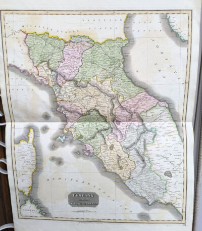
Tuscany, Central Italy, antique map Thomsons New General atlas, 1817

160,00 

Mappa della Toscana e dell’Italia Centrale, taken from Thomson’s New General Atlas, pubblicato nel 1817.
Questa grande mappa antica, caratterizzata da una colorazione coeva a mano, offre un’accurata rappresentazione della Toscana e delle regioni circostanti dell’Italia centrale. Stampata su carta pesante, si distingue per la precisione dei dettagli geografici e la qualità dell’esecuzione.

  • Era: XIX secolo (1817)
  • Technique: Incisione su rame con colorazione coeva
  • Dimensions: Alla battuta del rame: 65×50 cm; intero foglio: 71×54 cm
  • Support: Heavy paper
  • Condition: Excellent

Un esempio notevole di cartografia del XIX secolo, perfetto per collezionisti e appassionati di storia geografica italiana ed europea

Türkiye and Greece, Otto Petri, 1853

50,00 

Türkiye and Greece It is a hand-engraved and hand-colored map, made by Otto Petri in 1853.
This map shows the regions of Türkiye and Greece in detail, and is part of the School Atlas Alle Deelen Der Aarde, published by J. Van Den Bosch in Rotterdam.

  • Sheet size: cm. 26×34 approx.
  • Map dimensions: cm. 22×27 approx.
  • Support: Medium thickness paper
  • Condition: Excellent state of preservation
  • Fold: Editorial fold present

Türkiye, CF Delamarche, 1816

70,00 

Türkiye è una mappa incisa da C.F. Delamarche nel 1816, che rappresenta la Turchia d’Europa e parte dell’Asia.
This copper engraving is colored around the outline and is taken from the volume Petit Atlas Moderne ou Collection de Cartes Elementaires, dedicato alla gioventù e pubblicato a Parigi da Delamarche.

  • Sheet size: cm. 21×27
  • Condition: Good condition, with some peeling and a central editorial crease
  • Support: Paper

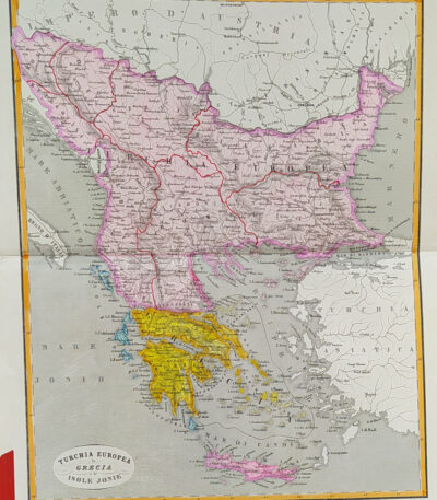
Türkiye, Greece and the Ionian Islands, 1865

60,00 

Türkiye, Greece and Ionian Islands It is a watercolour map made in 1865.
Drawn by Naymiller and engraved by Allodi, this map is from the work Atlas of Universal Geography Chronological, Historical, Statistical and Literary by Francesco Pagnoni, published in Milan.

  • Sheet size: cm. 49×38 approx.
  • Map dimensions: cm. 40×32 approx.
  • Support: Paper
  • Condition: Excellent

Thuringia, St.Munster, 1614

60,00 

Thuringia It is a historical map of the German region, made by Sebastian Munster in 1614.
This map is taken from his famous work Cosmography Universalis, published in Basel.

  • Sheet size: cm. 36×22 approx.
  • Image size: cm. 9×13,5 approx.
  • Support: Watercolored laid paper
  • Condition: Excellent state of preservation

Thuringia, St.Munster, 1614

60,00 

Thuringia, St.Munster, 1614 è una veduta storica di Gotha, situata nella regione della Turingia in Germania.
This map was extracted from the famous work Cosmography Universalis by Sebastian Munster, published in Basel in 1614.

  • Author: Sebastian Münster (1488-1552)
  • Technique: Woodcut on laid paper with watercolour
  • Sheet size: cm. 36×22 approx.
  • Image size: cm. 12×15,5 approx.
  • Condition: Excellent

Hungary, CF Delamarche, 1816

70,00 

Hungary è una mappa dettagliata dell’Ungheria, realizzata da C.F. Delamarche nel 1816.
Questa incisione su rame, colorata al contorno, rappresenta le principali province del paese.
It is taken from the volume Petit Atlas Moderne ou Collection de Cartes Elementaires, dedicated to youth and published in Paris by Delamarche.

  • Sheet size: cm. 21×27
  • Engraving size: cm. 21×27
  • Technique: Burin
  • Condition: Good
  • Support: Paper

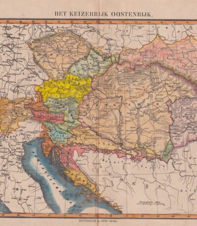
Hungary, Otto Petri, 1853

50,00 

Map of Hungary, made by Otto Petri in 1853, is a hand-colored engraving depicting not only Hungary, but also Slovenia and Moravia.
This map is part of the School Atlas Alle Deelen Der Aarde, published by J. Van Den Bosch in Rotterdam.

  • Sheet size: cm. 26×34 approx.
  • Map dimensions: cm. 22×27 approx.
  • Support: Medium thickness paper
  • Condition: Excellent condition, with editorial fold and white back

Urbino, St. Munster, 1614

60,00 

Urbino It is a woodcut made by Sebastian Munster in 1614, taken from his famous work Cosmography Universalis.
This view of Urbino offers a fascinating representation of the city, with details that reflect the Renaissance era. On the back there is a written text that further enriches the value of this page.

  • Sheet size: cm. 36×22 approx.
  • Image size: cm. 8.5×13 approx.
  • Support: Watercolored laid paper
  • Condition: Excellent

Utrecht, St.Munster, 1614

90,00 

Utrecht, S. Munster è una veduta affascinante della città di Utrecht, realizzata da Sebastian Munster in 1614.
Questa opera è estratta dalla Cosmography Universalis, pubblicata a Basilea. La stampa è stata colorata a mano all’acquarello, conferendole un aspetto unico e vivace.

  • Sheet size: cm. 36×22 approx.
  • Image size: cm. 12.5×16 approx.
  • Support: Laid paper
  • Condition: Excellent

Minor Valley of Caltanissetta, B. Marzolla, 1832

80,00 

Minor Valley of Caltanissetta It is a geographical map made by Benedict Marzolla in 1832, performed in lithography with watercolor borders.
This map is part of the work Historical and statistical chorographic atlas of the Kingdom of the Two Sicilies, dedicated to HM King Ferdinand II and published by the Royal Military Typography of Naples.

  • Sheet size: cm. 45×60
  • Condition: Good state of preservation
  • Support: Paper
  • Details: It has age stains and light humidity stains, but is free of editorial creases.

On the sides of the map there are historical and statistical information about the provinces of Caltanissetta, Piazza, Terranova and Cefalù. The map will be sent in a rigid tube with registered mail.

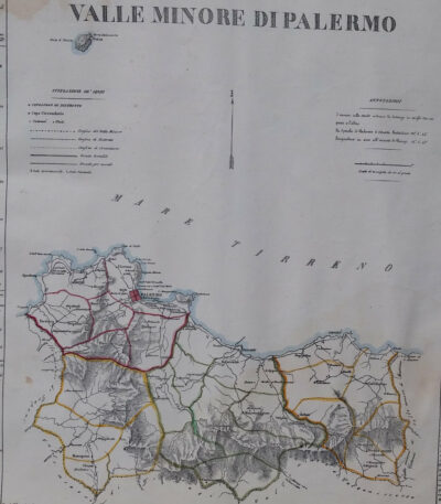
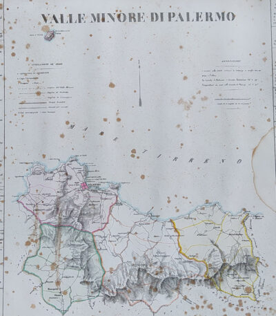
Minor Valley of Palermo, B. Marzolla, 1832

80,00 

Minor Valley of Palermo It is a lithographic geographical map made by Benedict Marzolla in 1832.
This map, part of the work Historical and statistical chorographic atlas of the Kingdom of the Two Sicilies, has watercolour borders and measures 45x60 cm.

  • Sheet size: cm. 45×60
  • Map dimensions: cm. 45×60
  • Technique: Lithography
  • Condition: Good state of preservation
  • Support: Paper

The paper has age stains and light humidity stains, but is free of editorial creases.
On the sides there are historical news and statistics of the provinces of Palermo, Corleone, Termini and Cefalù. The map will be sent in a rigid tube with registered mail.

Minor Valley of Palermo, B. Marzolla, 1832

90,00 

Minor Valley of Palermo it is a geographical map created by B. Marzolla in 1832.
This lithograph has watercolored borders and is part of the work Historical and statistical chorographic atlas of the Kingdom of the Two Sicilies, dedicated to HM King Ferdinand II.

  • Sheet size: cm. 45×60
  • Paper size: Great
  • Technique: Lithography
  • Condition: Good state of preservation
  • Support: Paper

The paper has some age stains and light humidity stains, but is free of editorial creases.
It will be shipped in a rigid tube with registered mail.

Minor Valley of Trapani, B. Marzolla, 1832

90,00 

Minor Valley of Trapani it is a geographical map created by B. Marzolla in 1832.
This map was made in lithography with watercolor borders and is part of the work Historical and statistical chorographic atlas of the Kingdom of the Two Sicilies, dedicated to HM King Ferdinand II.

  • Sheet size: cm. 45×60
  • Condition: Good state of preservation
  • Support: Paper

The paper has some age stains and light humidity stains, but is free of editorial creases.
On the sides of the map there are historical information and statistics of the province. The map will be sent in a rigid tube with registered mail.

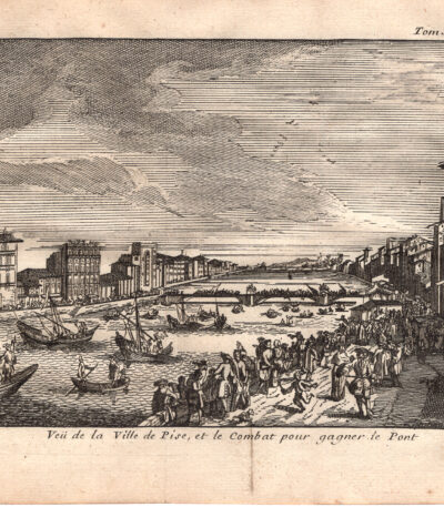
Veduta della città di Pisa e del combattimento sul Ponte, 1707

50,00 

Incisione realizzata nel 1707, utilizzando la tecnica dell’acquaforte su rame.
Questa opera è stampata su carta leggera vergellata con retro bianco.
It is part of the volume Les delices de l’Italie di De Rogissart, edizione francese, pubblicata a Parigi nel 1707.

  • Sheet size: cm. 19×16 circa
  • Dimensioni dell’incisione: cm. 10×14 circa
  • Support: Laid paper
  • Condition: Discrete condizioni. Due pieghe editoriali.

View of Arles, 1614

50,00 

View of Arles, 1614 It is a page extracted from the Cosmography Universalis by Sebastian Munster, made in Basel in 1614.
This work represents a detailed view of the city of Arles, France, and has been colored in watercolor. On the back there is a writing that adds further historical value to the work.

  • Sheet size: cm. 36×22 approx.
  • Image size: cm. 8×15,5 approx.
  • Support: Laid paper
  • Condition: Excellent state of preservation

View of Avignon, 1614

80,00 

Veduta di Avignone è una pregiata pagina estratta dalla Cosmography Universalis, created by Sebastian Munster in 1614.
Questa incisione offre una dettagliata rappresentazione di Avignone, in Francia, colorata all’acquerello. Sul retro, è presente una veduta del famoso Pont du Gard, un antico acquedotto romano.

  • Sheet size: cm. 36×22 approx.
  • Image size: cm. 8×15,5 approx.
  • Support: Laid paper
  • Condition: Excellent state of preservation

View of Edinburgh, 1614

120,00 

View of Edinburgh it is a valuable engraving made by Sebastian Munster in 1614, taken from his work Cosmography Universalis.
This view represents the city of Edinburgh, located in Scotland, and is distinguished by its watercolour colouring. At the bottom right is the monogram of Hans Rudolf Manuel German, a well-known German cartographer.

  • Sheet size: cm. 36×22 approx.
  • Engraving size: cm. 10×18 approx.
  • Technique: Woodcut on laid paper with watercolour
  • Condition: Excellent
  • Support: Paper

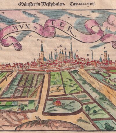
View of Munster, 1614

80,00 

Veduta di Munster It is an engraving made by Sebastian Munster nel 1614, proveniente dalla sua celebre opera Cosmography Universalis.
Questa veduta rappresenta la città di Munster, situata nel Monaco di Vestfalia, Germania. L’opera è caratterizzata da un piccolo strappo riparato con carta e presenta sul retro altre immagini.

  • Sheet size: cm. 36×22 approx.
  • Engraving size: cm. 12×15 approx.
  • Support: Laid paper
  • Condition: Good

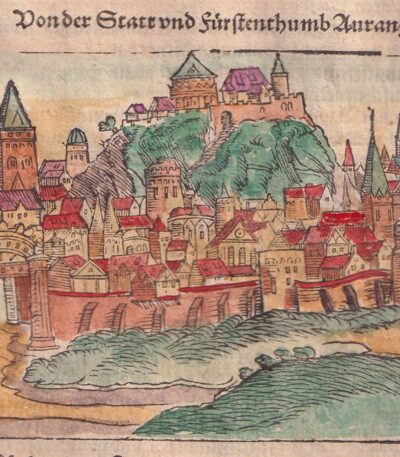
View of Orange, Aurange, 1614

50,00 

Veduta di Orange, Aurange It is a page extracted from the Cosmography Universalis, created by Sebastian Munster in 1614.
Questa opera presenta una veduta colorata all’acquerello della città di Orange, arricchita da un retro scritto.

  • Sheet size: cm. 36×22 approx.
  • Image size: cm. 8×12,5 circa
  • Support: Laid paper
  • Condition: Excellent

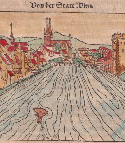
View of Vienna, Wien, 1614

50,00 

View of Vienna It is a woodcut made by Sebastian Munster in 1614, taken from his famous work Cosmography Universalis.
This page offers a fascinating view of the city of Vienna, depicted with fine details and an artistic touch.

  • Sheet size: cm. 36×22 approx.
  • Image size: cm. 8×13 approx.
  • Support: Watercolored laid paper
  • Condition: Excellent state of preservation

Explore the fascinating world of antique prints

Antique prints are silent witnesses of history, capable of transporting us to distant eras through the art of engraving. Our e-commerce offers a vast selection of these precious finds, carefully selected for their authenticity and artistic value. Whether you are an expert collector or a novice enthusiast, you will find unique pieces here that will enrich your spaces with a touch of timeless elegance.

A safe and rewarding shopping experience

We understand the importance of each individual print and are committed to ensuring a flawless purchasing experience. Our secure payment system and insured shipping with professional packaging ensure that each piece arrives in the best condition. Our expertise in the sector allows us to offer detailed descriptions and personalized advice, helping you to make informed choices. If you have any questions or specific requests, do not hesitate to contact us: we will be happy to guide you into the wonderful world of antique prints.