English (UK)
  Italiano
  Français


Cartography
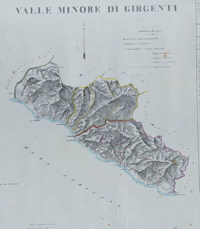
Provincia di Agrigento, B. Marzolla, 1832
90,00 €Provincia di Agrigento It is a geographical map created by B. Marzolla in 1832, executed in lithography with watercolor borders.
This map is part of the work Historical and statistical chorographic atlas of the Kingdom of the Two Sicilies, compilato e dedicato a S.M. il Re Ferdinando II, pubblicato a Napoli dalla Reale Tipografia Milit. nel 1832.
- Sheet size: cm. 45×60
- Condition: Good state of preservation
- Support: Paper
La carta presenta macchie del tempo e leggere gore di umidità, ma è priva di pieghe editoriali. Ai lati, sono riportate notizie storiche e statistiche della provincia. La spedizione avverrà in tubo rigido con posta raccomandata.

Province of Bari, B. Marzolla, 1832
80,00 €Province of Bari It is a geographical map made by Benedict Marzolla in 1832, performed in lithography with watercolor borders.
This map is part of the work Historical and statistical chorographic atlas of the Kingdom of the Two Sicilies, dedicated to HM King Ferdinand II.
- Sheet size: cm. 45×60
- Condition: Good state of preservation
- Support: Paper
The paper has age stains and light humidity stains, but is free of editorial creases.
On the sides, there are historical and statistical information about the provinces of Bari, Trani, Monopoli, Andria and Molfetta. The map will be sent in a rigid tube with registered mail.

Province of Bari, B. Marzolla, 1832
90,00 €Province of Bari it is a geographical map created by B. Marzolla in 1832.
This map was made in lithography with watercolor borders and is part of the work Historical and statistical chorographic atlas of the Kingdom of the Two Sicilies, dedicated to HM King Ferdinand II.
- Sheet size: cm. 45×60
- Condition: Good state of preservation
- Support: Paper
- Notes: Stains of time and light humidity stains, sheet without editorial fold

Provincia di Calabria Citra, B. Marzolla, 1832
90,00 €Provincia di Calabria Citra it is a geographical map created by B. Marzolla in 1832.
This lithograph has watercolored borders and is part of the work Historical and statistical chorographic atlas of the Kingdom of the Two Sicilies, dedicated to HM King Ferdinand II.
- Sheet size: cm. 45×60
- Paper size: Great
- Technique: Lithography
- Condition: Good state of preservation
- Support: Paper
The paper has age stains and light humidity stains, but is free of editorial creases.
Ai lati sono riportate notizie storiche e statistiche della provincia. La carta verrà spedita in tubo rigido con posta raccomandata.

Provincia di Calabria Ultra I, B. Marzolla, 1832
90,00 €Provincia di Calabria Ultra I it is a geographical map created by B. Marzolla in 1832.
This map was made in lithography with watercolor borders and is part of the work Historical and statistical chorographic atlas of the Kingdom of the Two Sicilies, dedicated to HM King Ferdinand II.
- Sheet size: cm. 45×60
- Condition: Good state of preservation
- Support: Paper
- Details: Stains of time and light humidity stains, sheet without editorial fold
The card will be shipped in a rigid tube via registered mail.

Provincia di Calabria Ultra II, B. Marzolla, 1832
90,00 €Provincia di Calabria Ultra II è una carta geografica litografica realizzata da B. Marzolla nel 1832.
This map is part of the work Historical and statistical chorographic atlas of the Kingdom of the Two Sicilies, dedicated to HM King Ferdinand II.
- Sheet size: cm. 45×60
- Map dimensions: cm. 45×60
- Technique: Lithography
- Condition: Good state of preservation
- Support: Paper
La carta presenta confini acquarellati e include notizie storiche e statistiche della provincia.
È importante notare che ci sono macchie del tempo e leggere gore di umidità, ma il foglio è senza piega editoriale. La mappa verrà spedita in tubo rigido con posta raccomandata.

Province of Caltanissetta, B. Marzolla, 1832
Provincia di Caltanisetta It is a geographical map created by B. Marzolla in 1832, executed in lithography with watercolor borders.
This map is taken from the work Historical and statistical chorographic atlas of the Kingdom of the Two Sicilies, dedicated to HM King Ferdinand II and published by the Royal Military Typography of Naples.
- Sheet size: cm. 45×60
- Condition: Good state of preservation
- Support: Paper
- Notes: It has age stains and light humidity stains, but is free of editorial creases.
La carta include anche notizie storiche e statistiche sulla provincia e verrà spedita in tubo rigido con posta raccomandata.
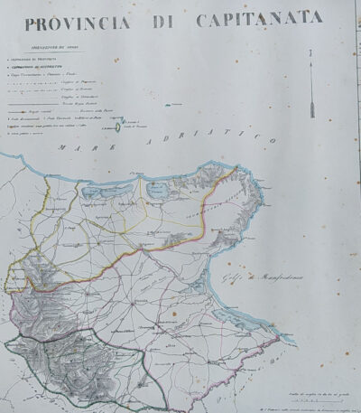
Province of Capitanata, B. Marzolla, 1832
90,00 €Province of Capitanata it is a geographical map created by B. Marzolla in 1832.
This lithograph has watercolored borders and is part of the work Historical and statistical chorographic atlas of the Kingdom of the Two Sicilies, dedicated to HM King Ferdinand II.
- Sheet size: cm. 45×60
- Technique: Lithography
- Condition: Good state of preservation
- Support: Paper
- Notes: Stains of time and light damp stains
The card will be shipped in a rigid tube via registered mail.

Provincia di Molise, B. Marzolla, 1832
90,00 €Provincia di Molise It is a geographical map created by B. Marzolla in 1832, executed in lithography with watercolor borders.
This map is part of the work Historical and statistical chorographic atlas of the Kingdom of the Two Sicilies, dedicated to HM King Ferdinand II and published by the Royal Military Typography of Naples.
- Sheet size: cm. 45×60
- Condition: Good state of preservation
- Support: Paper
- Notes: It has age stains and light humidity stains, but is free of editorial creases.
The card will be shipped in a rigid tube via registered mail.

Provincia di Napoli, B. Marzolla, 1832
Provincia di Napoli It is a geographical map created by B. Marzolla in 1832, executed in lithography with watercolor borders.
This map is taken from the work Historical and statistical chorographic atlas of the Kingdom of the Two Sicilies, dedicated to HM King Ferdinand II.
- Sheet size: cm. 45×60
- Condition: Good state of preservation
- Support: Paper
La carta presenta macchie del tempo e leggere gore di umidità, ma è priva di pieghe editoriali. Ai lati sono riportate notizie storiche e statistiche della provincia. La spedizione avverrà in tubo rigido con posta raccomandata.

Province of Syracuse, B. Marzolla, 1832
90,00 €Province of Syracuse it is a geographical map created by B. Marzolla in 1832.
This lithograph has watercolored borders and is taken from the work Historical and statistical chorographic atlas of the Kingdom of the Two Sicilies, executed lithographically and dedicated to HM King Ferdinand II.
- Sheet size: cm. 45×60
- Technique: Lithography
- Condition: Good state of preservation
- Support: Paper
The paper has age stains and light humidity stains, but is free of editorial creases.
On the sides, there are historical news and statistics related to the province. The map will be shipped in a rigid tube with registered mail.

Prussia, 1865
60,00 €Prussia, 1865 è una piccola mappa della Turchia, realizzata nel 1821.
This copper engraving was hand-watercoloured and measures approximately 9 x 9 cm, on a sheet of 13 x 15 cm.
- Sheet size: cm. 13×15 approx.
- Engraving size: cm. 9×9 approx.
- Support: Paper
- Condition: Excellent condition

Prussia, Otto Petri, 1853
50,00 €Mappa della Prussia è un’incisione colorata a mano realizzata da Otto Petri nel 1853.
This map, part of the School Atlas Alle Deelen Der Aarde, pubblicato da J. Van Den Bosch a Rotterdam, offre una rappresentazione dettagliata della Prussia dell’epoca.
- Sheet size: cm. 26×34 approx.
- Engraving size: cm. 22×27 approx.
- Support: Medium thickness paper
- Condition: Excellent condition
- Characteristics: White back, editorial fold
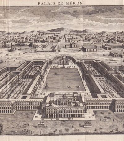
Rome, Domus Aurea, Nero's Palace, 1791
70,00 €Roma, Domus Aurea, Palazzo di Nerone è un’incisione realizzata nel 1791, che rappresenta un’importante testimonianza storica dell’architettura romana.
Questa acquaforte è parte del volume Histoire Universelle depuis les commencement du monde jusque a present, pubblicato a Parigi nel 1791.
- Sheet size: mm. 235×385 più margini irregolari di 2-3 cm
- Engraving size: mm. 235×385
- Technique: Etching
- Support: Laid paper
- Condition: Excellent general condition
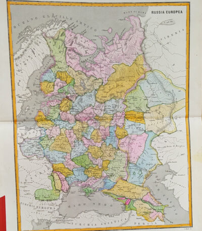
European Russia, 1865
60,00 €European Russia, 1865 It is a watercolor map that offers a detailed view of Russia in the year 1865.
Drawn by Naymiller and engraved by Allodi, this map is part of theAtlas of Universal Geography Chronological, Historical, Statistical and Literary by Francesco Pagnoni, published in Milan in 1865.
- Sheet size: cm. 49×38 approx.
- Paper size: cm. 40×32 approx.
- Support: Paper
- Condition: Excellent

Russia, C.F. Delamarche, 1816
70,00 €Russia è una mappa dell’Europa, realizzata da C.F. Delamarche nel 1816.
This copper engraving is colored around the outline and comes from the volume Petit Atlas Moderne ou Collection de Cartes Elementaires, dedicato alla gioventù, pubblicato a Parigi presso Delamarche.
- Sheet size: cm. 21×27 approx.
- Condition: Good condition, with some peeling and a central editorial crease
- Support: Paper
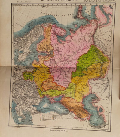
Russia, Otto Petri, 1853
50,00 €Russia It is a detailed map made by Eight Petri In the 1853.
This hand-colored engraving measures cm. 22×27 on a sheet of paper cm. 26×34.
- Sheet size: cm. 26×34
- Map dimensions: cm. 22×27
- Support: Medium thickness paper
- Condition: Excellent condition
The map is taken from the School Atlas Alle Deelen Der Aarde, published by J. Van Den Bosch, Rotterdam.

Salzburg, St. Munster, 1614
Salzburg, St. Munster, 1614 è una splendida veduta della città di Salisburgo, estratta dalla celebre opera Cosmography Universalis by Sebastian Munster.
Questa xilografia, realizzata su carta vergellata acquarellata, offre un affascinante sguardo sulla città nel 1614. Sul retro, sono presenti altre immagini che arricchiscono ulteriormente l’opera.
- Sheet size: cm. 36×22 approx.
- Image size: cm. 12.5×15 approx.
- Support: Watercolored laid paper
- Condition: Excellent
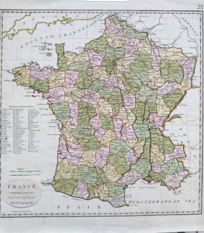
Samuel John Neele (1763 – 1824) vintage colored map of France 1798
80,00 €Map of France, realizzata nel 1798 da Samuel John Neele (1763–1824), incisore e cartografo britannico.
Quest’opera offre una rappresentazione dettagliata della Francia rivoluzionaria, arricchita da una colorazione coeva che evidenzia le divisioni amministrative e i principali centri urbani. Stampata su carta vergellata con filigrana, si distingue per la qualità della lavorazione e si presenta in ottime condizioni.
- Era: XVIII secolo (1798)
- Technique: Incisione su rame con colorazione coeva
- Dimensions: Alla battuta del rame: 36×36 cm; intero foglio: 44×42 cm
- Support: Laid paper with watermark
- Condition: Excellent
Questa mappa è un’importante testimonianza della cartografia di fine Settecento, ideale per collezionisti e studiosi di storia e geografia della Francia.

Sardinia Piedmont Northern Italy map by R. Wilkinson 1808 contemporary colored
40,00 €Mappa della Sardegna, Piemonte e Italia Settentrionale, made by R. Wilkinson nel 1808, è un’incisione storica di grande interesse.
La carta, decorata con colorazione coeva, offre una rappresentazione accurata dei territori del Nord Italia e della Sardegna, con confini ben definiti e dettagli geografici rilevanti. Stampata su carta di medio spessore, presenta una piccola riparazione al margine destro, effettuata con carta al verso, senza comprometterne la qualità estetica o la leggibilità.
- Era: XIX secolo (1808)
- Technique: Incisione su rame con colorazione coeva
- Dimensions: Alla battuta del rame: 28×22 cm; intero foglio: 33×25 cm
- Support: Medium thickness paper
- Condition: Buone (riparazione al margine destro)
Questa mappa è un eccellente esempio di cartografia ottocentesca, perfetta per collezionisti e appassionati di storia geografica italiana.
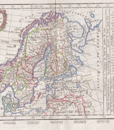
Scandinavia, CF Delamarche, 1816
70,00 €Scandinavia è un’incisione realizzata da C.F. Delamarche nel 1816, che rappresenta una mappa dettagliata della Penisola Scandinava, comprendente Norvegia, Svezia, Finlandia e Danimarca.
This work is taken from the Petit Atlas Moderne ou Collection de Cartes Elementaires, published in Paris by Delamarche.
- Sheet size: cm. 21×27 approx.
- Engraving size: cm. 20×26 approx.
- Technique: Burin
- Support: Paper
- Condition: Good

Scotland, England, Ireland, 1865
60,00 €Scozia, Inghilterra, Irlanda It is a watercolour map made in 1865.
Drawn by Naymiller and engraved by Allodi, this map is part of theAtlas of Universal Geography Chronological, Historical, Statistical and Literary by Francesco Pagnoni, published in Milan.
- Sheet size: cm. 49×38 approx.
- Paper size: cm. 40×32 approx.
- Support: Paper
- Condition: Excellent
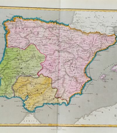
Ancient Spain, 1865
60,00 €Spagna Antica è una carta geografica acquarellata realizzata nel 1865, disegnata da Naymiller e incisa da Allodi.
This map is taken from the work Atlas of Universal Geography Chronological, Historical, Statistical and Literary by Francesco Pagnoni, published in Milan.
- Sheet size: cm. 49×38 approx.
- Paper size: cm. 40×32 approx.
- Technique: Etching
- Condition: Excellent
- Support: Paper

Spain and Portugal, Otto Petri, 1853
50,00 €Spain and Portugal It is a hand-engraved and hand-colored map, made by Otto Petri in 1853.
This map, part of the School Atlas Alle Deelen Der Aarde, published by J. Van Den Bosch in Rotterdam, offers a detailed representation of Iberian geography.
- Sheet size: cm. 26×34 approx.
- Map dimensions: cm. 22×27 approx.
- Support: Medium thickness paper
- Condition: Excellent condition
- Fold: Editorial fold