English (UK)
  Italiano
  Français


Cartography
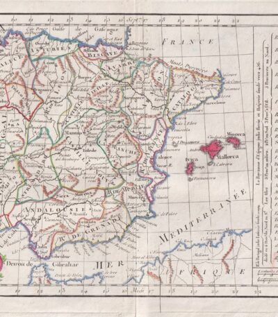
Spain, CF Delamarche, 1816
70,00 €Map of Spain and Portugal realizzata da C.F. Delamarche nel 1816.
This copper engraving is colored around the outline and comes from the volume Petit Atlas Moderne ou Collection de Cartes Elementaires, dedicato alla gioventù e pubblicato a Parigi da Delamarche.
- Sheet size: cm. 21×27
- Condition: Good condition, with some peeling and a central editorial crease
- Support: Paper
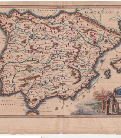
Spain. Cellarius – 1701
80,00 €Spain – Hispania Antiqua It is a copperplate map made by Christophorus Cellarius in 1701.
This work is taken from the volume Notitia Orbis Antiqui sive Geographia Plenior and presents historical and geographical details of Spain.
- Sheet size: cm. 24×33 approx.
- Engraving size: cm. 20×30 approx.
- Support: Laid paper
- Condition: Good condition
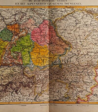
States of Germany, Otto Petri, 1853
50,00 €Stati della Germania è una mappa incisa a mano da Otto Petri nel 1853, che rappresenta gli stati della Germania meridionale e l’area delle Alpi, da Ginevra a Vienna.
Questa incisione colorata è parte del School Atlas Alle Deelen Der Aarde, published by J. Van Den Bosch in Rotterdam.
- Sheet size: cm. 26×34 approx.
- Engraving size: cm. 22×27 approx.
- Support: Medium thickness paper
- Condition: Excellent state of preservation

South America, Otto Petri, 1853
50,00 €Mappa del Sud America, realizzata da Otto Petri nel 1853, è un’incisione colorata a mano che offre una rappresentazione dettagliata del continente sudamericano.
This map is part of the School Atlas Alle Deelen Der Aarde, pubblicato a Rotterdam da J. Van Den Bosch.
- Sheet size: cm. 26×34 approx.
- Engraving size: cm. 22×27 approx.
- Support: Medium thickness paper
- Condition: Excellent state of preservation
- Characteristics: White back, editorial fold

Sweden, Norway and Denmark, 1865
60,00 €Sweden, Norway and Denmark It is a watercolour map made in 1865.
Drawn by Naymiller and engraved by Allodi, this map is from the work Atlas of Universal Geography Chronological, Historical, Statistical and Literary by Francesco Pagnoni, published in Milan.
- Sheet size: cm. 49×38 approx.
- Map dimensions: cm. 40×32 approx.
- Support: Paper
- Condition: Excellent
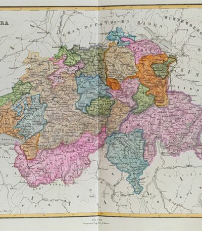
Switzerland, 1865
60,00 €Switzerland, 1865 è una carta geografica acquarellata che offre una rappresentazione dettagliata della Svizzera nel XIX secolo.
Drawn by Naymiller and engraved by Allodi, this map is from the work Atlas of Universal Geography Chronological, Historical, Statistical and Literary by Francesco Pagnoni, pubblicata a Milano nel 1865.
- Sheet size: cm. 49×38 approx.
- Paper size: cm. 40×32 approx.
- Support: Paper
- Condition: Excellent

Switzerland, Canton Ticino, Tyrol, 1865
60,00 €Switzerland, Canton Ticino, Tyrol It is a watercolour map made in 1865.
Drawn by Naymiller and engraved by Allodi, this map is from the Atlas of Universal Geography Chronological, Historical, Statistical and Literary by Francesco Pagnoni, published in Milan.
- Sheet size: cm. 49×38 approx.
- Map dimensions: cm. 40×32 approx.
- Technique: Watercolor
- Condition: Excellent state of preservation
- Support: Paper

Switzerland, Otto Petri, 1853
50,00 €Map of Switzerland Made by Otto Petri in 1853, this hand-colored engraving features Switzerland and Liechtenstein.
- Sheet size: cm. 26×34
- Map dimensions: cm. 22×27
- Support: Medium thickness paper
- Condition: Excellent condition
- Taken from: School Atlas Alle Deelen Der Aarde, J. Van Den Bosch, Rotterdam

Verona Theatre, Sebastian Münster, 1614
120,00 €Pagina della Cosmografia – Teatro di Verona, estratta dall’edizione tedesca della Universal Cosmography Of Sebastian Münster (1488–1552), una delle opere geografiche più influenti del Rinascimento.
Questa pagina, illustrata con una splendida xilografia, è firmata in basso a destra con il monogramma C.S., attribuito a Christoph Stimmer Johann l’Ancien (1490–1562). Tratta dall’edizione del 1588 stampata a Basilea, l’opera presenta una rappresentazione del Teatro di Verona, testimonianza dell’eccezionale perizia artistica e cartografica dell’epoca.
- Era: XVI secolo (1588)
- Technique: Xilografia su carta vergellata
- Dimensions: 30×39 cm (foglio)
- Autore della pubblicazione: Sebastian Münster
- Condition: Excellent
Questa xilografia, un raro esempio dell’arte e della cartografia rinascimentale, è ideale per collezionisti di libri antichi e appassionati di storia dell’arte e della geografia.

Land of Otranto, B. Marzolla, 1832
90,00 €Land of Otranto It is a geographical map created by B. Marzolla in 1832, executed in lithography with watercolor borders.
This map is part of the work Historical and statistical chorographic atlas of the Kingdom of the Two Sicilies, dedicated to HM King Ferdinand II and published by the Royal Military Typography of Naples.
- Sheet size: cm. 45×60
- Condition: Good state of preservation
- Support: Paper
The paper has some age stains and light humidity stains, but is free of editorial creases.
On the sides of the map there are historical information and statistics of the province. The map will be sent in a rigid tube with registered mail.

Türkiye and Greece, Otto Petri, 1853
50,00 €Türkiye and Greece It is a hand-engraved and hand-colored map, made by Otto Petri in 1853.
This map shows the regions of Türkiye and Greece in detail, and is part of the School Atlas Alle Deelen Der Aarde, published by J. Van Den Bosch in Rotterdam.
- Sheet size: cm. 26×34 approx.
- Map dimensions: cm. 22×27 approx.
- Support: Medium thickness paper
- Condition: Excellent state of preservation
- Fold: Editorial fold present

Türkiye, CF Delamarche, 1816
70,00 €Türkiye è una mappa incisa da C.F. Delamarche nel 1816, che rappresenta la Turchia d’Europa e parte dell’Asia.
This copper engraving is colored around the outline and is taken from the volume Petit Atlas Moderne ou Collection de Cartes Elementaires, dedicato alla gioventù e pubblicato a Parigi da Delamarche.
- Sheet size: cm. 21×27
- Condition: Good condition, with some peeling and a central editorial crease
- Support: Paper
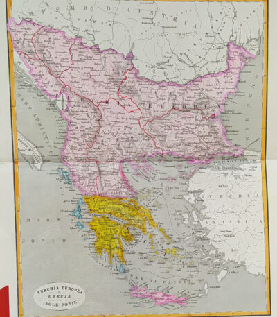
Türkiye, Greece and the Ionian Islands, 1865
60,00 €Türkiye, Greece and Ionian Islands It is a watercolour map made in 1865.
Drawn by Naymiller and engraved by Allodi, this map is from the work Atlas of Universal Geography Chronological, Historical, Statistical and Literary by Francesco Pagnoni, published in Milan.
- Sheet size: cm. 49×38 approx.
- Map dimensions: cm. 40×32 approx.
- Support: Paper
- Condition: Excellent

Hungary, CF Delamarche, 1816
70,00 €Hungary è una mappa dettagliata dell’Ungheria, realizzata da C.F. Delamarche nel 1816.
Questa incisione su rame, colorata al contorno, rappresenta le principali province del paese.
It is taken from the volume Petit Atlas Moderne ou Collection de Cartes Elementaires, dedicated to youth and published in Paris by Delamarche.
- Sheet size: cm. 21×27
- Engraving size: cm. 21×27
- Technique: Burin
- Condition: Good
- Support: Paper
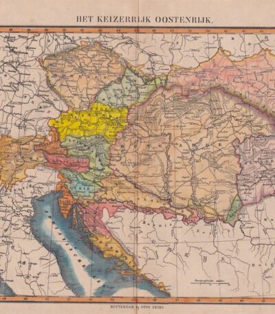
Hungary, Otto Petri, 1853
50,00 €Map of Hungary, made by Otto Petri in 1853, is a hand-colored engraving depicting not only Hungary, but also Slovenia and Moravia.
This map is part of the School Atlas Alle Deelen Der Aarde, published by J. Van Den Bosch in Rotterdam.
- Sheet size: cm. 26×34 approx.
- Map dimensions: cm. 22×27 approx.
- Support: Medium thickness paper
- Condition: Excellent condition, with editorial fold and white back

Minor Valley of Caltanissetta, B. Marzolla, 1832
Minor Valley of Caltanissetta It is a geographical map made by Benedict Marzolla in 1832, performed in lithography with watercolor borders.
This map is part of the work Historical and statistical chorographic atlas of the Kingdom of the Two Sicilies, dedicated to HM King Ferdinand II and published by the Royal Military Typography of Naples.
- Sheet size: cm. 45×60
- Condition: Good state of preservation
- Support: Paper
- Details: It has age stains and light humidity stains, but is free of editorial creases.
On the sides of the map there are historical and statistical information about the provinces of Caltanissetta, Piazza, Terranova and Cefalù. The map will be sent in a rigid tube with registered mail.
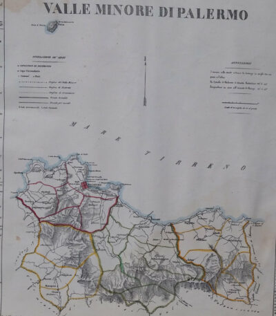
Minor Valley of Palermo, B. Marzolla, 1832
80,00 €Minor Valley of Palermo It is a lithographic geographical map made by Benedict Marzolla in 1832.
This map, part of the work Historical and statistical chorographic atlas of the Kingdom of the Two Sicilies, has watercolour borders and measures 45x60 cm.
- Sheet size: cm. 45×60
- Map dimensions: cm. 45×60
- Technique: Lithography
- Condition: Good state of preservation
- Support: Paper
The paper has age stains and light humidity stains, but is free of editorial creases.
On the sides there are historical news and statistics of the provinces of Palermo, Corleone, Termini and Cefalù. The map will be sent in a rigid tube with registered mail.
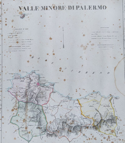
Minor Valley of Palermo, B. Marzolla, 1832
90,00 €Minor Valley of Palermo it is a geographical map created by B. Marzolla in 1832.
This lithograph has watercolored borders and is part of the work Historical and statistical chorographic atlas of the Kingdom of the Two Sicilies, dedicated to HM King Ferdinand II.
- Sheet size: cm. 45×60
- Paper size: Great
- Technique: Lithography
- Condition: Good state of preservation
- Support: Paper
The paper has some age stains and light humidity stains, but is free of editorial creases.
It will be shipped in a rigid tube with registered mail.

Minor Valley of Trapani, B. Marzolla, 1832
90,00 €Minor Valley of Trapani it is a geographical map created by B. Marzolla in 1832.
This map was made in lithography with watercolor borders and is part of the work Historical and statistical chorographic atlas of the Kingdom of the Two Sicilies, dedicated to HM King Ferdinand II.
- Sheet size: cm. 45×60
- Condition: Good state of preservation
- Support: Paper
The paper has some age stains and light humidity stains, but is free of editorial creases.
On the sides of the map there are historical information and statistics of the province. The map will be sent in a rigid tube with registered mail.
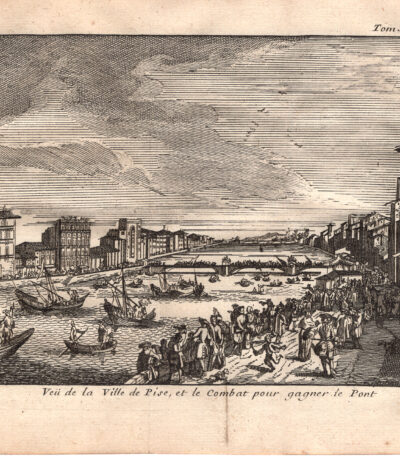
Veduta della città di Pisa e del combattimento sul Ponte, 1707
50,00 €Incisione realizzata nel 1707, utilizzando la tecnica dell’acquaforte su rame.
Questa opera è stampata su carta leggera vergellata con retro bianco.
It is part of the volume Les delices de l’Italie di De Rogissart, edizione francese, pubblicata a Parigi nel 1707.
- Sheet size: cm. 19×16 circa
- Dimensioni dell’incisione: cm. 10×14 circa
- Support: Laid paper
- Condition: Discrete condizioni. Due pieghe editoriali.
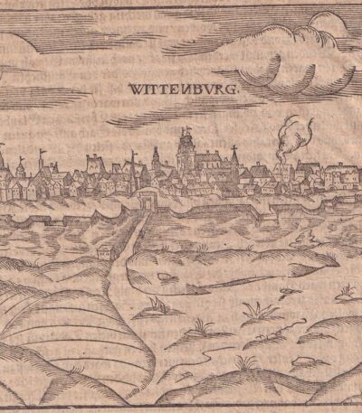
Wittenburg, St.Munster, 1614
Wittenburg, S.Munster è una veduta di Wittenberg, rappresentante un’importante località legata a Martin Lutero in Germania.
This engraving is taken from the famous work Cosmography Universalis di Sebastian Munster, pubblicata a Basilea nel 1614. Sul retro si trova un’immagine di Martin Lutero, figura centrale della Riforma protestante.
- Sheet size: cm. 36×22 approx.
- Image size: cm. 12×15 approx.
- Support: Watercolored laid paper
- Condition: Excellent state of preservation