Cartography

Showing 289–312 of 412 results

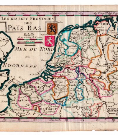
Matthieu Ogier, Map of the Netherlands, Holland, 1700

50,00 

Matthieu Ogier, Map of the Netherlands It is an engraving made in 1700, representing the seventeen provinces of the Netherlands.
This map was engraved by Matthieu Ogier and hand-colored in watercolor, making it a unique and fascinating piece.

  • Sheet size: cm. 16×23 approx.
  • Map dimensions: cm. 14×18 approx.
  • Support: Paper
  • Condition: Excellent

Mexico, CF Delamarche, 1816

70,00 

Messico è una mappa del Golfo del Messico con le isole Antille, realizzata da C.F. Delamarche nel 1816.
This copper engraving is colored around the outline and is taken from the volume Petit Atlas Moderne ou Collection de Cartes Elementaires, dedicated to youth and published in Paris by Delamarche.

  • Sheet size: cm. 21×27
  • Technique: Burin
  • Condition: Good
  • Support: Paper

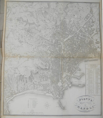
Naples, City Plan, Vallardi, 1867

240,00 

Napoli, Pianta della Città It is a copper engraving made in 1867 da Vallardi.
Questa dettagliata carta geografica fa parte dell’Atlante geografico dell’Italia, pubblicato a Milano.
La pianta offre una chiara rappresentazione delle principali località e delle sezioni della città, rendendola un prezioso documento storico.

  • Sheet size: cm. 56,8×67,8 circa
  • Engraving size: cm. 56,8×67,8 circa
  • Support: Paper
  • Condition: Excellent

Neptune, St. Munster, 1614

60,00 

Neptune It is a page extracted from the Cosmography Universalis by Sebastian Munster, published in Basel in 1614.
This work represents a color map of Neptune, located near Rome, and on the back is a portrait of Andrea Doria.

  • Author: Sebastian Münster (1488-1552)
  • Sheet size: cm. 36×22 approx.
  • Image size: cm. 12.5x15.5 approx.
  • Technique: Woodcut
  • Support: Watercolored laid paper
  • Condition: Excellent

North Africa, CF Delamarche, 1816

70,00 

North Africa It is a historical map made by CF Delamarche in 1816, which represents the Coast of the Barbarians, including Morocco, Algeria, Tunisia and Tripoli.
This copper engraving is colored around the outline and is taken from the volume Petit Atlas Moderne ou Collection de Cartes Elementaires, published in Paris by Delamarche.

  • Sheet size: cm. 21×27
  • Condition: Good condition, with some peeling and a central editorial crease
  • Support: Paper

Nordgau, St.Munster, 1614

60,00 

Nordgau, St.Munster, 1614 This is a detailed map view of the Nordgau region, located between Austria and Bavaria.
This map was extracted from the famous work Cosmography Universalis by Sebastian Munster, published in Basel in 1614.

  • Sheet size: cm. 36×22 approx.
  • Image size: cm. 12×15,5 approx.
  • Support: Watercolored laid paper
  • Condition: Excellent state of preservation

Nuremberg, St. Munster, 1614

80,00 

Nuremberg It is a historical view of the city of Nurnberg, located in Bavaria, Germany.
This engraving is taken from the famous work Cosmography Universalis by Sebastian Munster, published in Basel in 1614.
On the back of the work there are other images and writings that enrich the historical context.

  • Sheet size: cm. 36×22 approx.
  • Image size: cm. 12.5x15.5 approx.
  • Support: Watercolored laid paper
  • Condition: Excellent state of preservation

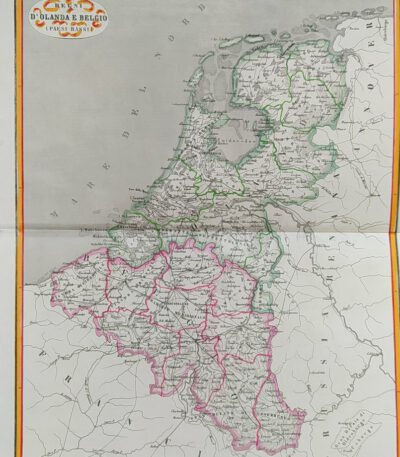
Holland, Belgium, Netherlands, 1865

60,00 

Olanda, Belgio, Paesi Bassi It is a watercolour map made in 1865.
Drawn by Naymiller and engraved by Allodi, this map is from the work Atlas of Universal Geography Chronological, Historical, Statistical and Literary by Francesco Pagnoni, published in Milan.

  • Sheet size: cm. 49×38 approx.
  • Paper size: cm. 40×32 approx.
  • Support: Paper
  • Condition: Excellent

Netherlands, CF Delamarche, 1816

70,00 

Netherlands It is a detailed map of the Northern and Southern Netherlands, made by CF Delamarche in 1816.
This copper engraving is colored around the outline and is part of the volume Petit Atlas Moderne ou Collection de Cartes Elementaires, dedicated to youth and published in Paris by Delamarche.

  • Sheet size: cm. 21×27 approx.
  • Technique: Burin
  • Condition: Good
  • Support: Paper

Netherlands, Otto Petri, 1853

50,00 

Netherlands è una mappa incisa a mano da Otto Petri nel 1853, rappresentante il Koningrijk der Nederlanden.
Questa incisione colorata è parte del School Atlas Alle Deelen Der Aarde, published by J. Van Den Bosch in Rotterdam.

  • Sheet size: cm. 26×34 approx.
  • Map dimensions: cm. 22×27 approx.
  • Support: Medium thickness paper
  • Condition: Excellent condition
  • Characteristics: White back, editorial fold

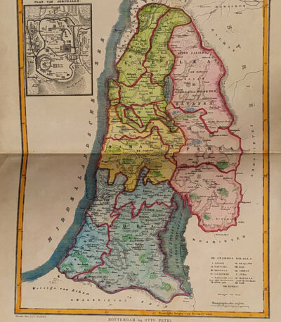
Palestine, Otto Petri, 1853

50,00 

Palestina è un’incisione colorata a mano realizzata da Otto Petri nel 1853.
Questa mappa dettagliata della Palestina è parte del School Atlas Alle Deelen Der Aarde, published by J. Van Den Bosch in Rotterdam.

  • Sheet size: cm. 26×34 approx.
  • Engraving size: cm. 22×27 approx.
  • Support: Medium thickness paper
  • Condition: Excellent condition, with editorial fold and white back

Pesaro, Salmon Thomas, 1738-1768

40,00 

Pesaro it is an etching on copper made by Thomas Salmon between 1738 and 1768.
This work represents the city of Pesaro in the Duchy of Urbino, part of the Ecclesiastical State.

  • Size of the joke: cm. 15×10 approx.
  • Margins: Irregular
  • Technique: Etching on copper
  • Support: Laid paper without watermark
  • Condition: Excellent state of preservation

The work is taken from the volume The present state of all the Countries, and Peoples of the World, Natural, Political, and Moral…, Naples edition.

Petrus Bertius, Anjou,1612

40,00 

Petrus Bertius, Anjou It is an original watercolor map made in 1612 by Petrus Bertius, a well-known 17th century geographer.
This map is from his work Petri Bertii Geographischer eyn oder zusammengezogener Tabeln Funff unterschiedliche Bucher, and is a significant example of the cartography of the time.

  • Sheet size: cm. 12×17 approx.
  • Map dimensions: mm. 125×83
  • Support: Laid paper
  • Condition: Excellent condition

Petrus Bertius, Artesia,1612

40,00 

Petrus Bertius, Artesia It is an original watercolor map made in 1612 by Petrus Bertius, a well-known French geographer.
This map is taken from Petri Bertii Geographischer eyn oder zusammengezogener Tabeln Funff unterschiedliche Bucher, a significant work of the 17th century.

  • Sheet size: cm. 12×17 approx.
  • Map dimensions: mm. 125×83
  • Support: Laid paper
  • Condition: Excellent condition

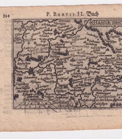
Petrus Bertius, Hesse,1612

40,00 

Petrus Bertius, Hesse It is an original map made in 1612 by Petrus Bertius (1565-1629), a well-known Dutch geographer.
This map is taken from the volume Petri Bertii Geographischer eyn oder zusammengezogener Tabeln Funff unterschiedliche Bucher.

  • Paper size: mm. 125×83
  • Sheet size: cm. 12×17
  • Support: Laid paper
  • Condition: Excellent condition

Petrus Bertius, Caletenfium,1612

40,00 

Petrus Bertius, Caletenfium It is an original watercolor map made by Petrus Bertius in 1612.
This map is taken from Petri Bertii Geographischer eyn oder zusammengezogener Tabeln Funff unterschiedliche Bucher, a work that collects various geographical representations of the time.

  • Sheet size: cm. 12×17 approx.
  • Map dimensions: mm. 125×83
  • Support: Laid paper
  • Condition: Excellent state of preservation

Petrus Bertius, Gascony, 1612

40,00 

Petrus Bertius, Gascony It is an original watercolor map made in 1612 by Petrus Bertius, a well-known 16th century geographer.
This map is from his work Geographischer eyn oder zusammengezogener Tabeln Funff unterschiedliche Bucher.

  • Sheet size: cm. 12×17 approx.
  • Map dimensions: mm. 125×83
  • Support: Laid paper
  • Condition: Excellent condition

Petrus Bertius, Hannonia,1612

40,00 

Petrus Bertius, Hannonia It is an original watercolor map made in 1612 by Petrus Bertius, a well-known French geographer.
This map is taken from the volume Petri Bertii Geographischer eyn oder zusammengezogener Tabeln Funff unterschiedliche Bucher.

  • Sheet size: cm. 12×17 approx.
  • Map dimensions: mm. 125×83
  • Support: Laid paper
  • Condition: Excellent condition

Petrus Bertius, Lotharingia 1612

40,00 

Petrus Bertius, Lotharingia 1612 It is an original watercolor map, made by Petrus Bertius in 1612.
This map is taken from Petri Bertii Geographischer eyn oder zusammengezogener Tabeln Funff unterschiedliche Bucher.

  • Paper size: mm. 125×83
  • Stand dimensions: cm. 12×17
  • Support: Laid paper
  • Condition: Excellent condition

Petrus Bertius, Namur,1612

40,00 

Petrus Bertius, Namur, 1612 It is an original watercolor map, taken from Petri Bertii Geographischer eyn oder zusammengezogener Tabeln Funff unterschiedliche Bucher, published in 1612.
This small map is a significant example of 17th century cartography.

  • Sheet size: cm. 12×17 approx.
  • Map dimensions: mm. 125×83
  • Support: Laid paper
  • Condition: Excellent condition

Petrus Bertius, Normandy, 1612

40,00 

Petrus Bertius, Normandy It is an original watercolor map made in 1612 by Petrus Bertius (1565-1629).
This map is taken from the volume Petri Bertii Geographischer eyn oder zusammengezogener Tabeln Funff unterschiedliche Bucher.

  • Sheet size: cm. 12×17 approx.
  • Map dimensions: mm. 125×83
  • Support: Laid paper
  • Condition: Excellent condition

Petrus Bertius, Picardy,1612

40,00 

Petrus Bertius, Picardia è una mappa originale acquarellata realizzata nel 1612 da Petrus Bertius, un noto geografo olandese.
This map is taken from Petri Bertii Geographischer eyn oder zusammengezogener Tabeln Funff unterschiedliche Bucher.

  • Paper size: mm. 125×83
  • Stand dimensions: cm. 12×17
  • Support: Laid paper
  • Condition: Excellent condition

Petrus Bertius, Vaucluse, 1612

40,00 

Petrus Bertius, Vaucluse It is an original watercolor map made in 1612 by Petrus Bertius (1565-1629).
This map is taken from Petri Bertii Geographischer eyn oder zusammengezogener Tabeln Funff unterschiedliche Bucher.

  • Sheet size: cm. 12×17 approx.
  • Map dimensions: mm. 125×83
  • Support: Laid paper
  • Condition: Excellent condition

Explore the fascinating world of antique prints

Antique prints are silent witnesses of history, capable of transporting us to distant eras through the art of engraving. Our e-commerce offers a vast selection of these precious finds, carefully selected for their authenticity and artistic value. Whether you are an expert collector or a novice enthusiast, you will find unique pieces here that will enrich your spaces with a touch of timeless elegance.

A safe and rewarding shopping experience

We understand the importance of each individual print and are committed to ensuring a flawless purchasing experience. Our secure payment system and insured shipping with professional packaging ensure that each piece arrives in the best condition. Our expertise in the sector allows us to offer detailed descriptions and personalized advice, helping you to make informed choices. If you have any questions or specific requests, do not hesitate to contact us: we will be happy to guide you into the wonderful world of antique prints.