Cartography

Showing 337–360 of 412 results

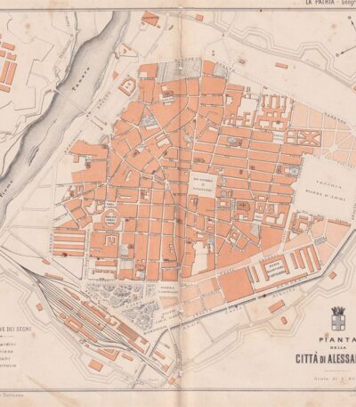
Pianta della città di Alessandria, 1890

30,00 

Pianta della città di Alessandria It is a woodcut print made in 1890 by the engraver Barberis.
Questa opera è tratta da un testo italiano di fine Ottocento e presenta un design dettagliato della città.

  • Sheet size: cm. 24×28 circa
  • Support: Paper
  • Condition: Buone, con fori e tagli al centro dovuti all’impaginazione

Si precisa che verrà spedito l’intero foglio che contiene la stampa.

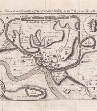
Map of Rome, 1791

80,00 

Pianta di Roma, made in 1791, è un’acquaforte su carta vergellata che offre una vista dettagliata della città eterna.
Questa pianta, parte dell’opera Histoire Universelle depuis les commencement du monde jusque a present, pubblicata a Parigi, rappresenta l’evoluzione di Roma dai tempi di Servio Tullio fino alla conquista da parte dei Galli.

  • Sheet size: cm. 16×33 alla linea marginale, con margini irregolari di 2-7 cm
  • Technique: Etching
  • Condition: Excellent
  • Support: Laid paper

Ai lati della pianta si trovano le legende dei siti indicati e numerati, rendendo questa opera non solo un documento storico, ma anche un utile strumento di riferimento.

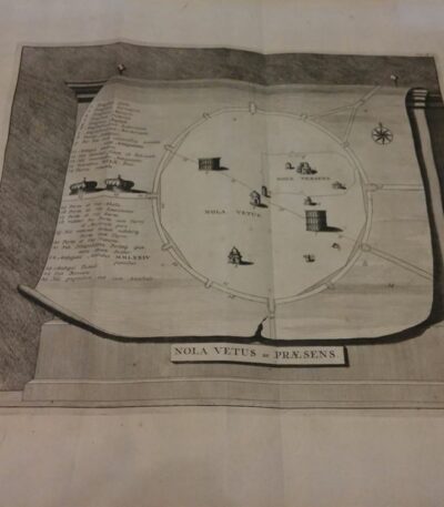
Pierre Vander AA, Plan of the city of Nola, 1729

90,00 

Map of the city of Nola It is an engraving made by Pierre Vander AA in 1729, taken from the volume Thesaurus antiquitatum et historiarum Italiae.
This map, from Leiden, offers a detailed representation of the city of Nola, located in the province of Naples.
The map includes a legend explaining the various locations, making it not only a work of art, but also an important historical resource.

  • Sheet size: cm. 33×25 approx.
  • Engraving size: cm. 47×40 approx.
  • Technique: Etching
  • Support: Laid paper
  • Condition: Excellent
  • Rarity: Extremely rare

Pierre Vander AA, Plan of the city of Nola, 1729

40,00 

Map of the city of Nola It is an engraving made by Pierre Vander AA in 1729, taken from the Thesaurus antiquitatum et historiarum Italiae.
This detailed map represents the city of Nola, located in the province of Naples, and was created using the etching technique on laid paper.

  • Sheet size: cm. 40×24 approx.
  • Engraving size: cm. 18×24 approx.
  • Support: Laid paper
  • Condition: Excellent

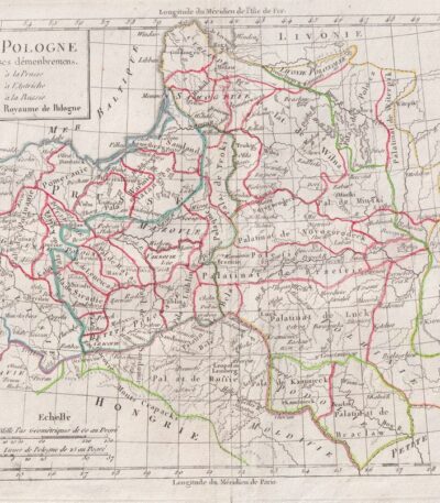
Polonia, C.F. Delamarche, 1816

70,00 

Polonia, C.F. Delamarche, 1816 è una mappa dettagliata della Polonia, che illustra i suoi dipartimenti.
This copper engraving is colored around the outline and is taken from the volume Petit Atlas Moderne ou Collection de Cartes Elementaires, dedicato alla gioventù e pubblicato a Parigi da Delamarche nel 1816.

  • Sheet size: cm. 21×27 approx.
  • Support: Paper
  • Condition: Good condition, with some peeling and a central editorial crease

Dutch possessions, Otto Petri, 1853

50,00 

Possedimenti Olandesi è un’incisione colorata a mano realizzata da Otto Petri nel 1853.
Questa mappa rappresenta i possedimenti olandesi d’oltremare, inclusi Java e Borneo, ed è tratta dal School Atlas Alle Deelen Der Aarde, published by J. Van Den Bosch in Rotterdam.

  • Sheet size: cm. 26×34 approx.
  • Engraving size: cm. 22×27 approx.
  • Support: Medium thickness paper
  • Condition: Excellent state of preservation

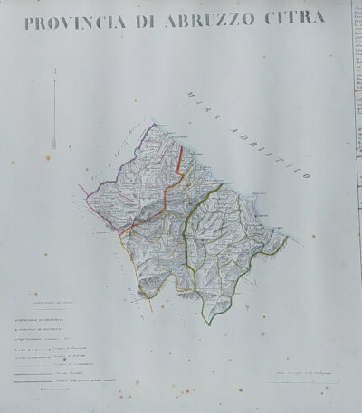
Provincia di Abruzzo Citra, B. Marzolla, 1832

90,00 

Provincia di Abruzzo Citra it is a geographical map created by B. Marzolla in 1832.
Questa opera è stata eseguita in lithography con confini acquarellati e fa parte dell’ Historical and statistical chorographic atlas of the Kingdom of the Two Sicilies, dedicated to HM King Ferdinand II.

  • Sheet size: cm. 45×60
  • Condition: Good state of preservation
  • Support: Paper

La carta presenta macchie del tempo e leggere gore di umidità, ma è priva di pieghe editoriali. Ai lati sono riportate notizie storiche e statistiche della provincia.
The card will be shipped in a rigid tube via registered mail.

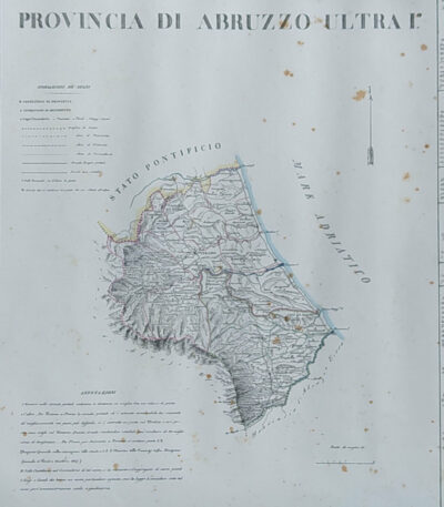
Provincia di Abruzzo Ultra I, B. Marzolla, 1832

90,00 

Provincia di Abruzzo Ultra I it is a geographical map created by B. Marzolla in 1832.
Questa opera è parte dell’Historical and statistical chorographic atlas of the Kingdom of the Two Sicilies, eseguito litograficamente e dedicato a S.M. il Re Ferdinando II.

  • Sheet size: cm. 45×60
  • Paper size: Great
  • Technique: Lithography
  • Condition: Good state of preservation
  • Support: Paper

La carta presenta confini acquarellati e include notizie storiche e statistiche della provincia. Si notano alcune macchie del tempo e leggere gore di umidità, ma il foglio è privo di pieghe editoriali.
La spedizione avverrà in tubo rigido con posta raccomandata.

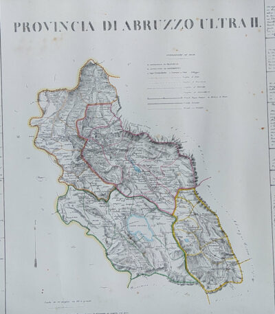
Provincia di Abruzzo Ultra II, B. Marzolla, 1832

90,00 

Provincia di Abruzzo Ultra II it is a geographical map created by B. Marzolla in 1832.
This lithograph has watercolored borders and is part of the work Historical and statistical chorographic atlas of the Kingdom of the Two Sicilies, dedicated to HM King Ferdinand II.

  • Sheet size: cm. 45×60
  • Paper size: Great
  • Technique: Lithography
  • Condition: Good state of preservation
  • Support: Paper

The paper has some age stains and light humidity stains, but is free of editorial creases.
It will be shipped in a rigid tube with registered mail.

Provincia di Agrigento, B. Marzolla, 1832

90,00 

Provincia di Agrigento It is a geographical map created by B. Marzolla in 1832, executed in lithography with watercolor borders.
This map is part of the work Historical and statistical chorographic atlas of the Kingdom of the Two Sicilies, compilato e dedicato a S.M. il Re Ferdinando II, pubblicato a Napoli dalla Reale Tipografia Milit. nel 1832.

  • Sheet size: cm. 45×60
  • Condition: Good state of preservation
  • Support: Paper

La carta presenta macchie del tempo e leggere gore di umidità, ma è priva di pieghe editoriali. Ai lati, sono riportate notizie storiche e statistiche della provincia. La spedizione avverrà in tubo rigido con posta raccomandata.

Province of Bari, B. Marzolla, 1832

80,00 

Province of Bari It is a geographical map made by Benedict Marzolla in 1832, performed in lithography with watercolor borders.
This map is part of the work Historical and statistical chorographic atlas of the Kingdom of the Two Sicilies, dedicated to HM King Ferdinand II.

  • Sheet size: cm. 45×60
  • Condition: Good state of preservation
  • Support: Paper

The paper has age stains and light humidity stains, but is free of editorial creases.
On the sides, there are historical and statistical information about the provinces of Bari, Trani, Monopoli, Andria and Molfetta. The map will be sent in a rigid tube with registered mail.

Province of Bari, B. Marzolla, 1832

90,00 

Province of Bari it is a geographical map created by B. Marzolla in 1832.
This map was made in lithography with watercolor borders and is part of the work Historical and statistical chorographic atlas of the Kingdom of the Two Sicilies, dedicated to HM King Ferdinand II.

  • Sheet size: cm. 45×60
  • Condition: Good state of preservation
  • Support: Paper
  • Notes: Stains of time and light humidity stains, sheet without editorial fold

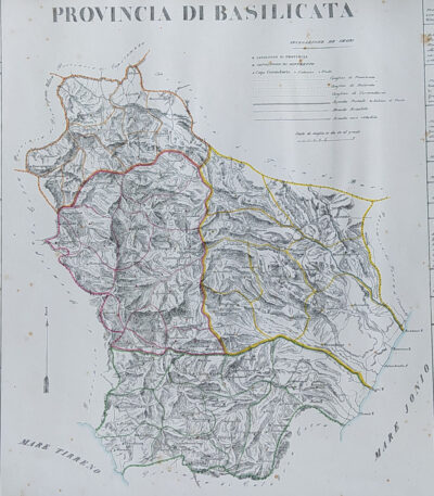
Provincia di Basilicata, B. Marzolla, 1832

90,00 

Provincia di Basilicata it is a geographical map created by B. Marzolla in 1832.
This lithograph has watercolored borders and is part of the work Historical and statistical chorographic atlas of the Kingdom of the Two Sicilies, dedicated to HM King Ferdinand II.

  • Sheet size: cm. 45×60
  • Paper size: Great
  • Technique: Lithography
  • Condition: Good state of preservation
  • Support: Paper

The paper has some age stains and light humidity stains, but is free of editorial creases.
It will be shipped in a rigid tube with registered mail.

Provincia di Calabria Citra, B. Marzolla, 1832

90,00 

Provincia di Calabria Citra it is a geographical map created by B. Marzolla in 1832.
This lithograph has watercolored borders and is part of the work Historical and statistical chorographic atlas of the Kingdom of the Two Sicilies, dedicated to HM King Ferdinand II.

  • Sheet size: cm. 45×60
  • Paper size: Great
  • Technique: Lithography
  • Condition: Good state of preservation
  • Support: Paper

The paper has age stains and light humidity stains, but is free of editorial creases.
Ai lati sono riportate notizie storiche e statistiche della provincia. La carta verrà spedita in tubo rigido con posta raccomandata.

Provincia di Calabria Ultra I, B. Marzolla, 1832

90,00 

Provincia di Calabria Ultra I it is a geographical map created by B. Marzolla in 1832.
This map was made in lithography with watercolor borders and is part of the work Historical and statistical chorographic atlas of the Kingdom of the Two Sicilies, dedicated to HM King Ferdinand II.

  • Sheet size: cm. 45×60
  • Condition: Good state of preservation
  • Support: Paper
  • Details: Stains of time and light humidity stains, sheet without editorial fold

The card will be shipped in a rigid tube via registered mail.

Provincia di Calabria Ultra II, B. Marzolla, 1832

90,00 

Provincia di Calabria Ultra II è una carta geografica litografica realizzata da B. Marzolla nel 1832.
This map is part of the work Historical and statistical chorographic atlas of the Kingdom of the Two Sicilies, dedicated to HM King Ferdinand II.

  • Sheet size: cm. 45×60
  • Map dimensions: cm. 45×60
  • Technique: Lithography
  • Condition: Good state of preservation
  • Support: Paper

La carta presenta confini acquarellati e include notizie storiche e statistiche della provincia.
È importante notare che ci sono macchie del tempo e leggere gore di umidità, ma il foglio è senza piega editoriale. La mappa verrà spedita in tubo rigido con posta raccomandata.

Province of Caltanissetta, B. Marzolla, 1832

90,00 

Provincia di Caltanisetta It is a geographical map created by B. Marzolla in 1832, executed in lithography with watercolor borders.
This map is taken from the work Historical and statistical chorographic atlas of the Kingdom of the Two Sicilies, dedicated to HM King Ferdinand II and published by the Royal Military Typography of Naples.

  • Sheet size: cm. 45×60
  • Condition: Good state of preservation
  • Support: Paper
  • Notes: It has age stains and light humidity stains, but is free of editorial creases.

La carta include anche notizie storiche e statistiche sulla provincia e verrà spedita in tubo rigido con posta raccomandata.

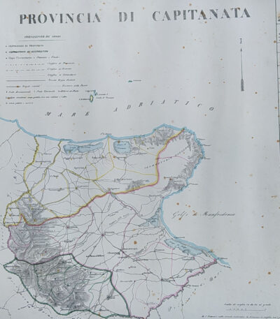
Province of Capitanata, B. Marzolla, 1832

90,00 

Province of Capitanata it is a geographical map created by B. Marzolla in 1832.
This lithograph has watercolored borders and is part of the work Historical and statistical chorographic atlas of the Kingdom of the Two Sicilies, dedicated to HM King Ferdinand II.

  • Sheet size: cm. 45×60
  • Technique: Lithography
  • Condition: Good state of preservation
  • Support: Paper
  • Notes: Stains of time and light damp stains

The card will be shipped in a rigid tube via registered mail.

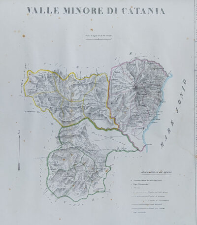
Provincia di Catania, B. Marzolla, 1832

90,00 

Provincia di Catania it is a geographical map created by B. Marzolla in 1832.
This map was made in lithography with watercolor borders and is part of the work Historical and statistical chorographic atlas of the Kingdom of the Two Sicilies, dedicated to HM King Ferdinand II.

  • Sheet size: cm. 45×60
  • Condition: Good state of preservation
  • Support: Paper
  • Notes: Stains of time and light humidity stains, sheet without editorial fold

The card will be shipped in a rigid tube via registered mail.

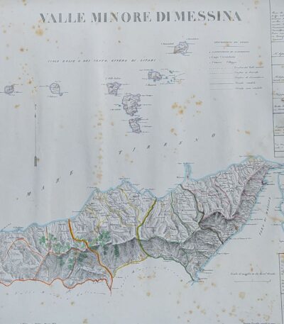
Province of Messina, B. Marzolla, 1832

90,00 

Provincia di Messina It is a geographical map created by B. Marzolla in 1832, executed in lithography with watercolor borders.
This map is part of the work Historical and statistical chorographic atlas of the Kingdom of the Two Sicilies, dedicated to HM King Ferdinand II and published by the Royal Military Typography of Naples.

  • Sheet size: cm. 45×60
  • Condition: Good state of preservation
  • Support: Paper
  • Details: Stains of time and light humidity stains, sheet without editorial fold

The card will be shipped in a rigid tube via registered mail.

Provincia di Molise, B. Marzolla, 1832

90,00 

Provincia di Molise It is a geographical map created by B. Marzolla in 1832, executed in lithography with watercolor borders.
This map is part of the work Historical and statistical chorographic atlas of the Kingdom of the Two Sicilies, dedicated to HM King Ferdinand II and published by the Royal Military Typography of Naples.

  • Sheet size: cm. 45×60
  • Condition: Good state of preservation
  • Support: Paper
  • Notes: It has age stains and light humidity stains, but is free of editorial creases.

The card will be shipped in a rigid tube via registered mail.

Provincia di Napoli, B. Marzolla, 1832

90,00 

Provincia di Napoli It is a geographical map created by B. Marzolla in 1832, executed in lithography with watercolor borders.
This map is taken from the work Historical and statistical chorographic atlas of the Kingdom of the Two Sicilies, dedicated to HM King Ferdinand II.

  • Sheet size: cm. 45×60
  • Condition: Good state of preservation
  • Support: Paper

La carta presenta macchie del tempo e leggere gore di umidità, ma è priva di pieghe editoriali. Ai lati sono riportate notizie storiche e statistiche della provincia. La spedizione avverrà in tubo rigido con posta raccomandata.

Province of Syracuse, B. Marzolla, 1832

90,00 

Province of Syracuse it is a geographical map created by B. Marzolla in 1832.
This lithograph has watercolored borders and is taken from the work Historical and statistical chorographic atlas of the Kingdom of the Two Sicilies, executed lithographically and dedicated to HM King Ferdinand II.

  • Sheet size: cm. 45×60
  • Technique: Lithography
  • Condition: Good state of preservation
  • Support: Paper

The paper has age stains and light humidity stains, but is free of editorial creases.
On the sides, there are historical news and statistics related to the province. The map will be shipped in a rigid tube with registered mail.

Prussia, 1865

60,00 

Prussia, 1865 è una piccola mappa della Turchia, realizzata nel 1821.
This copper engraving was hand-watercoloured and measures approximately 9 x 9 cm, on a sheet of 13 x 15 cm.

  • Sheet size: cm. 13×15 approx.
  • Engraving size: cm. 9×9 approx.
  • Support: Paper
  • Condition: Excellent condition

Explore the fascinating world of antique prints

Antique prints are silent witnesses of history, capable of transporting us to distant eras through the art of engraving. Our e-commerce offers a vast selection of these precious finds, carefully selected for their authenticity and artistic value. Whether you are an expert collector or a novice enthusiast, you will find unique pieces here that will enrich your spaces with a touch of timeless elegance.

A safe and rewarding shopping experience

We understand the importance of each individual print and are committed to ensuring a flawless purchasing experience. Our secure payment system and insured shipping with professional packaging ensure that each piece arrives in the best condition. Our expertise in the sector allows us to offer detailed descriptions and personalized advice, helping you to make informed choices. If you have any questions or specific requests, do not hesitate to contact us: we will be happy to guide you into the wonderful world of antique prints.