English (UK)
  Italiano
  Français


Cartography

Fano, Salmon Thomas, 1738-1768
50,00 €The City of Fano in the Duchy of Urbino It is an engraving made by Thomas Salmon between 1738 and 1768.
This work, an etching on copper, is part of the volume The present state of all the Countries, and Peoples of the World, Natural, Political, and Moral…, published in Naples.
- Sheet size: cm. 15×10 approx.
- Support: Laid paper
- Condition: Excellent state of preservation

Félix Delamarche vintage colored map of England 1826
60,00 €Mappa dell’Inghilterra, made by Félix Delamarche nel 1826, è un raffinato esempio della cartografia francese del XIX secolo.
Questa mappa rappresenta l’Inghilterra con grande precisione, arricchita da una colorazione coeva a mano che ne evidenzia i confini e le divisioni amministrative. Stampata su carta vergellata, si presenta in ottime condizioni, unendo qualità estetica e valore storico.
- Era: XIX secolo (1826)
- Technique: Incisione su rame con colorazione coeva
- Dimensions: Alla battuta del rame: 28×36 cm; intero foglio: 32×46 cm
- Support: Laid paper
- Condition: Excellent
Questa mappa è un’opera perfetta per collezionisti e appassionati di geografia storica, offrendo una visione dettagliata dell’Inghilterra nell’era pre-vittoriana.

France, CF Delamarche, 1816
70,00 €France, CF Delamarche, 1816 it's a carta della Francia divisa nei suoi dipartimenti, realizzata con incisione su rame colorata al contorno.
This map is taken from the volume Petit Atlas Moderne ou Collection de Cartes Elementaires, dedicato alla gioventù, pubblicato a Parigi da Delamarche nel 1816.
- Sheet size: cm. 21×27
- Engraving size: cm. 21×27
- Support: Paper
- Condition: Good
Presenta qualche spellatura e una piega centrale editoriale, ma nel complesso si trova in buone condizioni.

France, CF Delamarche, 1816
70,00 €Map of France It is an engraving made by CF Delamarche in 1816, which represents France divided into its 86 departments.
This work is taken from the Petit Atlas Moderne ou Collection de Cartes Elementaires, dedicated to youth and published in Paris by Delamarche.
- Sheet size: cm. 21×27 approx.
- Engraving size: cm. 20×26 approx.
- Support: Paper
- Condition: Good condition, with some peeling and central editorial crease

Francia, La Gallia sotto l’Impero Romano, 1865
60,00 €Francia, La Gallia sotto l’Impero Romano It is a watercolour map made in 1865.
Drawn by Naymiller and engraved by Allodi, this map is part of theAtlas of Universal Geography Chronological, Historical, Statistical and Literary by Francesco Pagnoni, published in Milan.
- Sheet size: cm. 49×38 approx.
- Paper size: cm. 40×32 approx.
- Technique: Etching
- Condition: Excellent
- Support: Paper
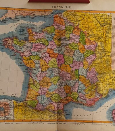
Francia, Otto Petri, 1853
50,00 €Map of France realizzata da Otto Petri nel 1853, questa incisione colorata a mano rappresenta i dipartimenti francesi.
Dimensions: cm. 22×27 su foglio cm. 26×34.
- Support: Medium thickness paper
- Condition: Excellent condition
- Fold: Editorial fold
This map is taken from the School Atlas Alle Deelen Der Aarde, pubblicato a Rotterdam da J. Van Den Bosch.

Northern Germany, Otto Petri, 1853
50,00 €Northern Germany It is a detailed map of Northern Germany (Noord Duitschland), made by Otto Petri in 1853.
This engraving is hand colored and is part of the School Atlas Alle Deelen Der Aarde, published by J. Van Den Bosch in Rotterdam.
- Sheet size: cm. 26×34 approx.
- Map dimensions: cm. 22×27 approx.
- Support: Medium thickness paper
- Condition: Excellent condition, with editorial fold and white back

Germany, CF Delamarche, 1816
70,00 €Germany It is a historical map made by CF Delamarche in 1816, which represents Germany divided into zones, including the Bohemian states.
This copper engraving is colored around the outline and is taken from the volume Petit Atlas Moderne ou Collection de Cartes Elementaires, dedicated to youth and published in Paris by Delamarche.
- Sheet size: cm. 21×27
- Condition: Good condition, with some peeling and a central editorial crease
- Support: Paper
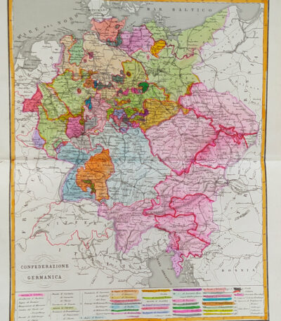
Germany, German Confederation, 1865
60,00 €Germany, German Confederation It is a watercolour map made in 1865.
Drawn by Naymiller and engraved by Allodi, this map is from the work Atlas of Universal Geography Chronological, Historical, Statistical and Literary by Francesco Pagnoni, published in Milan.
- Sheet size: cm. 49×38 approx.
- Paper size: cm. 40×32 approx.
- Support: Paper
- Condition: Excellent
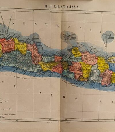
Java, Otto Petri, 1853
50,00 €Map of Java Island (Het Eiland Java) is a hand-colored engraving made by Otto Petri in 1853.
This map, part of the School Atlas Alle Deelen Der Aarde published by J. Van Den Bosch in Rotterdam, offers a detailed representation of the island of Java.
- Sheet size: cm. 26×34 approx.
- Engraving size: cm. 22×27 approx.
- Support: Medium thickness paper
- Condition: Excellent condition, with editorial fold and white back
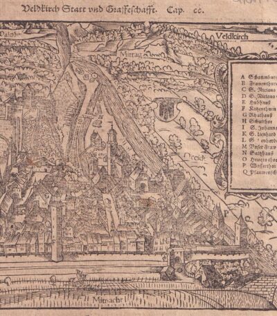
Grafschaft Tyrol, S.Munster, 1614
County of Tyrol it is a view extracted from the Cosmography Universalis by Sebastian Munster, published in Basel in 1614.
This engraving represents an important geographical testimony of the time, offering a detailed vision of the Tyrol region.
- Sheet size: cm. 36×22 approx.
- Image size: cm. 14.5x18 approx.
- Support: Laid paper
- Condition: Excellent state of preservation
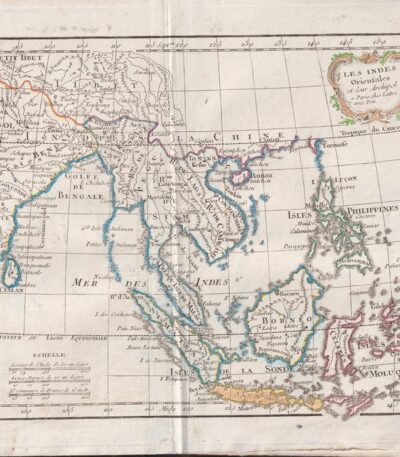
Indie Orientali, C.F. Delamarche, 1816
70,00 €Indie Orientali è una mappa dettagliata delle Indie Orientali e del loro arcipelago, realizzata da C.F. Delamarche nel 1816.
This copper engraving is colored around the outline and comes from the volume Petit Atlas Moderne ou Collection de Cartes Elementaires, dedicated to youth and published in Paris by Delamarche.
- Sheet size: cm. 21×27 approx.
- Condition: Good condition, with some peeling and a central editorial crease
- Support: Paper

Ingelheim, St.Munster, 1614
Ingelheim, St.Munster, 1614 It is a watercolour woodcut representing a view of Ingelheim, taken from the famous work Cosmography Universalis by Sebastian Munster.
This page, published in Basel in 1614, offers a fascinating look at the city of Ingelheim, with accurate details and a back enriched with additional images.
- Sheet size: cm. 36×22 approx.
- Image size: cm. 9×12,5 approx.
- Support: Laid paper
- Condition: Excellent
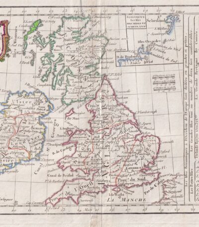
England, CF Delamarche, 1816
70,00 €Mappa dell’Inghilterra e Irlanda, realizzata da C.F. Delamarche nel 1816.
Questa incisione su rame colorata al contorno è tratta dal volume Petit Atlas Moderne ou Collection de Cartes Elementaires, dedicated to youth and published in Paris by Delamarche.
- Sheet size: cm. 21×27
- Condition: Good condition, with some peeling and central editorial crease
- Support: Paper
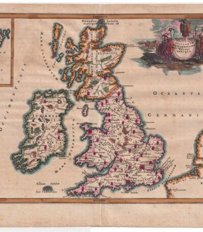
Inghilterra, Cellarius – 1701
80,00 €Inghilterra, Cellarius – 1701 è una mappa storica dell’Inghilterra, realizzata nel 1701 da Christophorus Cellarius.
Questa incisione su rame, tratta da Notitia Orbis Antiqui sive Geographia Plenior, presenta una rappresentazione dettagliata delle isole britanniche, colorata a mano.
- Sheet size: cm. 24×33 approx.
- Engraving size: cm. 20×30 approx.
- Technique: Burin
- Support: Laid paper
- Condition: Good condition
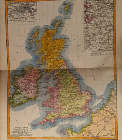
England, Otto Petri, 1853
50,00 €Map of England and Ireland, made by Otto Petri in 1853, is a hand-colored engraving that offers a detailed representation of the two nations.
This map is part of the School Atlas Alle Deelen Der Aarde, published by J. Van Den Bosch in Rotterdam.
- Sheet size: cm. 26×34 approx.
- Map dimensions: cm. 22×27 approx.
- Support: Medium thickness paper
- Condition: Excellent condition, with editorial fold and white back

Israel, CF Delamarche, 1816
70,00 €Mappa di Israele delle 12 tribù, realizzata da C.F. Delamarche nel 1816.
Questa incisione su rame colorata al contorno è tratta dal Petit Atlas Moderne ou Collection de Cartes Elementaires, published in Paris by Delamarche.
- Sheet size: cm. 21×27 approx.
- Support: Paper
- Condition: Good condition, with some peeling and central editorial crease
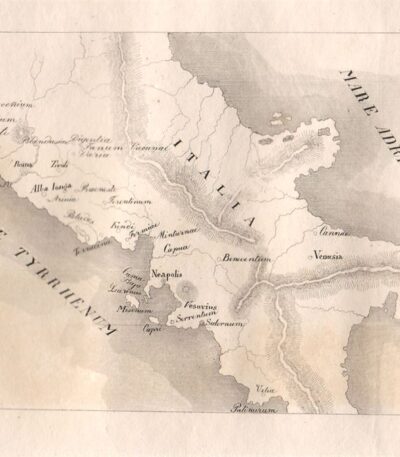
Italia Centrale, 1829
20,00 €Italia Centrale, 1829 è un’incisione realizzata a bulino su rame, che cattura l’essenza della regione centrale italiana.
This work is taken from Horazen's Works by Dr. Sickler, with engravings by Carl Frommel.
- Sheet size: cm. 26×21 approx.
- Engraving size: cm. 11×7 approx.
- Support: Medium paper with white back
- Condition: Excellent state of preservation
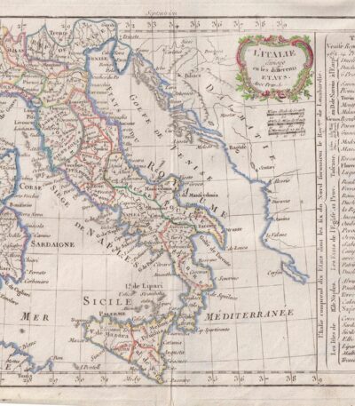
Italy, CF Delamarche, 1816
80,00 €Italy è un’incisione su rame colorata al contorno realizzata da C.F. Delamarche nel 1816.
Questa mappa dell’Italia è tratta dal Petit Atlas Moderne ou Collection de Cartes Elementaires, dedicated to youth and published in Paris by Delamarche.
- Sheet size: cm. 21×27
- Condition: Good condition, with some peeling and a central editorial crease
- Support: Paper

John Johnston Large Map of Spain and Portugal 19th century cm.66×55 chromolithograph
80,00 €Grande carta geografica della Spagna e del Portogallo è una dettagliata mappa realizzata da John Johnston nel XIX secolo. Questa stampa, eseguita in cromolitografia, rappresenta con precisione i confini territoriali e le principali caratteristiche geografiche di Spagna e Portogallo. L’opera si distingue per la qualità dei dettagli e la vivacità dei colori, tipica delle tecniche litografiche del XIX secolo.
- Era: 19th century
- Technique: Chromolithography
- Dimensions: Grandi (cm 66×55)
- Support: Heavy paper
- Condition: Excellent condition

John Tallis, 1851 map of Belgium, contemporary colouring
80,00 €John Tallis, 1851 mappa del Belgio
La mappa illustra con grande dettaglio il territorio del Belgium, includendo confini, città principali e dettagli topografici. Realizzata da uno dei cartografi più rinomati del XIX secolo, l’opera è accompagnata dal tipico stile decorativo di Tallis, che unisce accuratezza geografica e valore estetico. Si segnalano leggere macchie ai margini, dovute alla presenza di una precedente cornice, senza compromettere la bellezza e la leggibilità della mappa.
Era: XIX secolo (1851)
Technique: Incisione su rame con colorazione coeva
Dimensions: Medie (circa 27×35 cm)
Support: Paper
Condition: Discrete (con macchie marginali), al retro tracce di cornice
Questa mappa, dal forte valore storico e artistico, è ideale per collezionisti di cartografia del XIX secolo e per appassionati di storia europea.

Kitchin Large map of France from 1754 contemporary colouring cm.50×60
60,00 €Map of France, incisione realizzata nel 1754 da Thomas Kitchin, celebre cartografo del XVIII secolo.
Questa mappa, in colorazione coeva, offre un dettaglio accurato della Francia dell’epoca ed è un esempio di maestria cartografica del periodo illuminista. Incisa su carta spessa, rappresenta una preziosa testimonianza storica e geografica.
- Era: 18th century
- Technique: Engraving
- Dimensions: Grandi (60×50 cm circa)
- Support: Thick paper
- Condition: Buone condizioni, con colorazione originale dell’epoca

Kitchin Large map of Italy from 1755 contemporary colouring cm.50×60
60,00 €Mappa dell’Italia è un’incisione cartografica realizzata da Thomas Kitchin, noto cartografo britannico del XVIII secolo.
La mappa, di ampie dimensioni e decorata con una raffinata colorazione coeva, offre una rappresentazione dettagliata della penisola italiana, evidenziando confini, città principali e caratteristiche geografiche dell’epoca. Realizzata su carta spessa di alta qualità, testimonia la maestria tecnica e l’accuratezza delle opere di Kitchin, apprezzato in tutta Europa per il suo contributo alla cartografia.
- Era: 18th century
- Technique: Incisione su rame con colorazione coeva
- Dimensions: Grandi (circa 60×50 cm)
- Support: Thick paper
- Condition: Excellent
Questa mappa rappresenta un prezioso oggetto da collezione, perfetto per arricchire una raccolta di cartografia storica o per studiosi interessati all’evoluzione geografica dell’Italia.
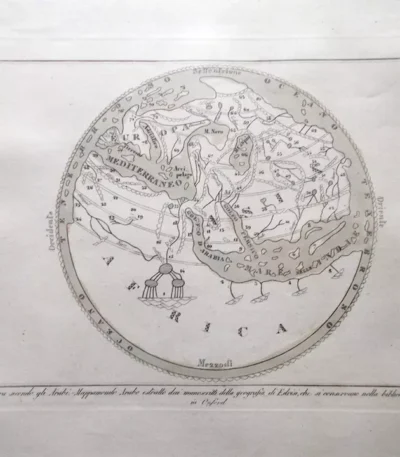
La Terra secondo gli arabi, planisfero, 1838
40,00 €La Terra secondo gli Arabi – Mappamondo Arabo, ispirato alla geografia di Edrisi e tratto dai manoscritti conservati a Oxford, è un’affascinante rappresentazione della visione geografica araba medievale.
Questa carta è inclusa nell’opera Atlante di Geografia Universale di F. C. Marmocchi, pubblicata a Firenze nel 1838 da Vincenzo Batelli e Figli. La mappa è arricchita da una coloritura coeva, che ne esalta i dettagli, e stampata su carta di medio spessore, si presenta in ottime condizioni.
- Era: XIX secolo (1838)
- Technique: Incisione su rame con colorazione coeva
- Dimensions: Alla battuta del rame: 17×23 cm; intero foglio: 26×40 cm
- Support: Medium thickness paper
- Condition: Excellent
Questa mappa è una testimonianza unica della cartografia ispirata alla tradizione araba e medievale, ideale per collezionisti di mappe antiche e studiosi di storia della geografia.